
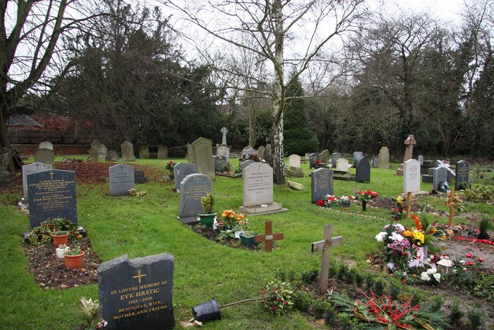
| Memorials | : | 3 |
| Location | : | St Albans, St Albans District, England |
| Coordinate | : | 51.7417450, -0.3483370 |
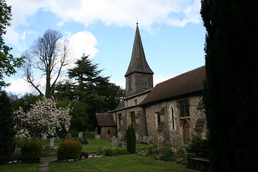
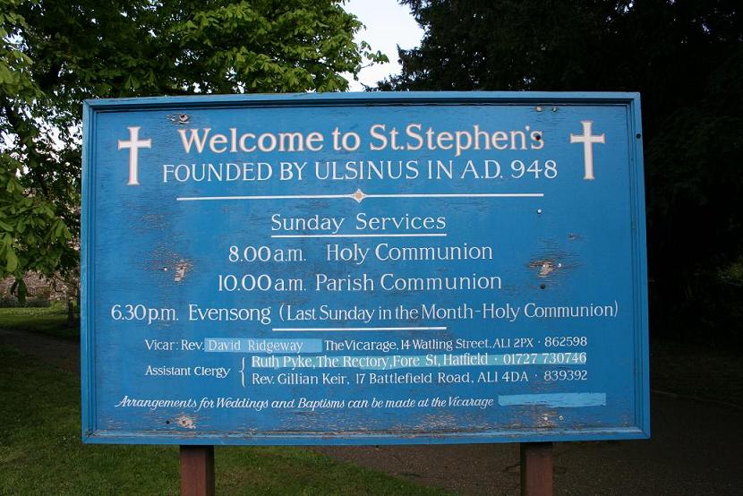
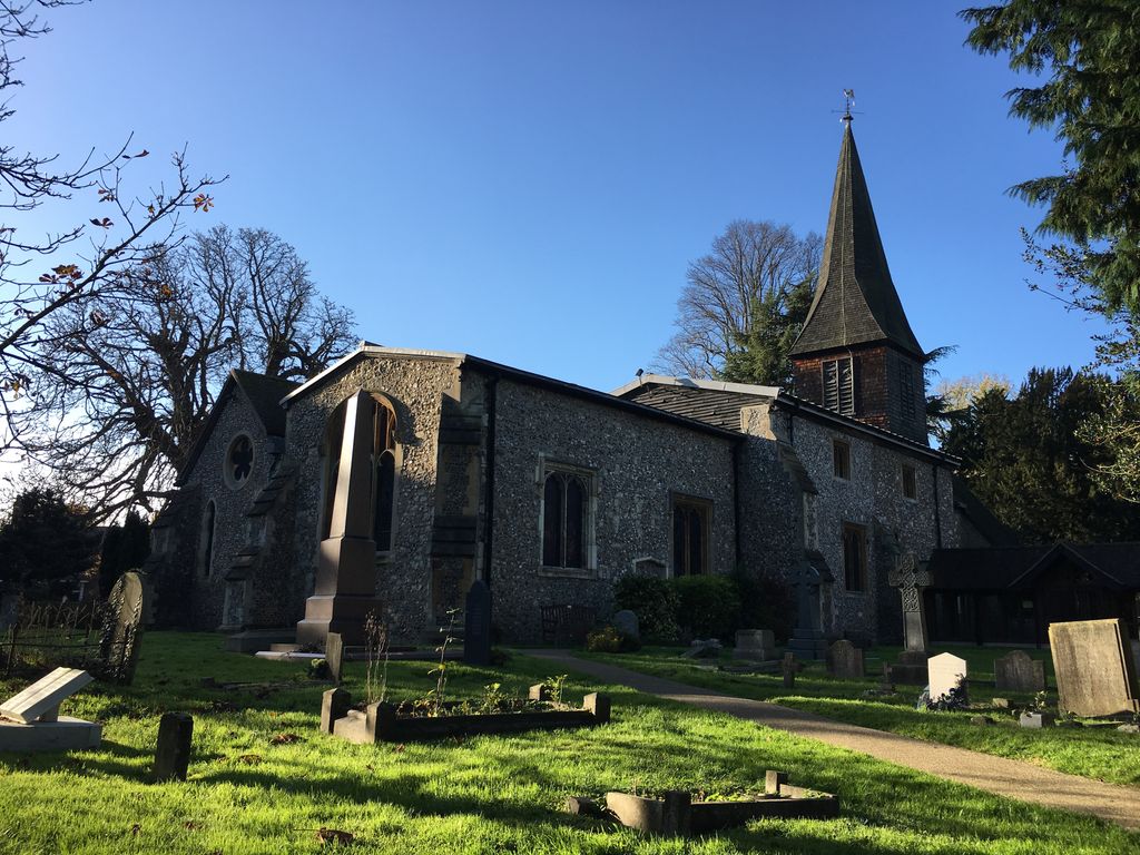
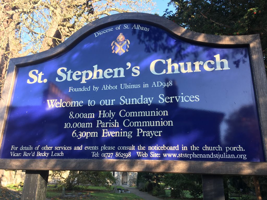
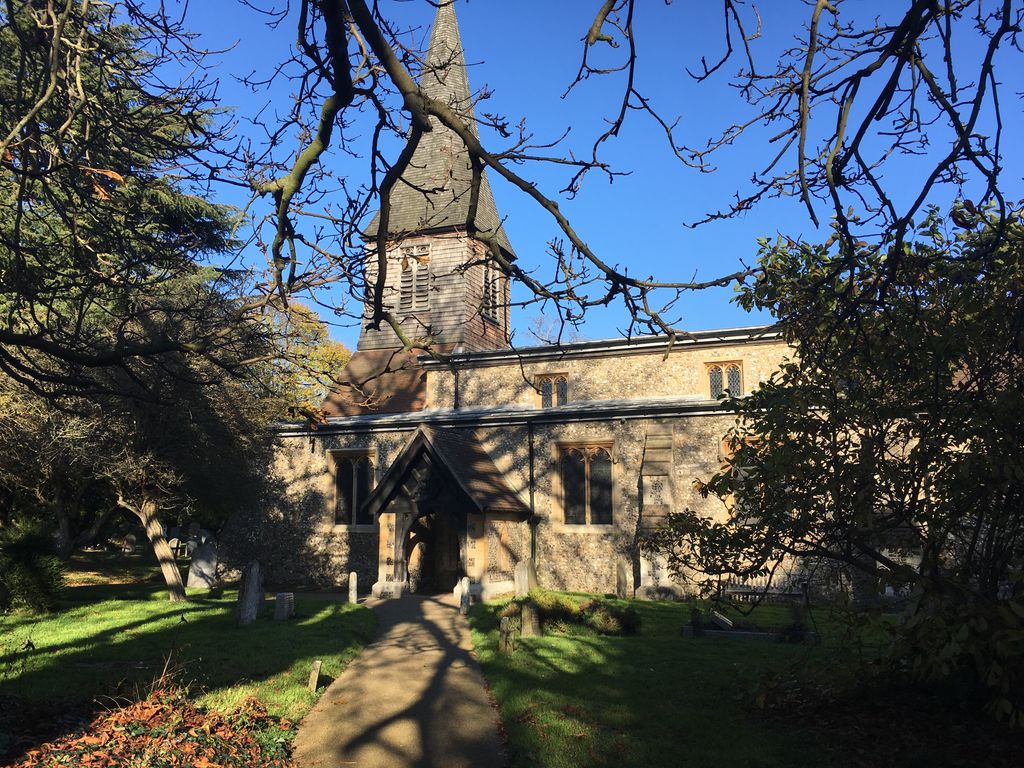
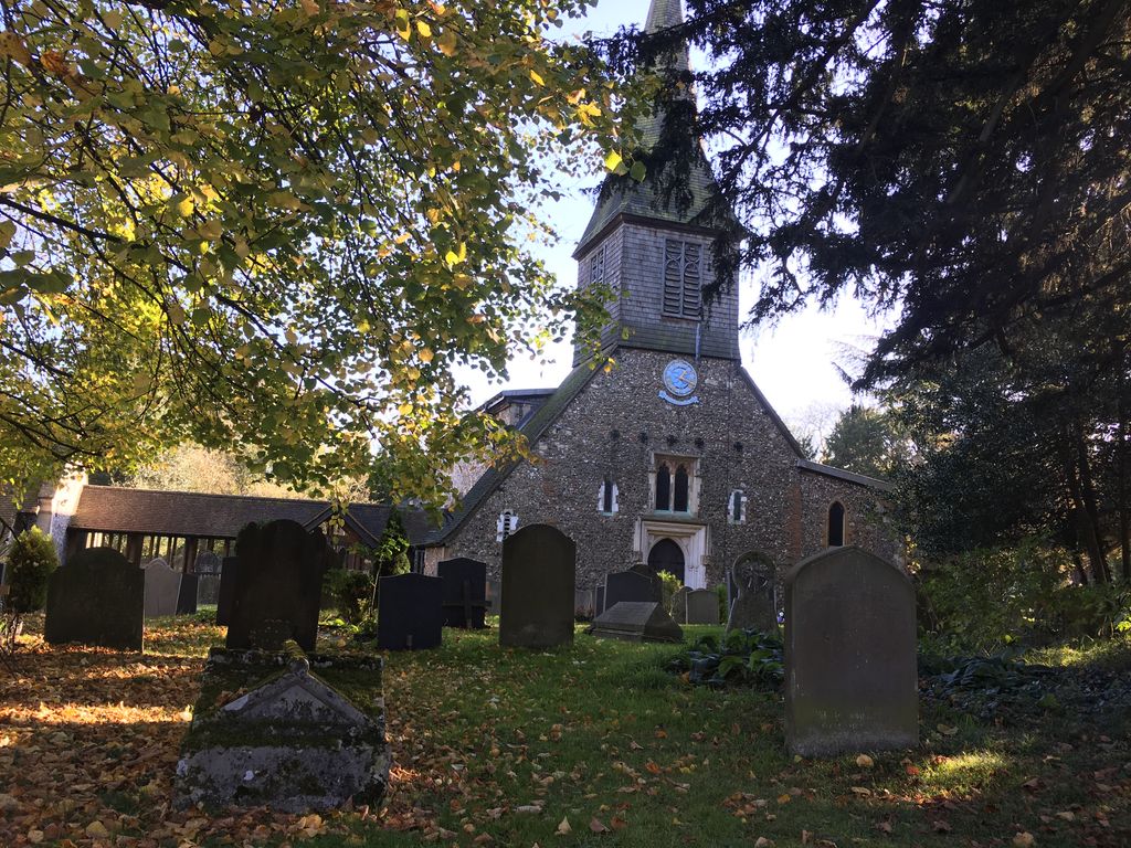
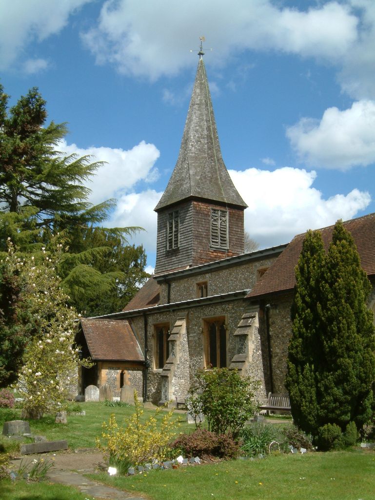
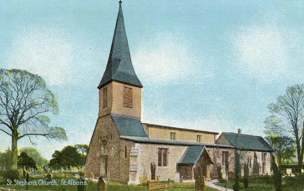
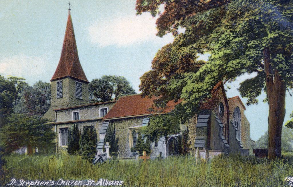
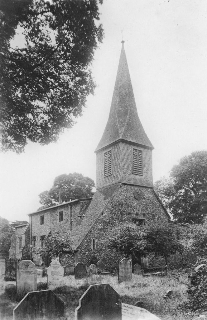
| Description | : | Founded in 948AD by Abbot Ulsinus of St Albans. Built to receive pilgrims (along with St Peter’s and St Michael’s) on their journey to St Albans Cathedral. These three parish churches all stand on the three main roads into St Albans. The building is largely medieval, restored in the 1860s by George Gilbert Scott. |
frequently asked questions (FAQ):
-
Where is St. Stephen's Churchyard?
St. Stephen's Churchyard is located at 14 Watling Street St Albans, St Albans District ,Hertfordshire , AL1 2PXEngland.
-
St. Stephen's Churchyard cemetery's updated grave count on graveviews.com?
3 memorials
-
Where are the coordinates of the St. Stephen's Churchyard?
Latitude: 51.7417450
Longitude: -0.3483370
Nearby Cemetories:
1. Saint Alban's Cathedral
St Albans, St Albans District, England
Coordinate: 51.7504425, -0.3423680
2. Romeland Hill Garden of Rest
St Albans, St Albans District, England
Coordinate: 51.7514540, -0.3438830
3. Spicer Street Chapel Burial Ground
St Albans, St Albans District, England
Coordinate: 51.7523288, -0.3423231
4. Dagnall Lane Baptist Chapel
St Albans, St Albans District, England
Coordinate: 51.7526990, -0.3405156
5. St Michael’s Churchyard
St Albans, St Albans District, England
Coordinate: 51.7529540, -0.3560640
6. St Peter's Churchyard
St Albans, St Albans District, England
Coordinate: 51.7555400, -0.3350270
7. Hatfield Road Cemetery
St Albans, St Albans District, England
Coordinate: 51.7523003, -0.3192620
8. Frogmore Holy Trinity Burial Ground
St Albans District, England
Coordinate: 51.7197598, -0.3365342
9. Holy Trinity Churchyard
St Albans, St Albans District, England
Coordinate: 51.7170354, -0.3334244
10. London Road Cemetery
St Albans, St Albans District, England
Coordinate: 51.7333610, -0.3066110
11. Childwickbury Manor
Childwickbury, St Albans District, England
Coordinate: 51.7809460, -0.3499100
12. Sir David Yule Mausoleum
St Albans, St Albans District, England
Coordinate: 51.7024660, -0.3505190
13. St Mary Churchyard
Childwickbury, St Albans District, England
Coordinate: 51.7836980, -0.3473020
14. West Herts Crematorium
Watford, Watford Borough, England
Coordinate: 51.7004195, -0.3847509
15. East Lane Cemetery
Leavesden, Three Rivers District, England
Coordinate: 51.7084796, -0.4036263
16. St Leonard Churchyard & Extension
Sandridge, St Albans District, England
Coordinate: 51.7813690, -0.3036580
17. Holy Trinity Churchyard
Leverstock Green, Dacorum Borough, England
Coordinate: 51.7466800, -0.4295770
18. Woodwells Cemetery
Hemel Hempstead, Dacorum Borough, England
Coordinate: 51.7576500, -0.4280300
19. All Saints Churchyard
Watford Borough, England
Coordinate: 51.6954810, -0.3885560
20. Saint Bololph's Churchyard
Shenley, Hertsmere Borough, England
Coordinate: 51.7030296, -0.2890460
21. St Lawrence the Martyr Churchyard
Abbots Langley, Three Rivers District, England
Coordinate: 51.7077650, -0.4170030
22. Hill End Hospital Cemetery
St Albans, St Albans District, England
Coordinate: 51.6982051, -0.2901128
23. St. Mary's Churchyard
Redbourn, St Albans District, England
Coordinate: 51.7916200, -0.4066100
24. Christ Church
Radlett, Hertsmere Borough, England
Coordinate: 51.6802460, -0.3163610