
| Memorials | : | 0 |
| Location | : | Swinford, Harborough District, England |
| Phone | : | 01788 869 007 |
| Website | : | www.swinfordparishcouncil.gov.uk |
| Coordinate | : | 52.4088297, -1.1695096 |
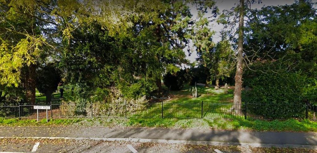
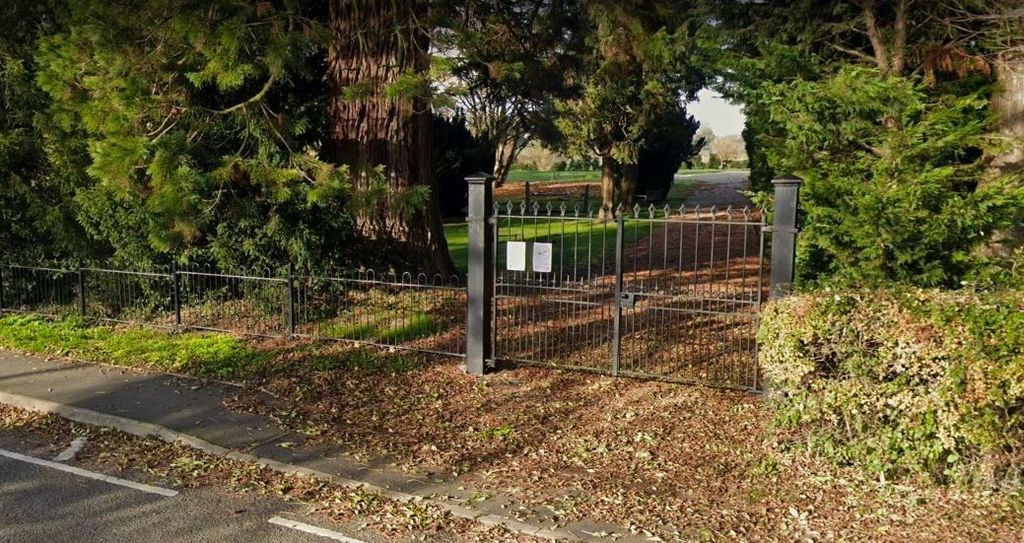
| Description | : | Swinford parish has a small cemetery on Rugby Road. that has been extended in the last few years is within the Misterton ward/electoral division, which is in the constituency of South Leicestershire. Swinford Cemetery is located on Rugby Road at the edge of the village. For any information please contact the Parish Clerk. |
frequently asked questions (FAQ):
-
Where is Swinford cemetery?
Swinford cemetery is located at Rugby Road, Swinford, lutterworthLeicestershire, Swinford, Harborough District ,Leicestershire , LE17 6BWEngland.
-
Swinford cemetery cemetery's updated grave count on graveviews.com?
0 memorials
-
Where are the coordinates of the Swinford cemetery?
Latitude: 52.4088297
Longitude: -1.1695096
Nearby Cemetories:
1. All Saints Churchyard
Swinford, Harborough District, England
Coordinate: 52.4099260, -1.1642830
2. St. Thomas Churchyard, Catthorpe
Catthorpe, Harborough District, England
Coordinate: 52.3986350, -1.1900710
3. All Saints Churchyard
Lilbourne, Daventry District, England
Coordinate: 52.3919370, -1.1778810
4. St Nicholas' Churchyard
Stanford on Avon, Harborough District, England
Coordinate: 52.4045560, -1.1362100
5. St. Nicholas's Churchyard
Stanford-on-Avon, Daventry District, England
Coordinate: 52.4045020, -1.1359770
6. Lilbourne Burial Ground
Lilbourne, Daventry District, England
Coordinate: 52.3885400, -1.1792400
7. All Saints Churchyard
Shawell, Harborough District, England
Coordinate: 52.4123910, -1.2055290
8. Greenhaven Woodland Burial Ground
Lilbourne, Daventry District, England
Coordinate: 52.3881390, -1.1545970
9. St. Andrew's Churchyard
Clay Coton, Daventry District, England
Coordinate: 52.3871456, -1.1290185
10. St Mary's Churchyard
Cotesbach, Harborough District, England
Coordinate: 52.4371220, -1.2085910
11. Clifton-Upon-Dunsmore Cemetery
Clifton upon Dunsmore, Rugby Borough, England
Coordinate: 52.3857800, -1.2197400
12. St. Mary's Churchyard
Clifton upon Dunsmore, Rugby Borough, England
Coordinate: 52.3830220, -1.2208600
13. St Nicholas Church
South Kilworth, Harborough District, England
Coordinate: 52.4316750, -1.1125110
14. St Leonard Churchyard
Misterton, Harborough District, England
Coordinate: 52.4510630, -1.1818140
15. Yelvertoft Independent Chapel Churchyard
Yelvertoft, Daventry District, England
Coordinate: 52.3736980, -1.1225680
16. All Saints Churchyard
Yelvertoft, Daventry District, England
Coordinate: 52.3717866, -1.1164310
17. St. John's Baptist Churchyard
Hillmorton, Rugby Borough, England
Coordinate: 52.3659310, -1.2113290
18. Yelvertoft Cemetery
Yelvertoft, Daventry District, England
Coordinate: 52.3707000, -1.1153400
19. Saint Mary's Churchyard
Lutterworth, Harborough District, England
Coordinate: 52.4554750, -1.2023830
20. Holy Trinity Churchyard
Churchover, Rugby Borough, England
Coordinate: 52.4229460, -1.2506850
21. St. Michael & All Angels Churchyard
Rugby Borough, England
Coordinate: 52.3920240, -1.2540180
22. Whinfield Cemetery
Rugby, Rugby Borough, England
Coordinate: 52.3718560, -1.2353290
23. Watts Lane Cemetery
Rugby, Rugby Borough, England
Coordinate: 52.3592560, -1.2133530
24. St. Andrew Churchyard
North Kilworth, Harborough District, England
Coordinate: 52.4432190, -1.0950880