
| Memorials | : | 6 |
| Location | : | Stanford-on-Avon, Daventry District, England |
| Coordinate | : | 52.4045020, -1.1359770 |
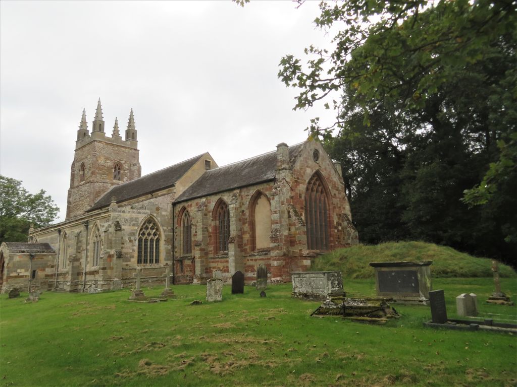
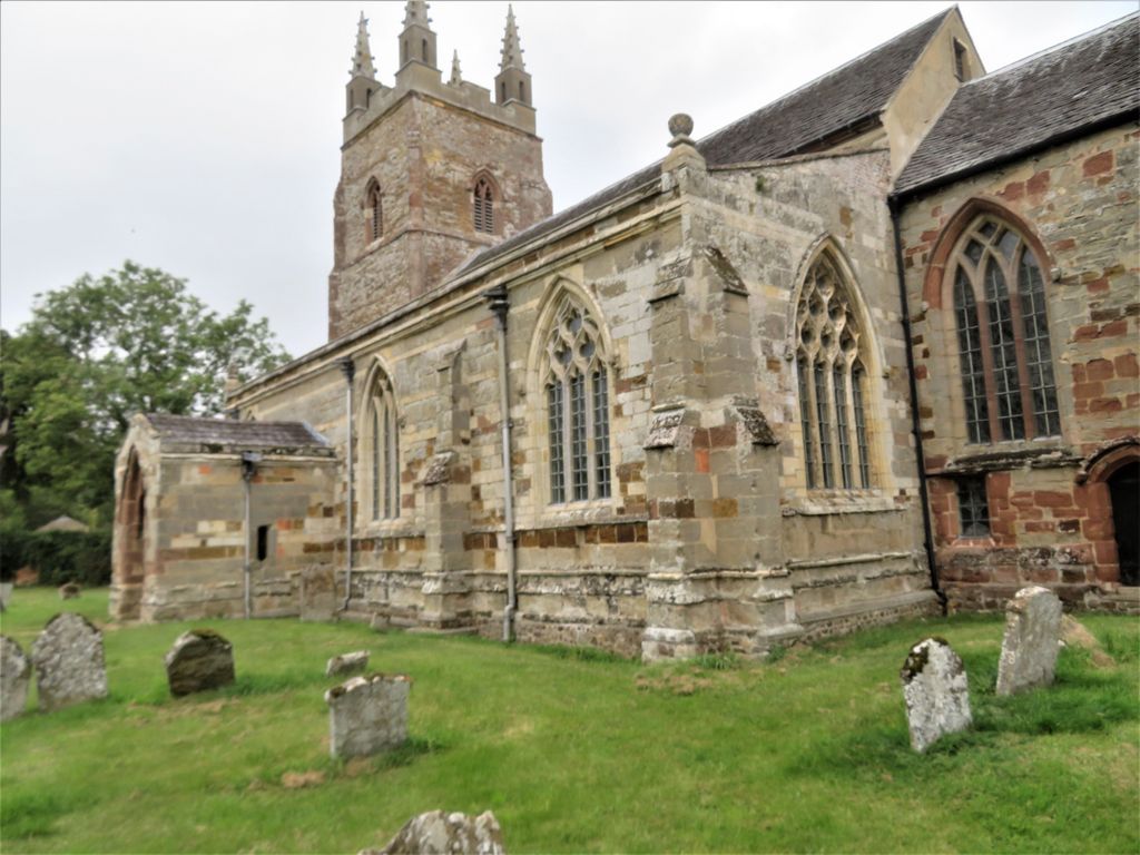
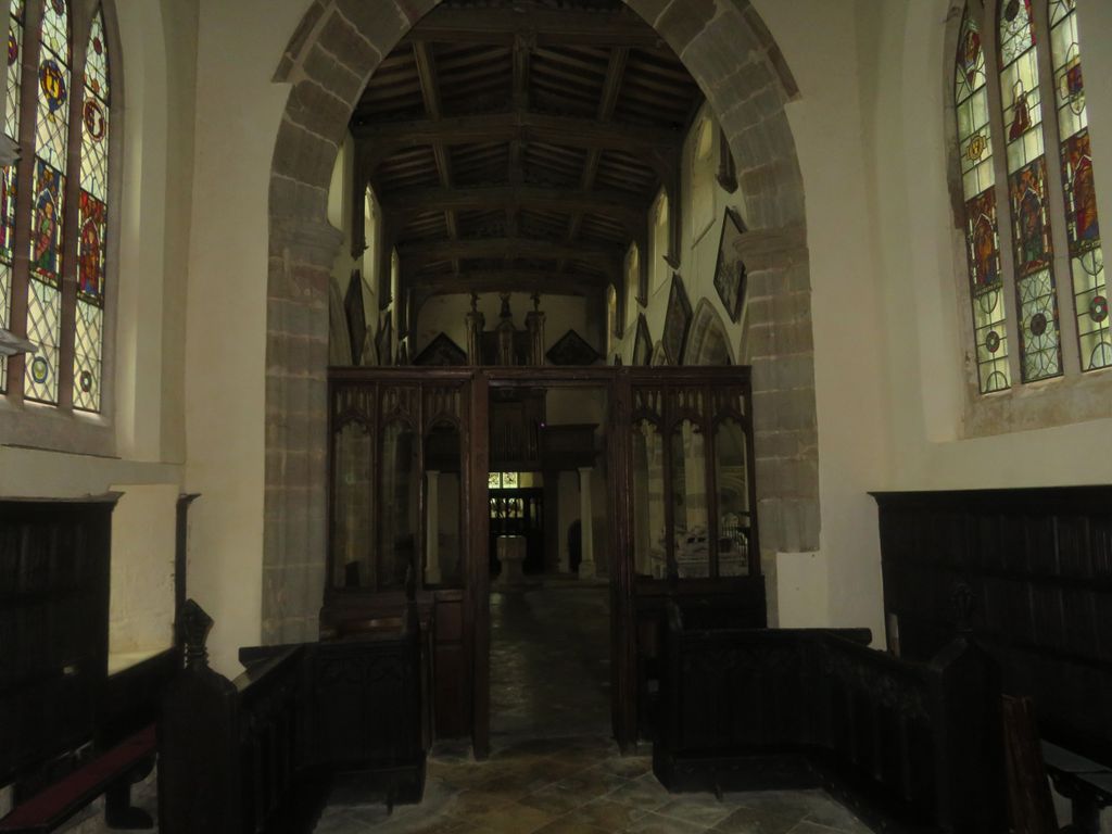
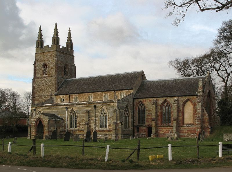
| Description | : | The Church of St Nicholas is in the hamlet, Stanford-on-Avon, in the civil parish of Stanford in the Daventry district of Northamptonshire, England. It lies next to the River Avon, forming the county boundary between Northamptonshire and Leicestershire. The church was originally built in Norman times. It was rebuilt in 1307. It was restored in 1909 and again in 1997. It also has a fine grave yard The church has a lot of beautiful stained glass dating from about 1330-1540. The early glass has images of Saints and Bishops. The later glass contains Netherlandish roundels, and images of the Cave... Read More |
frequently asked questions (FAQ):
-
Where is St. Nicholas's Churchyard?
St. Nicholas's Churchyard is located at Stanford-on-Avon, Daventry District ,Northamptonshire ,England.
-
St. Nicholas's Churchyard cemetery's updated grave count on graveviews.com?
5 memorials
-
Where are the coordinates of the St. Nicholas's Churchyard?
Latitude: 52.4045020
Longitude: -1.1359770
Nearby Cemetories:
1. St Nicholas' Churchyard
Stanford on Avon, Harborough District, England
Coordinate: 52.4045560, -1.1362100
2. St. Andrew's Churchyard
Clay Coton, Daventry District, England
Coordinate: 52.3871456, -1.1290185
3. All Saints Churchyard
Swinford, Harborough District, England
Coordinate: 52.4099260, -1.1642830
4. Greenhaven Woodland Burial Ground
Lilbourne, Daventry District, England
Coordinate: 52.3881390, -1.1545970
5. Swinford cemetery
Swinford, Harborough District, England
Coordinate: 52.4088297, -1.1695096
6. All Saints Churchyard
Lilbourne, Daventry District, England
Coordinate: 52.3919370, -1.1778810
7. St Nicholas Church
South Kilworth, Harborough District, England
Coordinate: 52.4316750, -1.1125110
8. Lilbourne Burial Ground
Lilbourne, Daventry District, England
Coordinate: 52.3885400, -1.1792400
9. Yelvertoft Independent Chapel Churchyard
Yelvertoft, Daventry District, England
Coordinate: 52.3736980, -1.1225680
10. St. Thomas Churchyard, Catthorpe
Catthorpe, Harborough District, England
Coordinate: 52.3986350, -1.1900710
11. All Saints Churchyard
Yelvertoft, Daventry District, England
Coordinate: 52.3717866, -1.1164310
12. Yelvertoft Cemetery
Yelvertoft, Daventry District, England
Coordinate: 52.3707000, -1.1153400
13. All Saints Churchyard
Shawell, Harborough District, England
Coordinate: 52.4123910, -1.2055290
14. St. Andrew Churchyard
North Kilworth, Harborough District, England
Coordinate: 52.4432190, -1.0950880
15. St. Mary's Churchyard Extension
Welford, Daventry District, England
Coordinate: 52.4173836, -1.0595687
16. St Mary the Virgin Churchyard
Welford, Daventry District, England
Coordinate: 52.4172618, -1.0587465
17. St Leonard Churchyard
Misterton, Harborough District, England
Coordinate: 52.4510630, -1.1818140
18. Clifton-Upon-Dunsmore Cemetery
Clifton upon Dunsmore, Rugby Borough, England
Coordinate: 52.3857800, -1.2197400
19. St Mary's Churchyard
Cotesbach, Harborough District, England
Coordinate: 52.4371220, -1.2085910
20. St. Mary's Churchyard
Clifton upon Dunsmore, Rugby Borough, England
Coordinate: 52.3830220, -1.2208600
21. St. Michael and All Angels Churchyard
Winwick, Daventry District, England
Coordinate: 52.3589063, -1.0820887
22. St. Margaret Churchyard
Crick, Daventry District, England
Coordinate: 52.3476230, -1.1378110
23. Crick United Reformed Churchyard
Crick, Daventry District, England
Coordinate: 52.3469872, -1.1339944
24. St. John's Baptist Churchyard
Hillmorton, Rugby Borough, England
Coordinate: 52.3659310, -1.2113290