
| Memorials | : | 0 |
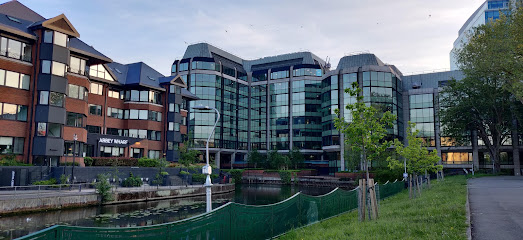
| Location | : | Reading, Reading Borough, England |
| Coordinate | : | 51.4564910, -0.9641120 |
| Description | : | HM Prison Reading was built in 1844 as the Berkshire County Gaol in the heart of Reading on the site of the former county prison, alongside the ruins of Reading Abbey and beside the River Kennet. In 1973 Reading was re-designated as a local prison, and around that time its old castle wall was removed. The building was designated as Grade II listed in 1978.[2] In 1992 it became a Remand Centre and Young Offenders Institution, holding prisoners between the ages of 18 and 21 years. On 4 September 2013, it was announced that HM Prison Reading would close by... Read More |
frequently asked questions (FAQ):
-
Where is Reading Prison Cemetery?
Reading Prison Cemetery is located at Reading, Reading Borough, Berkshire, England Reading, Reading Borough ,Berkshire ,England.
-
Reading Prison Cemetery cemetery's updated grave count on graveviews.com?
0 memorials
-
Where are the coordinates of the Reading Prison Cemetery?
Latitude: 51.4564910
Longitude: -0.9641120
Nearby Cemetories:
1. Reading Abbey Ruins
Reading, Reading Borough, England
Coordinate: 51.4563710, -0.9651130
2. St. Laurence Churchyard
Reading, Reading Borough, England
Coordinate: 51.4567474, -0.9686236
3. St. Mary's Churchyard
Reading, Reading Borough, England
Coordinate: 51.4544953, -0.9735278
4. St Giles Churchyard
Reading, Reading Borough, England
Coordinate: 51.4509510, -0.9704450
5. Greyfriars Churchyard
Reading, Reading Borough, England
Coordinate: 51.4567920, -0.9764880
6. Reading Cemetery
Reading, Reading Borough, England
Coordinate: 51.4529450, -0.9480160
7. St. Peter's Churchyard
Caversham, Reading Borough, England
Coordinate: 51.4686597, -0.9807669
8. Reading Cemetery and Crematorium
Caversham, Reading Borough, England
Coordinate: 51.4737690, -0.9546570
9. Caversham Cemetery
Caversham, Reading Borough, England
Coordinate: 51.4745850, -0.9758020
10. Earley St Peter Churchyard
Earley, Wokingham Borough, England
Coordinate: 51.4434820, -0.9290850
11. Mays Lane Burial Ground
Earley, Wokingham Borough, England
Coordinate: 51.4431680, -0.9240020
12. St. Andrew's Churchyard
Sonning, Wokingham Borough, England
Coordinate: 51.4740300, -0.9131640
13. All Saints Churchyard
Dunsden Green, South Oxfordshire District, England
Coordinate: 51.4917730, -0.9461650
14. St. Mary Churchyard
Shinfield, Wokingham Borough, England
Coordinate: 51.4081180, -0.9524620
15. St Mary the Virgin Cemetery
Purley on Thames, West Berkshire Unitary Authority, England
Coordinate: 51.4797100, -1.0402200
16. Chapel of St Michael the Archangel
Mapledurham, South Oxfordshire District, England
Coordinate: 51.4849140, -1.0355910
17. St. Margaret's Churchyard
Mapledurham, South Oxfordshire District, England
Coordinate: 51.4850830, -1.0364690
18. Kidmore End Cemetery
Kidmore End, South Oxfordshire District, England
Coordinate: 51.5071600, -0.9942160
19. St. John the Baptist Churchyard
Kidmore End, South Oxfordshire District, England
Coordinate: 51.5085170, -0.9951240
20. Old Churchyard
Arborfield, Wokingham Borough, England
Coordinate: 51.4061530, -0.9231220
21. St. Peter and St. Paul Churchyard
Shiplake, South Oxfordshire District, England
Coordinate: 51.4980750, -0.8963940
22. St Bartholomew Churchyard
Arborfield, Wokingham Borough, England
Coordinate: 51.4043310, -0.9118300
23. Holy Trinity Churchyard
Grazeley, Wokingham Borough, England
Coordinate: 51.3972008, -0.9965683
24. St Mary's Churchyard
Twyford, Wokingham Borough, England
Coordinate: 51.4763850, -0.8673190