
| Memorials | : | 0 |
| Location | : | Reading, Reading Borough, England |
| Coordinate | : | 51.4567920, -0.9764880 |
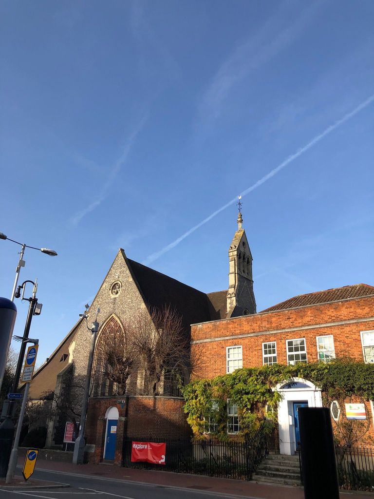
| Description | : | Greyfriars Church is an evangelical Anglican church, and former Franciscan friary, in the town centre of Reading in the English county of Berkshire. The church forms part of the Church of England's Diocese of Oxford. It is the oldest Franciscan church still in use as a place of worship in the UK, and is said to be the most complete surviving example of Franciscan architecture in England. As a consequence, it has been listed as a Grade I listed building. |
frequently asked questions (FAQ):
-
Where is Greyfriars Churchyard?
Greyfriars Churchyard is located at Reading, Reading Borough ,Berkshire ,England.
-
Greyfriars Churchyard cemetery's updated grave count on graveviews.com?
0 memorials
-
Where are the coordinates of the Greyfriars Churchyard?
Latitude: 51.4567920
Longitude: -0.9764880
Nearby Cemetories:
1. St. Mary's Churchyard
Reading, Reading Borough, England
Coordinate: 51.4544953, -0.9735278
2. St. Laurence Churchyard
Reading, Reading Borough, England
Coordinate: 51.4567474, -0.9686236
3. St Giles Churchyard
Reading, Reading Borough, England
Coordinate: 51.4509510, -0.9704450
4. Reading Abbey Ruins
Reading, Reading Borough, England
Coordinate: 51.4563710, -0.9651130
5. Reading Prison Cemetery
Reading, Reading Borough, England
Coordinate: 51.4564910, -0.9641120
6. St. Peter's Churchyard
Caversham, Reading Borough, England
Coordinate: 51.4686597, -0.9807669
7. Caversham Cemetery
Caversham, Reading Borough, England
Coordinate: 51.4745850, -0.9758020
8. Reading Cemetery
Reading, Reading Borough, England
Coordinate: 51.4529450, -0.9480160
9. Reading Cemetery and Crematorium
Caversham, Reading Borough, England
Coordinate: 51.4737690, -0.9546570
10. Earley St Peter Churchyard
Earley, Wokingham Borough, England
Coordinate: 51.4434820, -0.9290850
11. Mays Lane Burial Ground
Earley, Wokingham Borough, England
Coordinate: 51.4431680, -0.9240020
12. All Saints Churchyard
Dunsden Green, South Oxfordshire District, England
Coordinate: 51.4917730, -0.9461650
13. St. Andrew's Churchyard
Sonning, Wokingham Borough, England
Coordinate: 51.4740300, -0.9131640
14. St Mary the Virgin Cemetery
Purley on Thames, West Berkshire Unitary Authority, England
Coordinate: 51.4797100, -1.0402200
15. Chapel of St Michael the Archangel
Mapledurham, South Oxfordshire District, England
Coordinate: 51.4849140, -1.0355910
16. St. Margaret's Churchyard
Mapledurham, South Oxfordshire District, England
Coordinate: 51.4850830, -1.0364690
17. St. Mary Churchyard
Shinfield, Wokingham Borough, England
Coordinate: 51.4081180, -0.9524620
18. Kidmore End Cemetery
Kidmore End, South Oxfordshire District, England
Coordinate: 51.5071600, -0.9942160
19. St. John the Baptist Churchyard
Kidmore End, South Oxfordshire District, England
Coordinate: 51.5085170, -0.9951240
20. Saint Nicholas Churchyard
Sulham, West Berkshire Unitary Authority, England
Coordinate: 51.4632900, -1.0729000
21. Old Churchyard
Arborfield, Wokingham Borough, England
Coordinate: 51.4061530, -0.9231220
22. Holy Trinity Churchyard
Grazeley, Wokingham Borough, England
Coordinate: 51.3972008, -0.9965683
23. St. Mary's Churchyard
Burghfield, West Berkshire Unitary Authority, England
Coordinate: 51.4110000, -1.0420000
24. St. Peter and St. Paul Churchyard
Shiplake, South Oxfordshire District, England
Coordinate: 51.4980750, -0.8963940