
| Memorials | : | 0 |
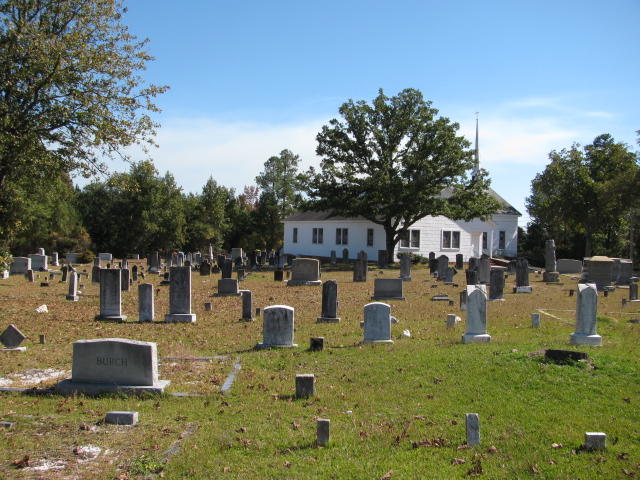
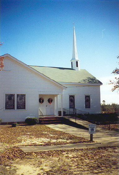
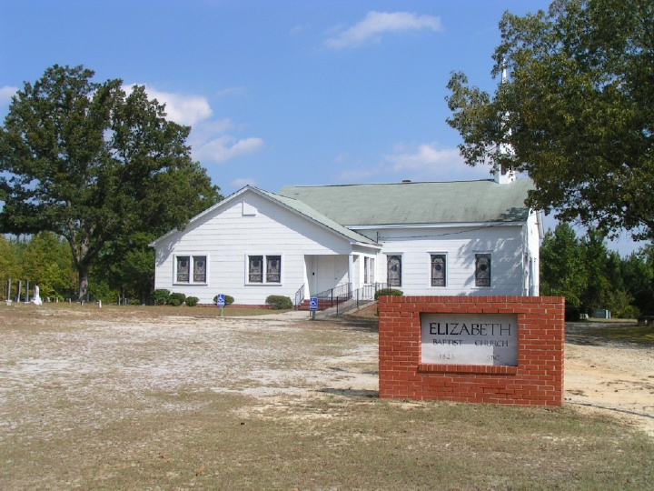
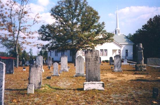
| Location | : | Mount Croghan, Chesterfield County, USA |
| Coordinate | : | 34.7806015, -80.2130966 |
frequently asked questions (FAQ):
-
Where is Elizabeth Baptist Church Cemetery?
Elizabeth Baptist Church Cemetery is located at Mount Croghan, Chesterfield County ,South Carolina ,USA.
-
Elizabeth Baptist Church Cemetery cemetery's updated grave count on graveviews.com?
0 memorials
-
Where are the coordinates of the Elizabeth Baptist Church Cemetery?
Latitude: 34.7806015
Longitude: -80.2130966
Nearby Cemetories:
1. Mount Croghan United Methodist Church Cemetery
Mount Croghan, Chesterfield County, USA
Coordinate: 34.7686430, -80.2240780
2. Mount Croghan Memorial Park
Mount Croghan, Chesterfield County, USA
Coordinate: 34.7686005, -80.2244034
3. Timmonsville Baptist Church Cemetery
Mount Croghan, Chesterfield County, USA
Coordinate: 34.7825050, -80.1944070
4. Timmonsville Baptist Church Cemetery Old
Mount Croghan, Chesterfield County, USA
Coordinate: 34.7789940, -80.1903360
5. Lamb of God Outreach Ministries Church Cemetery
Mount Croghan, Chesterfield County, USA
Coordinate: 34.7699190, -80.2325430
6. Sellers Cemetery
Ruby, Chesterfield County, USA
Coordinate: 34.7590400, -80.2025340
7. Watson Cemetery
Mount Croghan, Chesterfield County, USA
Coordinate: 34.8075580, -80.2188800
8. Hancock Cemetery
Ruby, Chesterfield County, USA
Coordinate: 34.7579830, -80.1923260
9. Gulledge Family Cemetery
Ruby, Chesterfield County, USA
Coordinate: 34.7685860, -80.1802830
10. Gulledge Cemetery
Mount Croghan, Chesterfield County, USA
Coordinate: 34.7516890, -80.2247430
11. Massey Cemetery
Ruby, Chesterfield County, USA
Coordinate: 34.7783050, -80.1735600
12. Campbell Cemetery
Ruby, Chesterfield County, USA
Coordinate: 34.7502340, -80.1913550
13. Smith Cemetery
Ruby, Chesterfield County, USA
Coordinate: 34.7449670, -80.2004310
14. Smith Family Cemetery
Ruby, Chesterfield County, USA
Coordinate: 34.7451960, -80.1958290
15. Brantley Family Cemetery
Ruby, Chesterfield County, USA
Coordinate: 34.7468360, -80.1879220
16. Ruby Church of God Cemetery
Ruby, Chesterfield County, USA
Coordinate: 34.7406250, -80.2151300
17. Long Pine United Methodist Church Cemetery
Long Pine, Anson County, USA
Coordinate: 34.8237038, -80.2201080
18. Long Pine Baptist Church Cemetery
Long Pine, Anson County, USA
Coordinate: 34.8240929, -80.2131348
19. Gulledge Cemetery
Ruby, Chesterfield County, USA
Coordinate: 34.7370540, -80.2192710
20. Thompson Creek Baptist Church Cemetery Old
Chesterfield, Chesterfield County, USA
Coordinate: 34.7771740, -80.1573740
21. Thompson Creek Baptist Church Cemetery New
Chesterfield County, USA
Coordinate: 34.7756004, -80.1575012
22. Smith Cemetery
Ruby, Chesterfield County, USA
Coordinate: 34.7451040, -80.1773000
23. Ruby Cemetery
Ruby, Chesterfield County, USA
Coordinate: 34.7447014, -80.1769028
24. Burch Family Cemetery
Maysville, Chesterfield County, USA
Coordinate: 34.7976160, -80.1581110