
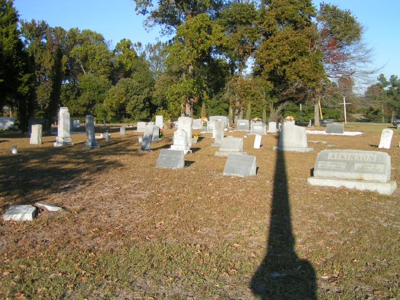
| Memorials | : | 0 |
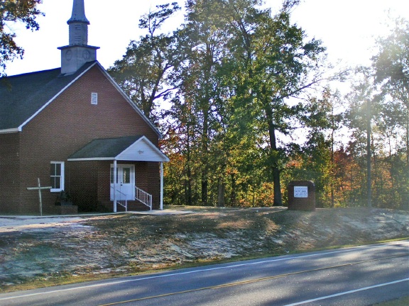
| Location | : | Mount Croghan, Chesterfield County, USA |
| Coordinate | : | 34.7682330, -80.2704480 |
| Description | : | Telephone: 843-634-6511 Directions: From Mt. Croghan, take SC Highway 9 west and travel 3.5 miles. The church is on the left side of the road and the cemetery is on the right side. |
frequently asked questions (FAQ):
-
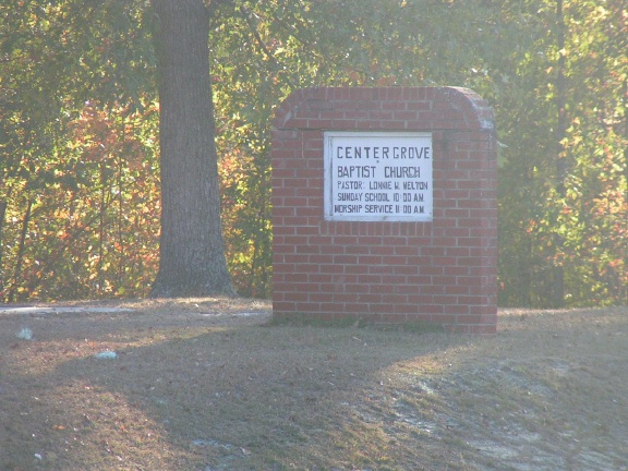
Where is Center Grove Baptist Church?
Center Grove Baptist Church is located at 22971 Highway 9 Mount Croghan, Chesterfield County ,South Carolina , 29727USA.
-
Center Grove Baptist Church cemetery's updated grave count on graveviews.com?
0 memorials
-
Where are the coordinates of the Center Grove Baptist Church?
Latitude: 34.7682330
Longitude: -80.2704480
Nearby Cemetories:
1. Piney Grove A.M.E. Zion Church Cemetery
Mount Croghan, Chesterfield County, USA
Coordinate: 34.7406480, -80.2731540
2. Antioch Methodist Church Cemetery
Hornsboro, Chesterfield County, USA
Coordinate: 34.7971992, -80.2742004
3. Gum Springs Baptist Church Cemetery
Pageland, Chesterfield County, USA
Coordinate: 34.7583780, -80.3050720
4. Lamb of God Outreach Ministries Church Cemetery
Mount Croghan, Chesterfield County, USA
Coordinate: 34.7699190, -80.2325430
5. Mount Croghan Memorial Park
Mount Croghan, Chesterfield County, USA
Coordinate: 34.7686005, -80.2244034
6. Mount Croghan United Methodist Church Cemetery
Mount Croghan, Chesterfield County, USA
Coordinate: 34.7686430, -80.2240780
7. Oro United Methodist Church
Pageland, Chesterfield County, USA
Coordinate: 34.7811170, -80.3157230
8. Gulledge Cemetery
Mount Croghan, Chesterfield County, USA
Coordinate: 34.7516890, -80.2247430
9. Elizabeth Baptist Church Cemetery
Mount Croghan, Chesterfield County, USA
Coordinate: 34.7806015, -80.2130966
10. Gulledge Cemetery
Ruby, Chesterfield County, USA
Coordinate: 34.7370540, -80.2192710
11. Ruby Church of God Cemetery
Ruby, Chesterfield County, USA
Coordinate: 34.7406250, -80.2151300
12. Horne Family Cemetery
Chesterfield County, USA
Coordinate: 34.8107860, -80.3114190
13. Cross Roads Baptist Church Cemetery
Ruby, Chesterfield County, USA
Coordinate: 34.7182999, -80.2386017
14. Sellers Cemetery
Ruby, Chesterfield County, USA
Coordinate: 34.7590400, -80.2025340
15. Providence Baptist Church Cemetery
Chesterfield County, USA
Coordinate: 34.7703640, -80.3404850
16. Watson Cemetery
Mount Croghan, Chesterfield County, USA
Coordinate: 34.8075580, -80.2188800
17. Old Mount Olive Cemetery
Chesterfield County, USA
Coordinate: 34.7182999, -80.3060989
18. Smith Cemetery
Ruby, Chesterfield County, USA
Coordinate: 34.7449670, -80.2004310
19. Timmonsville Baptist Church Cemetery
Mount Croghan, Chesterfield County, USA
Coordinate: 34.7825050, -80.1944070
20. Hancock Cemetery
Ruby, Chesterfield County, USA
Coordinate: 34.7579830, -80.1923260
21. Smith Family Cemetery
Ruby, Chesterfield County, USA
Coordinate: 34.7451960, -80.1958290
22. Timmonsville Baptist Church Cemetery Old
Mount Croghan, Chesterfield County, USA
Coordinate: 34.7789940, -80.1903360
23. Campbell Cemetery
Ruby, Chesterfield County, USA
Coordinate: 34.7502340, -80.1913550
24. Bethlehem Baptist Church Cemetery
Pageland, Chesterfield County, USA
Coordinate: 34.7270490, -80.3357220