
| Memorials | : | 0 |
| Location | : | Ginnum, Ferwerderadiel Municipality, Netherlands |
| Coordinate | : | 53.3231763, 5.8745312 |
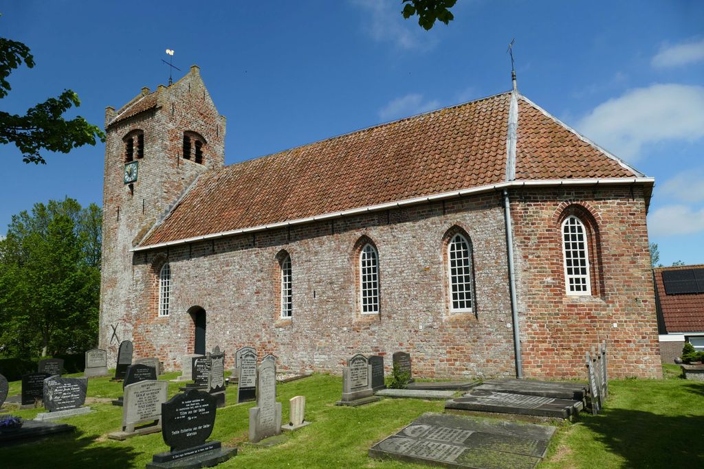
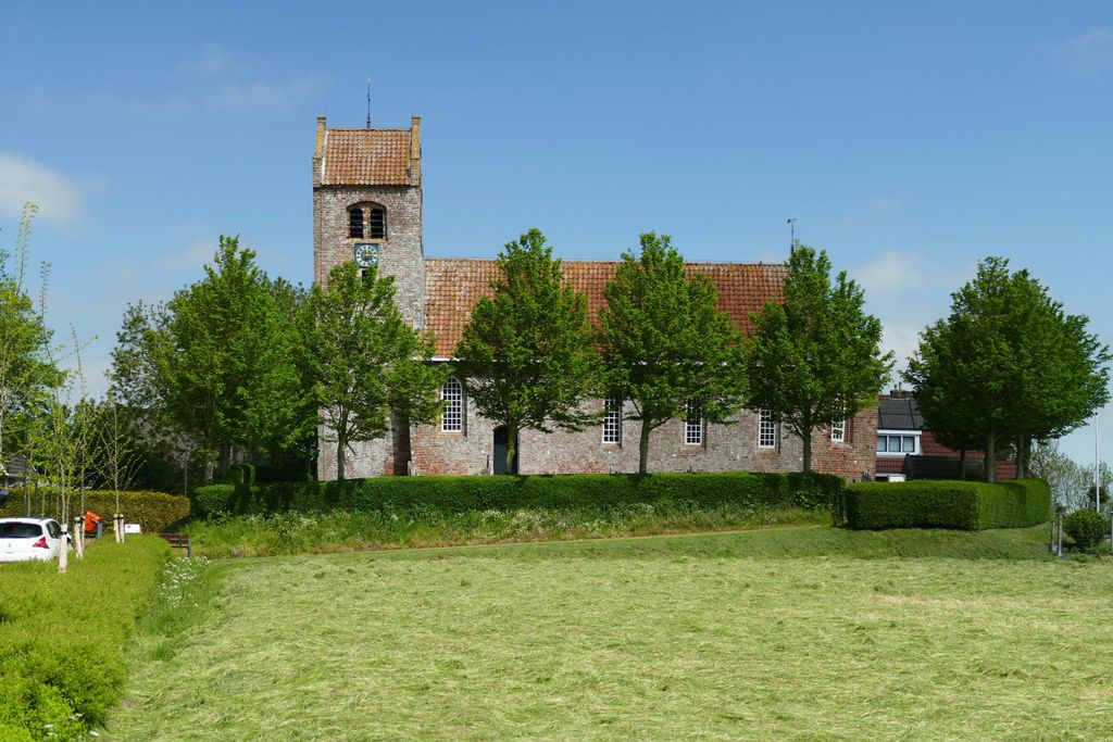
| Description | : | Het kerkje van Ginnum is gebouwd in de 12e eeuw, vrijwel zeker als vervanging van een houten kapelletje. Bij archeologisch onderzoek zijn sporen daarvan gevonden. De noordmuur van het schip is grotendeels gebouwd van tufsteen. De zuidmuur van het schip, het driezijdige koor en de toren zijn gebouwd van baksteen. Van de twee in de toren hangende klokken dateert de ene uit 1490, de andere uit het jaar 1344. Beide klokken zijn gegoten bij de gieterij Stephanus. De kerk werd daarom ook wel de Stephanuskerk genoemd. In 1973 vond een algehele restauratie plaats waarbij helaas het gehele interieur, zoals het doopvont uit... Read More |
frequently asked questions (FAQ):
-
Where is Atelierkerk?
Atelierkerk is located at Harstawei 7 Ginnum, Ferwerderadiel Municipality ,Friesland , 9173 GANetherlands.
-
Atelierkerk cemetery's updated grave count on graveviews.com?
0 memorials
-
Where are the coordinates of the Atelierkerk?
Latitude: 53.3231763
Longitude: 5.8745312
Nearby Cemetories:
1. Tsjerkhôf Jannum
Jannum, Ferwerderadiel Municipality, Netherlands
Coordinate: 53.3126308, 5.9027619
2. Kerkhof Nederlands Hervormde kerk Hegebeintum
Hegebeintum, Ferwerderadiel Municipality, Netherlands
Coordinate: 53.3368479, 5.8498713
3. Petruskerkhof
Lichtaard, Ferwerderadiel Municipality, Netherlands
Coordinate: 53.3263379, 5.9135862
4. Kerkhof Petruskerk
Wanswerd, Ferwerderadiel Municipality, Netherlands
Coordinate: 53.3009375, 5.8496879
5. Blija Protestant Churchyard
Blija, Ferwerderadiel Municipality, Netherlands
Coordinate: 53.3511734, 5.8606162
6. Ferwert Kerkhof
Ferwert, Ferwerderadiel Municipality, Netherlands
Coordinate: 53.3388900, 5.8237700
7. Marrum Churchyard
Marrum, Ferwerderadiel Municipality, Netherlands
Coordinate: 53.3341522, 5.8117681
8. Raard Protestant Churchyard
Raard, Dongeradeel Municipality, Netherlands
Coordinate: 53.3254600, 5.9444900
9. Kloosterkapel begraafplaats
Sibrandahûs, Dantumadeel Municipality, Netherlands
Coordinate: 53.3111878, 5.9425346
10. Westernijtsjerk Kerkhof
Westernijtsjerk, Ferwerderadiel Municipality, Netherlands
Coordinate: 53.3279795, 5.8003224
11. Kerkhof Alexanderkerk Rinsumageest
Rinsumageest, Dantumadeel Municipality, Netherlands
Coordinate: 53.2959488, 5.9429579
12. Holwerd Protestant Churchyard
Holwerd, Dongeradeel Municipality, Netherlands
Coordinate: 53.3710500, 5.8972200
13. Hallum Protestant Churchyard
Hallum, Ferwerderadiel Municipality, Netherlands
Coordinate: 53.3070540, 5.7853420
14. Begraafplaats Aldtsjerk
Aldtsjerk, Tytsjerksteradiel Municipality, Netherlands
Coordinate: 53.2648500, 5.8887300
15. Akkerwoude Protestant Churchyard
Akkerwoude, Dantumadeel Municipality, Netherlands
Coordinate: 53.2909300, 5.9779800
16. Marijetsjerke Begraafplaats
Oenkerk, Tytsjerksteradiel Municipality, Netherlands
Coordinate: 53.2537643, 5.8927362
17. It Readtsjerkje hôf
Readtsjerk, Dantumadeel Municipality, Netherlands
Coordinate: 53.2562756, 5.9332706
18. Sint-Vituskerk
Wyns, Tytsjerksteradiel Municipality, Netherlands
Coordinate: 53.2516880, 5.8322860
19. Giekerk Martinuskerk
Giekerk, Tytsjerksteradiel Municipality, Netherlands
Coordinate: 53.2411660, 5.8785276
20. Damwoude General Cemetery
Damwâld, Dantumadeel Municipality, Netherlands
Coordinate: 53.2857700, 5.9996900
21. Rêsthôf Broeksterwâld
Broeksterwoude, Dantumadeel Municipality, Netherlands
Coordinate: 53.2758766, 5.9907295
22. Kerkhof Johanneskerk
Britsum, Leeuwarderadeel Municipality, Netherlands
Coordinate: 53.2542998, 5.7855996
23. Stiens Protestant Churchyard
Stiens, Leeuwarderadeel Municipality, Netherlands
Coordinate: 53.2624810, 5.7572899
24. Kerkhof Cornjum
Cornjum, Leeuwarderadeel Municipality, Netherlands
Coordinate: 53.2431266, 5.7825235