
| Memorials | : | 17 |
| Location | : | Clipston, Daventry District, England |
| Coordinate | : | 52.4296989, -0.9582000 |
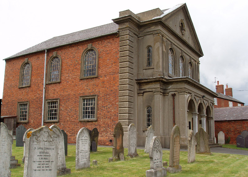
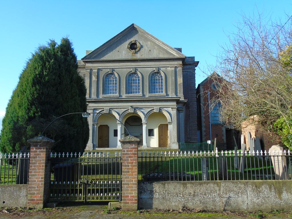
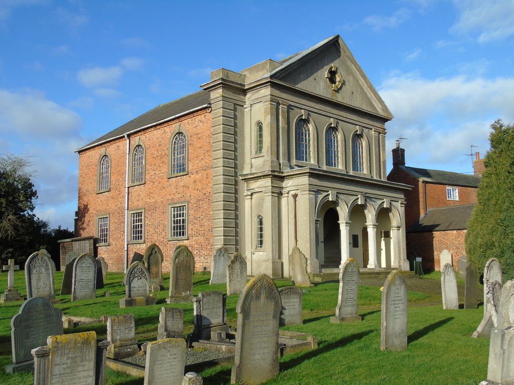
| Description | : | On Chapel Lane adjacent to the Baptist Chapel in Clipston, Northamptonshire, England. Clipston is administered as part of the Daventry district of Northamptonshire in England. The town of Market Harborough in the neighbouring county of Leicestershire is much nearer and so the village may be regarded as a satellite of that town rather than Daventry. |
frequently asked questions (FAQ):
-
Where is Baptist Graveyard?
Baptist Graveyard is located at Chapel Lane Clipston, Daventry District ,Northamptonshire , LE16 9RLEngland.
-
Baptist Graveyard cemetery's updated grave count on graveviews.com?
15 memorials
-
Where are the coordinates of the Baptist Graveyard?
Latitude: 52.4296989
Longitude: -0.9582000
Nearby Cemetories:
1. All Saints Churchyard
Clipston, Daventry District, England
Coordinate: 52.4273400, -0.9517300
2. St. Helen's Churchyard
Sibbertoft, Daventry District, England
Coordinate: 52.4386400, -0.9989200
3. Saint John the Baptist Churchyard
East Farndon, Daventry District, England
Coordinate: 52.4562100, -0.9472400
4. Saint Helen's Churchyard
Great Oxendon, Daventry District, England
Coordinate: 52.4484500, -0.9191000
5. St. Deny's Churchyard
Kelmarsh, Daventry District, England
Coordinate: 52.4060590, -0.9207120
6. All Saints Churchyard
Naseby, Daventry District, England
Coordinate: 52.3968790, -0.9889740
7. St. Nicholas' Churchyard
Marston Trussell, Daventry District, England
Coordinate: 52.4669200, -0.9804650
8. Saint Michael's Churchyard
Haselbech, Daventry District, England
Coordinate: 52.3891890, -0.9556720
9. St Andrew Churchyard
Arthingworth, Daventry District, England
Coordinate: 52.4255400, -0.8914700
10. All Saints Churchyard
Lubenham, Harborough District, England
Coordinate: 52.4770020, -0.9631870
11. Market Harborough Cemetery
Market Harborough, Harborough District, England
Coordinate: 52.4684000, -0.9132760
12. All Saints Churchyard
Theddingworth, Harborough District, England
Coordinate: 52.4655020, -1.0185520
13. St Dionysius Parish Church
Market Harborough, Harborough District, England
Coordinate: 52.4785850, -0.9213720
14. St. Nicholas Churchyard
Little Bowden, Harborough District, England
Coordinate: 52.4754180, -0.9114670
15. All Saints Churchyard
Braybrooke, Kettering Borough, England
Coordinate: 52.4538160, -0.8764390
16. Saint Mary the Virgin
Maidwell, Daventry District, England
Coordinate: 52.3854950, -0.9007770
17. St. Mary in Arden Churchyard
Market Harborough, Harborough District, England
Coordinate: 52.4804240, -0.9110140
18. All Saints Churchyard
Husbands Bosworth, Harborough District, England
Coordinate: 52.4536880, -1.0529010
19. St Mary the Virgin Churchyard
Welford, Daventry District, England
Coordinate: 52.4172618, -1.0587465
20. St. Mary's Churchyard Extension
Welford, Daventry District, England
Coordinate: 52.4173836, -1.0595687
21. Husbands Bosworth Cemetery
Husbands Bosworth, Harborough District, England
Coordinate: 52.4481064, -1.0583018
22. Saint Catherine
Draughton, Daventry District, England
Coordinate: 52.3840770, -0.8821840
23. St. Denys' Churchyard
Cold Ashby, Daventry District, England
Coordinate: 52.3806000, -1.0372700
24. Foxton Cemetery
Foxton, Harborough District, England
Coordinate: 52.4998900, -0.9734000