
| Memorials | : | 1 |
| Location | : | Welford, Daventry District, England |
| Coordinate | : | 52.4173836, -1.0595687 |
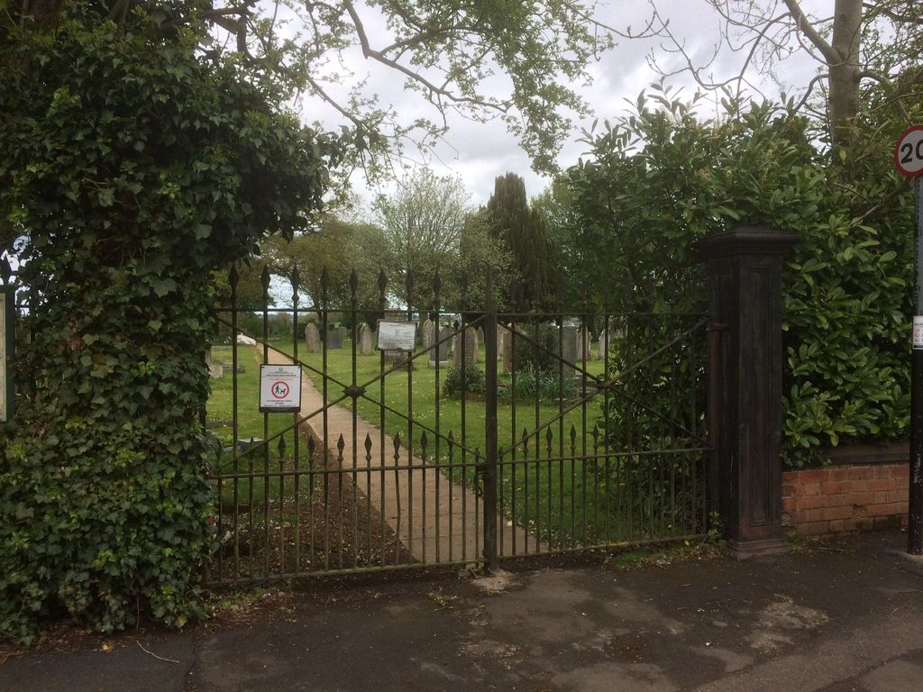
| Description | : | St. Mary's churchyard extension is located opposite St. Mary the Virgin Church in Welford. |
frequently asked questions (FAQ):
-
Where is St. Mary's Churchyard Extension?
St. Mary's Churchyard Extension is located at West Street Welford, Daventry District ,Northamptonshire ,England.
-
St. Mary's Churchyard Extension cemetery's updated grave count on graveviews.com?
1 memorials
-
Where are the coordinates of the St. Mary's Churchyard Extension?
Latitude: 52.4173836
Longitude: -1.0595687
Nearby Cemetories:
1. St Mary the Virgin Churchyard
Welford, Daventry District, England
Coordinate: 52.4172618, -1.0587465
2. Husbands Bosworth Cemetery
Husbands Bosworth, Harborough District, England
Coordinate: 52.4481064, -1.0583018
3. St. Andrew Churchyard
North Kilworth, Harborough District, England
Coordinate: 52.4432190, -1.0950880
4. St Nicholas Church
South Kilworth, Harborough District, England
Coordinate: 52.4316750, -1.1125110
5. All Saints Churchyard
Husbands Bosworth, Harborough District, England
Coordinate: 52.4536880, -1.0529010
6. St. Denys' Churchyard
Cold Ashby, Daventry District, England
Coordinate: 52.3806000, -1.0372700
7. St. Helen's Churchyard
Sibbertoft, Daventry District, England
Coordinate: 52.4386400, -0.9989200
8. All Saints Churchyard
Naseby, Daventry District, England
Coordinate: 52.3968790, -0.9889740
9. St. Nicholas's Churchyard
Stanford-on-Avon, Daventry District, England
Coordinate: 52.4045020, -1.1359770
10. St Nicholas' Churchyard
Stanford on Avon, Harborough District, England
Coordinate: 52.4045560, -1.1362100
11. St. Andrew's Churchyard
Clay Coton, Daventry District, England
Coordinate: 52.3871456, -1.1290185
12. All Saints Churchyard
Theddingworth, Harborough District, England
Coordinate: 52.4655020, -1.0185520
13. All Saints Churchyard
Yelvertoft, Daventry District, England
Coordinate: 52.3717866, -1.1164310
14. Yelvertoft Cemetery
Yelvertoft, Daventry District, England
Coordinate: 52.3707000, -1.1153400
15. Yelvertoft Independent Chapel Churchyard
Yelvertoft, Daventry District, England
Coordinate: 52.3736980, -1.1225680
16. St. Michael and All Angels Churchyard
Winwick, Daventry District, England
Coordinate: 52.3589063, -1.0820887
17. Baptist Graveyard
Clipston, Daventry District, England
Coordinate: 52.4296989, -0.9582000
18. All Saints Churchyard
Swinford, Harborough District, England
Coordinate: 52.4099260, -1.1642830
19. Greenhaven Woodland Burial Ground
Lilbourne, Daventry District, England
Coordinate: 52.3881390, -1.1545970
20. All Saints Churchyard
Clipston, Daventry District, England
Coordinate: 52.4273400, -0.9517300
21. Swinford cemetery
Swinford, Harborough District, England
Coordinate: 52.4088297, -1.1695096
22. St. Nicholas' Churchyard
Marston Trussell, Daventry District, England
Coordinate: 52.4669200, -0.9804650
23. Saint Michael's Churchyard
Haselbech, Daventry District, England
Coordinate: 52.3891890, -0.9556720
24. All Saints Churchyard
Kimcote, Harborough District, England
Coordinate: 52.4736330, -1.1390390