
| Memorials | : | 11 |
| Location | : | Wayne Township, Monroe County, USA |
| Coordinate | : | 39.7313995, -81.1819000 |
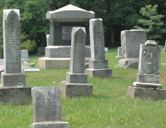
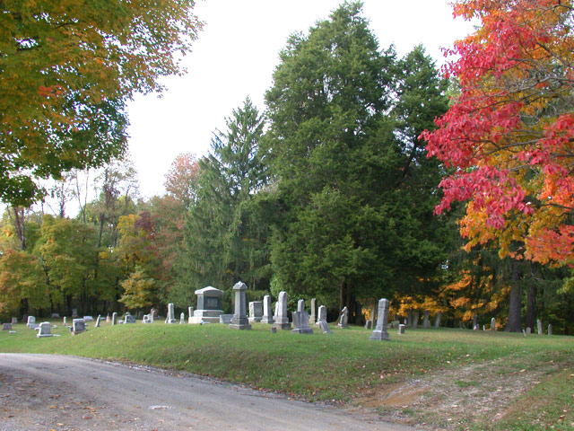
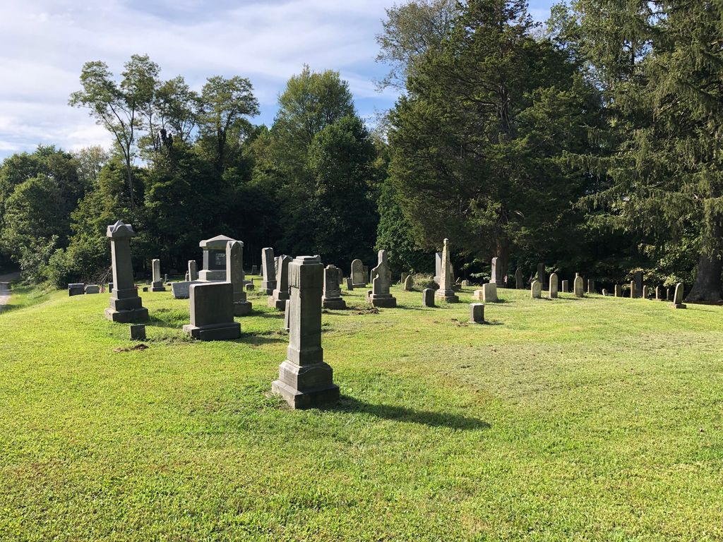
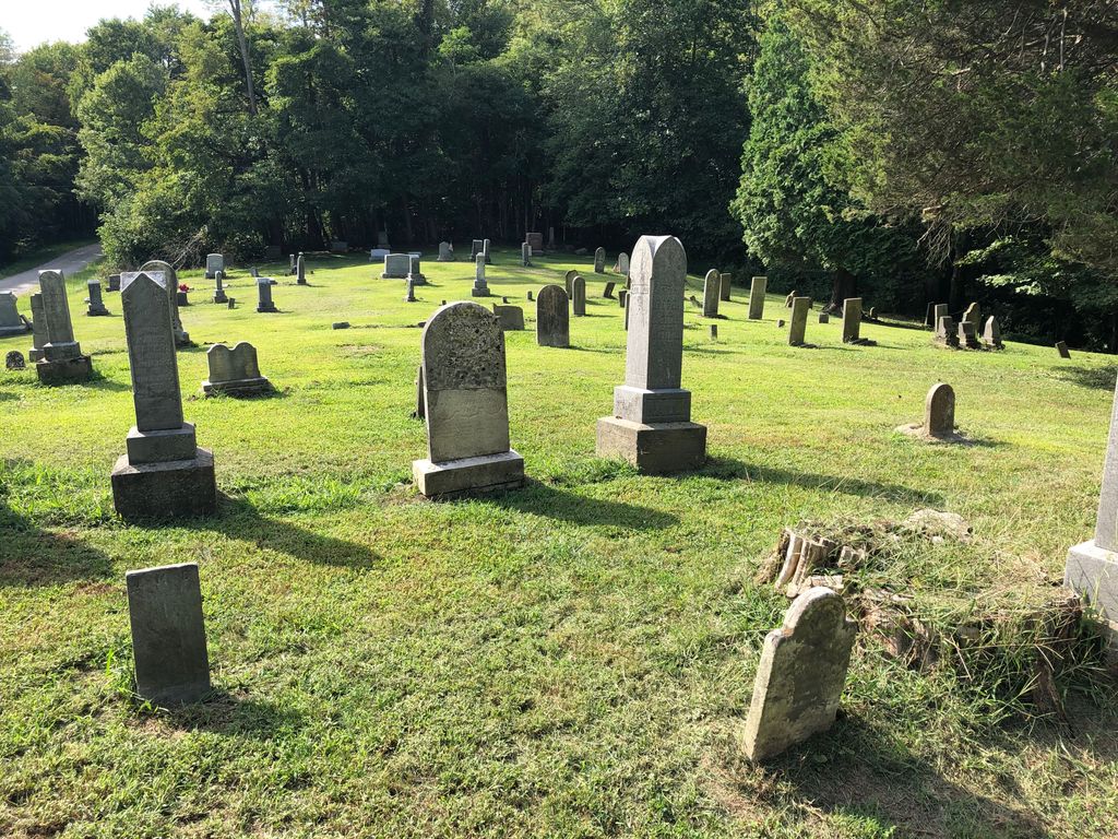
| Description | : | The cemetery is located on the north side of Barber Ridge Road (County Road 77) at its intersection with Township Road 662. The cemetery was established in 1850 and is 0.51 acres in size. The cemetery is located in Wayne Township, Monroe County, Ohio, and is # 15215 (Barber Ridge Cemetery / Barber Cemetery) in “Ohio Cemeteries 1803-2003”, compiled by the Ohio Genealogical Society. The U.S. Geological Survey (USGS) Geographic Names Information System (GNIS) feature ID for the cemetery is 1037622 (Barber Cemetery). |
frequently asked questions (FAQ):
-
Where is Barber Ridge Cemetery?
Barber Ridge Cemetery is located at Barber Ridge Road (County Road 77) Wayne Township, Monroe County ,Ohio , 43754USA.
-
Barber Ridge Cemetery cemetery's updated grave count on graveviews.com?
11 memorials
-
Where are the coordinates of the Barber Ridge Cemetery?
Latitude: 39.7313995
Longitude: -81.1819000
Nearby Cemetories:
1. Moose Ridge Cemetery
Monroe County, USA
Coordinate: 39.7430992, -81.1544037
2. Potts Cemetery
Monroe County, USA
Coordinate: 39.7588997, -81.1652985
3. Christy Cemetery
Hilltop, Monroe County, USA
Coordinate: 39.7020230, -81.1968830
4. Conners Ridge Cemetery
Monroe County, USA
Coordinate: 39.7016983, -81.1613998
5. Valley Cemetery
Woodsfield, Monroe County, USA
Coordinate: 39.7464700, -81.1426520
6. Buchanan Presbyterian Church Cemetery
Summit Township, Monroe County, USA
Coordinate: 39.7678490, -81.1798325
7. Hartshorn Ridge Cemetery
Monroe County, USA
Coordinate: 39.7047950, -81.2173339
8. Friendship Cemetery
Lewisville, Monroe County, USA
Coordinate: 39.7592010, -81.2221985
9. Lewisville German Lutheran Cemetery
Monroe County, USA
Coordinate: 39.7625700, -81.2184400
10. Evangelical Reformed Church Cemetery
Lewisville, Monroe County, USA
Coordinate: 39.7625723, -81.2184446
11. Drum Cemetery
Monroe County, USA
Coordinate: 39.7010994, -81.1414032
12. Steed Cemetery
Monroe County, USA
Coordinate: 39.7314000, -81.1197000
13. Baker Cemetery
Woodsfield, Monroe County, USA
Coordinate: 39.7313250, -81.1196140
14. McGrary Cemetery
Woodsfield, Monroe County, USA
Coordinate: 39.7585983, -81.1299973
15. Knowlton Cemetery
Monroe County, USA
Coordinate: 39.6852989, -81.2052994
16. Mount Zion Methodist Cemetery
Lewisville, Monroe County, USA
Coordinate: 39.7238390, -81.2483750
17. Saint Sylvester Catholic Church Cemetery
Woodsfield, Monroe County, USA
Coordinate: 39.7564621, -81.1176071
18. Cox-Gray-Myers Cemetery
Woodsfield, Monroe County, USA
Coordinate: 39.6967170, -81.1256170
19. Oaklawn Cemetery
Woodsfield, Monroe County, USA
Coordinate: 39.7663994, -81.1232986
20. Hines Chapel Church of Christ Cemetery
Monroe County, USA
Coordinate: 39.6922900, -81.2398300
21. Pioneer Cemetery
Woodsfield, Monroe County, USA
Coordinate: 39.7647018, -81.1175003
22. Dougherty Cemetery
Monroe County, USA
Coordinate: 39.6767006, -81.1406021
23. Fairview Cemetery
Center Township, Monroe County, USA
Coordinate: 39.7139015, -81.1014023
24. Pioneer Cemetery
Graysville, Monroe County, USA
Coordinate: 39.6672000, -81.1741000