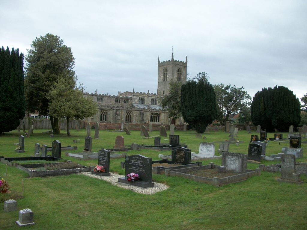
| Memorials | : | 0 |
| Location | : | Eastrington, East Riding of Yorkshire Unitary Authority, England |
| Coordinate | : | 53.7606920, -0.7922500 |
| Description | : | This cemetery was established in 1878 by the local authorities when the adjacent St Michael Churchyard was ordered closed. |
frequently asked questions (FAQ):
-
Where is Eastrington Cemetery?
Eastrington Cemetery is located at Eastrington, East Riding of Yorkshire Unitary Authority ,East Riding of Yorkshire ,England.
-
Eastrington Cemetery cemetery's updated grave count on graveviews.com?
0 memorials
-
Where are the coordinates of the Eastrington Cemetery?
Latitude: 53.7606920
Longitude: -0.7922500
Nearby Cemetories:
1. St Michael Churchyard
Eastrington, East Riding of Yorkshire Unitary Authority, England
Coordinate: 53.7599690, -0.7931110
2. St Peter Churchyard and Church Cemetery
Laxton, East Riding of Yorkshire Unitary Authority, England
Coordinate: 53.7196250, -0.8000900
3. Howden Minster Churchyard
Howden, East Riding of Yorkshire Unitary Authority, England
Coordinate: 53.7449550, -0.8670300
4. Catholic Church of The Sacred Heart
Howden, East Riding of Yorkshire Unitary Authority, England
Coordinate: 53.7428360, -0.8709800
5. Howden Cemetery
Howden, East Riding of Yorkshire Unitary Authority, England
Coordinate: 53.7438890, -0.8770090
6. St Mary the Virgin Churchyard
Hook, East Riding of Yorkshire Unitary Authority, England
Coordinate: 53.7207270, -0.8510590
7. Hook Cemetery
Hook, East Riding of Yorkshire Unitary Authority, England
Coordinate: 53.7204300, -0.8525380
8. Goole Cemetery
Goole, East Riding of Yorkshire Unitary Authority, England
Coordinate: 53.7105940, -0.8513370
9. Holy Trinity Churchyard
Blacktoft, East Riding of Yorkshire Unitary Authority, England
Coordinate: 53.7082510, -0.7271700
10. St. John the Evangelist Churchyard
Goole, East Riding of Yorkshire Unitary Authority, England
Coordinate: 53.7024600, -0.8719260
11. St David Churchyard
Airmyn, East Riding of Yorkshire Unitary Authority, England
Coordinate: 53.7178030, -0.9016700
12. St Mary Churchyard
Broomfleet, East Riding of Yorkshire Unitary Authority, England
Coordinate: 53.7338120, -0.6649730
13. All Saints Churchyard
Holme-on-Spalding-Moor, East Riding of Yorkshire Unitary Authority, England
Coordinate: 53.8401222, -0.7544300
14. Barmby on the Marsh Parish Burial Ground
Barmby on the Marsh, East Riding of Yorkshire Unitary Authority, England
Coordinate: 53.7472990, -0.9401910
15. All Saints Churchyard
Adlingfleet, East Riding of Yorkshire Unitary Authority, England
Coordinate: 53.6786760, -0.7238110
16. All Saints Churchyard
Bubwith, East Riding of Yorkshire Unitary Authority, England
Coordinate: 53.8170680, -0.9200130
17. St Oswald Churchyard
Hotham, East Riding of Yorkshire Unitary Authority, England
Coordinate: 53.7999020, -0.6434850
18. St. Helen's Churchyard
Barmby on the Marsh, East Riding of Yorkshire Unitary Authority, England
Coordinate: 53.7476490, -0.9549090
19. St Peter Churchyard
Harswell, East Riding of Yorkshire Unitary Authority, England
Coordinate: 53.8573320, -0.7556910
20. St John the Baptist
Whitton, North Lincolnshire Unitary Authority, England
Coordinate: 53.7093390, -0.6342340
21. Alkborough Cemetery
Alkborough, North Lincolnshire Unitary Authority, England
Coordinate: 53.6816460, -0.6686090
22. St Mary the Virgin Church
Fockerby, North Lincolnshire Unitary Authority, England
Coordinate: 53.6613050, -0.7138730
23. St Everilda Churchyard
Everingham, East Riding of Yorkshire Unitary Authority, England
Coordinate: 53.8707810, -0.7785920
24. St Mary the Virgin Churchyard
Hemingbrough, Selby District, England
Coordinate: 53.7672100, -0.9796300

