
| Memorials | : | 0 |
| Location | : | Mountfield, Rother District, England |
| Coordinate | : | 50.9558449, 0.4685820 |
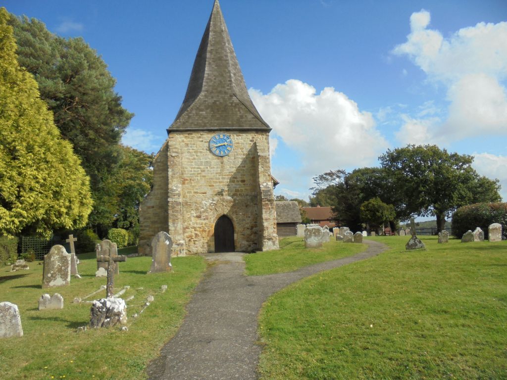
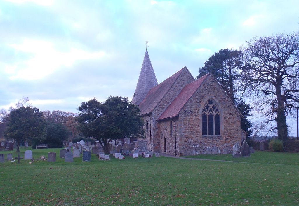
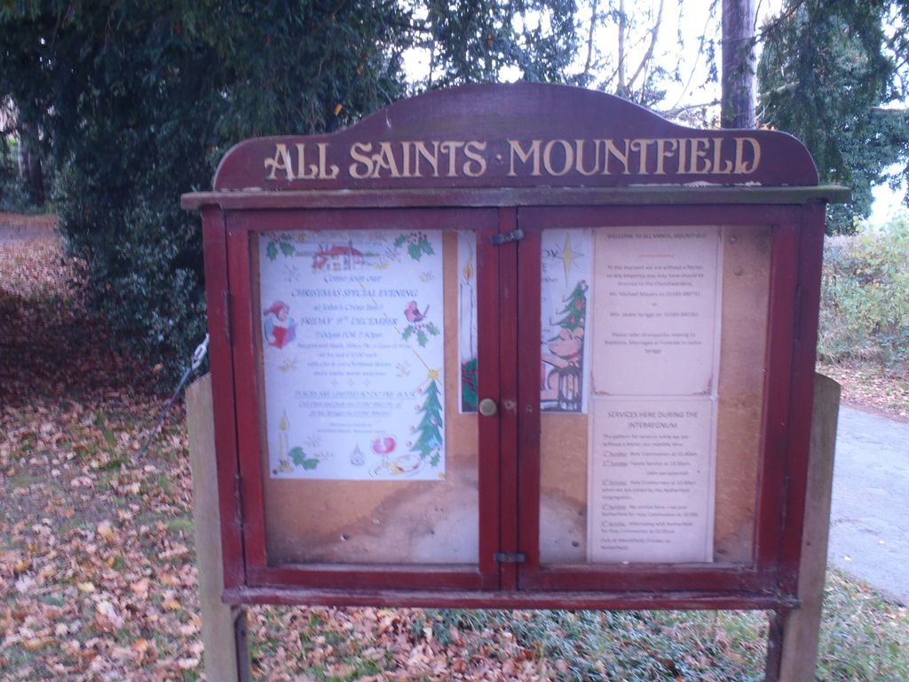
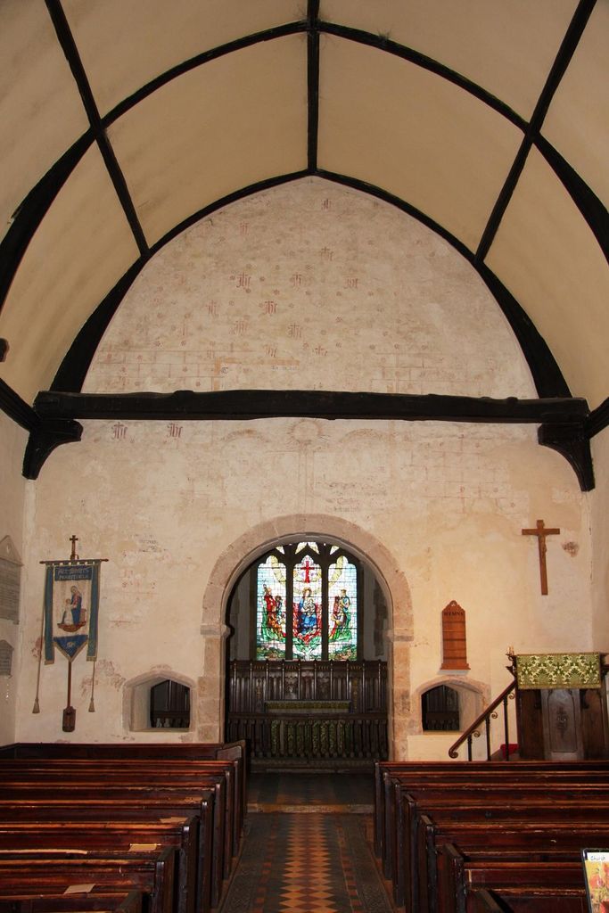
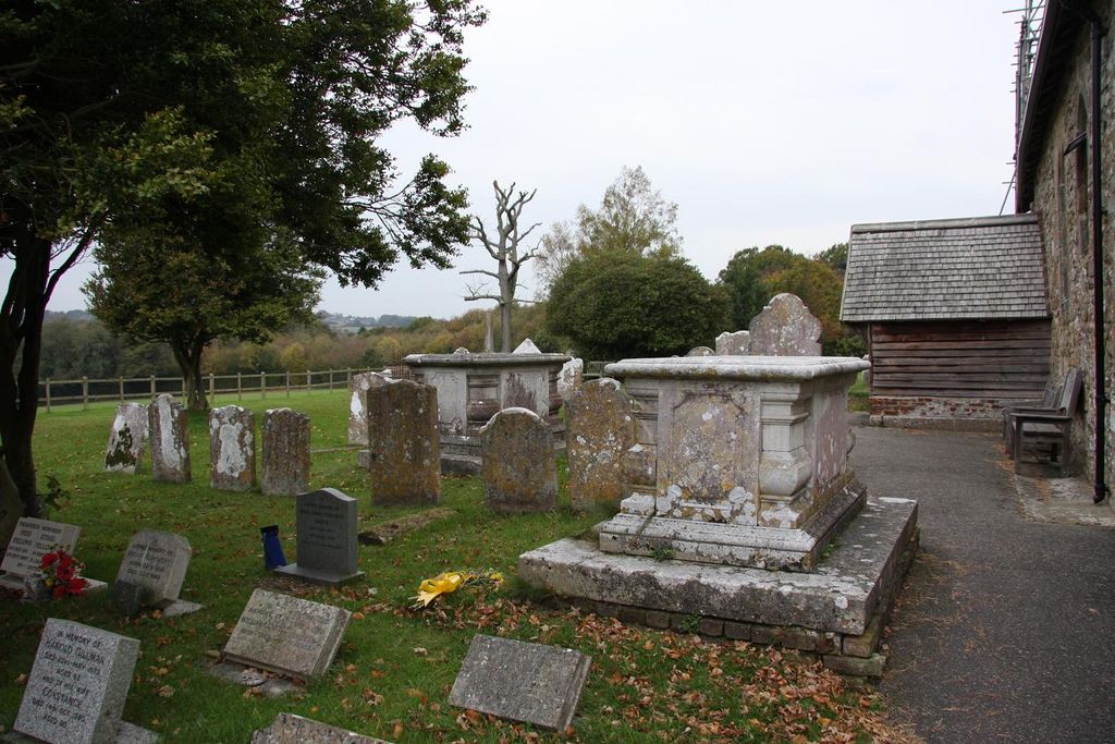
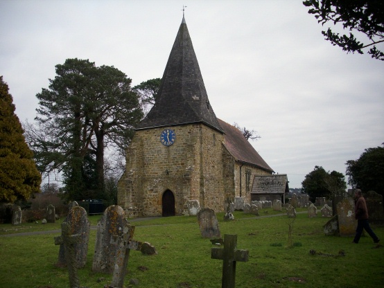
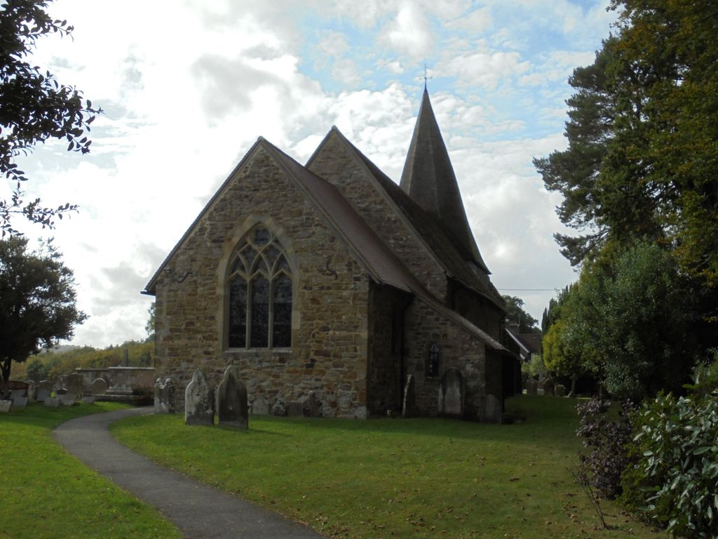
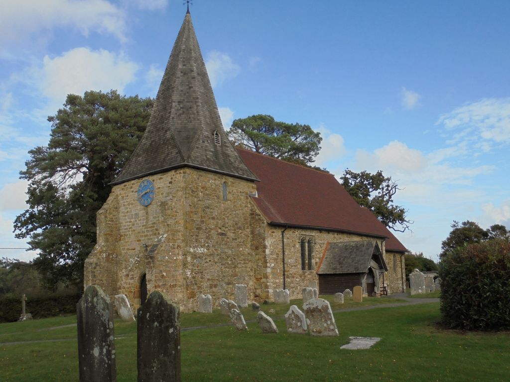
| Description | : | The Parish Church of All Saints, Mountfield dates back to the early 12th century - although it is possible that a wooden structure was on the site prior to 1066. It remains, essentially, a Norman building. The chancel and nave were built first, (c1107-1124), followed by the tower (c1180-1200). Some of the original windows survive - others were inserted in the 13th, 14th and 15th centuries. Of particular note is the large Norman font (the second largest in Sussex) with 16th century decoration. The paintings on the chancel wall range from form the 12th century to the 16th. Entry to... Read More |
frequently asked questions (FAQ):
-
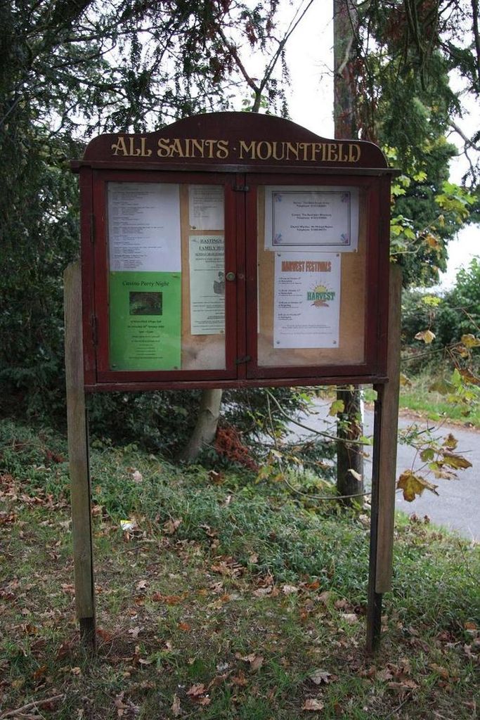
Where is All Saints Churchyard?
All Saints Churchyard is located at Church Road Mountfield, Rother District ,East Sussex ,England.
-
All Saints Churchyard cemetery's updated grave count on graveviews.com?
0 memorials
-
Where are the coordinates of the All Saints Churchyard?
Latitude: 50.9558449
Longitude: 0.4685820
Nearby Cemetories:
1. St John The Baptist Churchyard
Mountfield, Rother District, England
Coordinate: 50.9404170, 0.4512760
2. Darvell Bruderhof Cemetery
Robertsbridge, Rother District, England
Coordinate: 50.9790497, 0.4561470
3. St Mary Magdalene Churchyard
Whatlington, Rother District, England
Coordinate: 50.9365900, 0.5042980
4. St Mary the Virgin Churchyard
Salehurst, Rother District, England
Coordinate: 50.9910170, 0.4911260
5. St. John Baptist Anglcian Churchyard
Sedlescombe, Rother District, England
Coordinate: 50.9412440, 0.5281560
6. St Mary the Virgin Churchyard
Battle, Rother District, England
Coordinate: 50.9150690, 0.4883620
7. Battle Abbey
Battle, Rother District, England
Coordinate: 50.9144940, 0.4875140
8. Battle Cemetery
Battle, Rother District, England
Coordinate: 50.9155800, 0.4935500
9. St. Thomas A. Becket Churchyard
Brightling, Rother District, England
Coordinate: 50.9638440, 0.3961020
10. St Michael the Archangel Churchyard
Penhurst, Rother District, England
Coordinate: 50.9235920, 0.4092830
11. Assumption of Blessed Mary & St. Nicholas Church
Etchingham, Rother District, England
Coordinate: 51.0095830, 0.4416420
12. St. Laurence Churchyard
Catsfield, Rother District, England
Coordinate: 50.8938230, 0.4563190
13. Holy Trinity Churchyard
Hurst Green, Rother District, England
Coordinate: 51.0201400, 0.4691080
14. St. Bartholomew's Churchyard
Burwash, Rother District, England
Coordinate: 50.9976470, 0.3887490
15. St. Peter's Churchyard
Ashburnham, Rother District, England
Coordinate: 50.9056730, 0.4014650
16. Ewhurst Green Churchyard
Ewhurst, Rother District, England
Coordinate: 50.9924300, 0.5572900
17. Saint Giles' Churchyard
Bodiam, Rother District, England
Coordinate: 51.0074800, 0.5393000
18. St. Joseph's Roman Catholic Churchyard
Burwash, Rother District, England
Coordinate: 50.9963500, 0.3782670
19. St. Giles' Churchyard
Dallington, Rother District, England
Coordinate: 50.9470960, 0.3585090
20. Crowhurst Churchyard
Crowhurst, Rother District, England
Coordinate: 50.8838070, 0.4968630
21. St. Mary the Virgin Churchyard
Ninfield, Wealden District, England
Coordinate: 50.8848760, 0.4224590
22. Hawkhurst Cemetery
Hawkhurst, Tunbridge Wells Borough, England
Coordinate: 51.0302300, 0.5051300
23. St Theresa's Catholic Church
Northiam, Rother District, England
Coordinate: 50.9654510, 0.5958960
24. St John the Baptist Churchyard
Westfield, Rother District, England
Coordinate: 50.9080090, 0.5729280