
| Memorials | : | 0 |
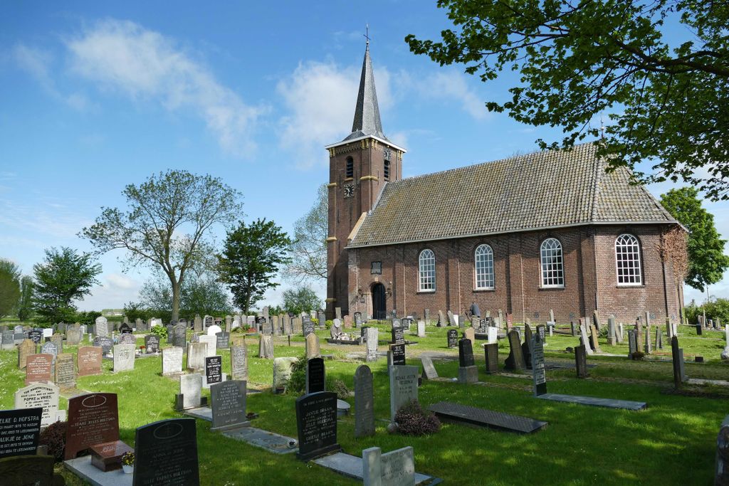
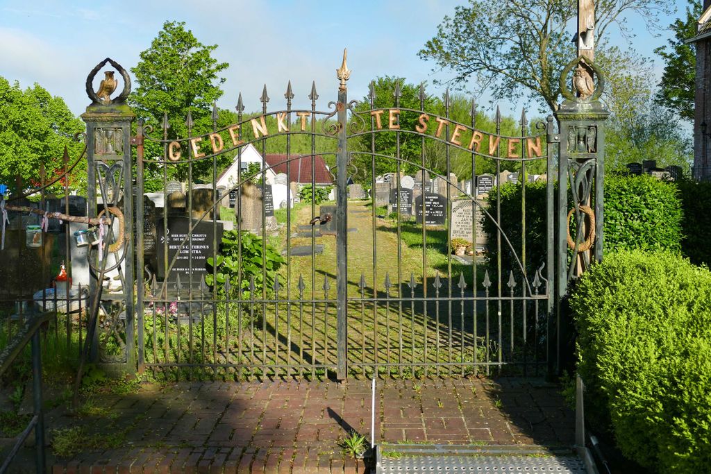
| Location | : | Lekkum, Leeuwarden Municipality, Netherlands |
| Coordinate | : | 53.2263300, 5.8194900 |
frequently asked questions (FAQ):
-
Where is Lekkum Churchyard?
Lekkum Churchyard is located at Lekkum, Leeuwarden Municipality ,Friesland ,Netherlands.
-
Lekkum Churchyard cemetery's updated grave count on graveviews.com?
0 memorials
-
Where are the coordinates of the Lekkum Churchyard?
Latitude: 53.2263300
Longitude: 5.8194900

Nearby Cemetories:
1. Joodse begraafplaats
Leeuwarden, Leeuwarden Municipality, Netherlands
Coordinate: 53.2089720, 5.7912400
2. Sint-Vituskerk
Wyns, Tytsjerksteradiel Municipality, Netherlands
Coordinate: 53.2516880, 5.8322860
3. Kerkhof Cornjum
Cornjum, Leeuwarderadeel Municipality, Netherlands
Coordinate: 53.2431266, 5.7825235
4. Leeuwarden Noorderbegraafplaats
Leeuwarden, Leeuwarden Municipality, Netherlands
Coordinate: 53.2135900, 5.7733900
5. Kerkhof Johanneskerk
Britsum, Leeuwarderadeel Municipality, Netherlands
Coordinate: 53.2542998, 5.7855996
6. Algemene Rooms-Katholieke Begraafplaats Vitushof
Leeuwarden, Leeuwarden Municipality, Netherlands
Coordinate: 53.2061700, 5.7694100
7. Giekerk Martinuskerk
Giekerk, Tytsjerksteradiel Municipality, Netherlands
Coordinate: 53.2411660, 5.8785276
8. Agnestsjerke
Goutum, Leeuwarden Municipality, Netherlands
Coordinate: 53.1786867, 5.8068433
9. Marijetsjerke Begraafplaats
Oenkerk, Tytsjerksteradiel Municipality, Netherlands
Coordinate: 53.2537643, 5.8927362
10. Stiens Protestant Churchyard
Stiens, Leeuwarderadeel Municipality, Netherlands
Coordinate: 53.2624810, 5.7572899
11. Begraafplaats Aldtsjerk
Aldtsjerk, Tytsjerksteradiel Municipality, Netherlands
Coordinate: 53.2648500, 5.8887300
12. Sint-Pontianustsjerke
Marsum, Menaldumadeel Municipality, Netherlands
Coordinate: 53.2108700, 5.7280502
13. Rijperkerk Nederlands Hervormd Kerkhof
Rijperkerk, Tytsjerksteradiel Municipality, Netherlands
Coordinate: 53.2221200, 5.9183300
14. Begraafplaats Sint-Vituskerk
Tytsjerk, Tytsjerksteradiel Municipality, Netherlands
Coordinate: 53.2062242, 5.9142663
15. It Readtsjerkje hôf
Readtsjerk, Dantumadeel Municipality, Netherlands
Coordinate: 53.2562756, 5.9332706
16. Hoftsjerke begraafplaats
Hurdegaryp, Tytsjerksteradiel Municipality, Netherlands
Coordinate: 53.2175817, 5.9445193
17. Kerkhof Petruskerk
Wanswerd, Ferwerderadiel Municipality, Netherlands
Coordinate: 53.3009375, 5.8496879
18. Wirdum Protestant Churchyard
Wirdum, Leeuwarden Municipality, Netherlands
Coordinate: 53.1497300, 5.8036500
19. Kerkhof Nederlands Hervormde Kerk
Suwâld, Tytsjerksteradiel Municipality, Netherlands
Coordinate: 53.1791922, 5.9273043
20. Hallum Protestant Churchyard
Hallum, Ferwerderadiel Municipality, Netherlands
Coordinate: 53.3070540, 5.7853420
21. Kerkepad Begraafplaats
Wytgaard, Leeuwarden Municipality, Netherlands
Coordinate: 53.1418671, 5.7857350
22. Mariatsjerke
Beers, Littenseradiel Municipality, Netherlands
Coordinate: 53.1558525, 5.7329919
23. Wartena General Cemetery
Wartena, Leeuwarden Municipality, Netherlands
Coordinate: 53.1489700, 5.8919100
24. Kerkhof Hervormde Kerk Wartena
Wartena, Leeuwarden Municipality, Netherlands
Coordinate: 53.1495985, 5.8972222