
| Memorials | : | 1 |
| Location | : | Bonicord, Dyer County, USA |
| Coordinate | : | 35.9485000, -89.2969000 |
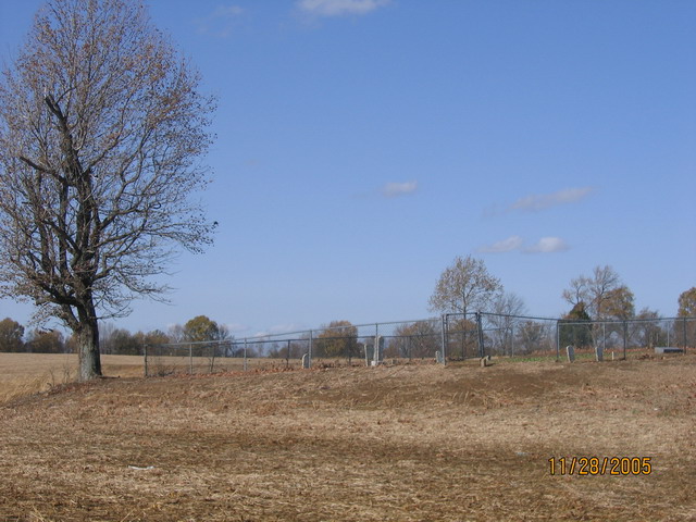
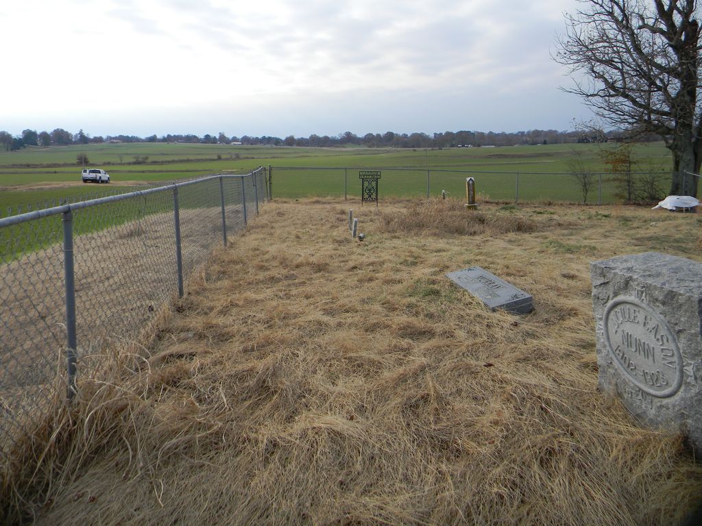
| Description | : | From Dyersburg, TN take 412 E towards Jackson, TN. Travel 6.5 miles to Bill Murray Road. (Sign for Parrish Chapel Baptist Church). Turn left on Bill Murry Road and travel 1.4 miles (road turns into gravel). Cemetery is fenced in and sits on a hillside on the left side of the road .1 mile from the road in the middle of a field. If it's summertime you might not be able to see the cemetery from the road due to the crops in the field. |
frequently asked questions (FAQ):
-
Where is Murray Cemetery?
Murray Cemetery is located at 1350 Bill Murray Road Bonicord, Dyer County ,Tennessee ,USA.
-
Murray Cemetery cemetery's updated grave count on graveviews.com?
1 memorials
-
Where are the coordinates of the Murray Cemetery?
Latitude: 35.9485000
Longitude: -89.2969000

Nearby Cemetories:
1. Staggs Cemetery
Friendship, Dyer County, USA
Coordinate: 35.9397930, -89.2896620
2. Bell-Walker Cemetery
Tigrett, Dyer County, USA
Coordinate: 35.9581400, -89.2913360
3. Millers Chapel Cemetery
Dyersburg, Dyer County, USA
Coordinate: 35.9385986, -89.3163986
4. Jones Cemetery
Tigrett, Dyer County, USA
Coordinate: 35.9552230, -89.2747450
5. Williams Chapel Cemetery
Bonicord, Dyer County, USA
Coordinate: 35.9472008, -89.3221970
6. Nash Cemetery
Dyersburg, Dyer County, USA
Coordinate: 35.9252500, -89.2822230
7. Shelton Cemetery
Fowlkes, Dyer County, USA
Coordinate: 35.9416530, -89.3281750
8. Mose M. Thompson Cemetery
Friendship, Dyer County, USA
Coordinate: 35.9243680, -89.2765870
9. Hardin Cemetery
Friendship, Dyer County, USA
Coordinate: 35.9243270, -89.2766430
10. Mount Pisgah Cemetery
Friendship, Dyer County, USA
Coordinate: 35.9162470, -89.2901740
11. Pate Family Cemetery
Bonicord, Dyer County, USA
Coordinate: 35.9575110, -89.3389720
12. Cock and Irvin Cemetery
Hawkinsville, Dyer County, USA
Coordinate: 35.9104430, -89.3046210
13. Saint Peter Cemetery
Tigrett, Dyer County, USA
Coordinate: 35.9616440, -89.2520140
14. Zion Hill Church Cemetery
Friendship, Dyer County, USA
Coordinate: 35.9095110, -89.2900760
15. McGary Family Cemetery
Tigrett, Dyer County, USA
Coordinate: 35.9649530, -89.2501520
16. Clay Cemetery
Fowlkes, Dyer County, USA
Coordinate: 35.9760780, -89.3453920
17. Sorrell Chapel Cemetery
Bonicord, Dyer County, USA
Coordinate: 35.9772470, -89.3458570
18. Bellevernon Cemetery
Friendship, Crockett County, USA
Coordinate: 35.9135830, -89.2495910
19. Bowen Chapel Cemetery
Friendship, Dyer County, USA
Coordinate: 35.9311810, -89.2353720
20. Parker Cemetery
RoEllen, Dyer County, USA
Coordinate: 36.0018100, -89.2845300
21. Peal and Bailey Land Cemetery
Bruceville, Dyer County, USA
Coordinate: 35.9256960, -89.3584940
22. Palestine Cemetery
Bruceville, Dyer County, USA
Coordinate: 35.9183080, -89.3536090
23. Stallcup Family Cemetery
Cross Roads, Dyer County, USA
Coordinate: 35.8980720, -89.3245320
24. Hodge Cemetery
Dyersburg, Dyer County, USA
Coordinate: 35.9836620, -89.3532490