
| Memorials | : | 8 |
| Location | : | Hawkinsville, Dyer County, USA |
| Coordinate | : | 35.9104430, -89.3046210 |
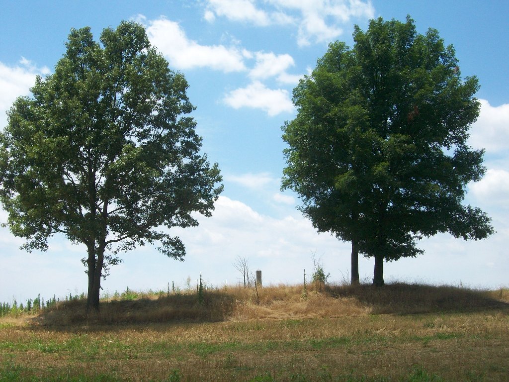
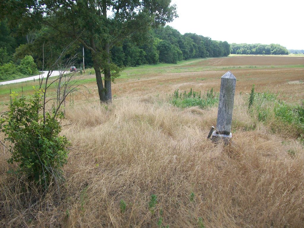
| Description | : | From the intersection of Lennie Clark Rd. & US-412 E, NW of Friendship, travel west on Lennie Clark Rd. for 0.2 mi., turning south (left) onto Clark Rd., going 0.9 mi.; continuing onto Bonicord Rd., going 0.1 mi.; turning west (right) onto Zion Hill Rd. going 1.2 mi. to the cemetery on the west (left) side about 100' from the roadway. This cemetery has no known name other than the family names of Cock and Irvin are on the stone. There is only one tombstone for all the family buried here. Mary A. R. Irvin Cock and... Read More |
frequently asked questions (FAQ):
-
Where is Cock and Irvin Cemetery?
Cock and Irvin Cemetery is located at Zion Hill Road Hawkinsville, Dyer County ,Tennessee ,USA.
-
Cock and Irvin Cemetery cemetery's updated grave count on graveviews.com?
3 memorials
-
Where are the coordinates of the Cock and Irvin Cemetery?
Latitude: 35.9104430
Longitude: -89.3046210
Nearby Cemetories:
1. Zion Hill Church Cemetery
Friendship, Dyer County, USA
Coordinate: 35.9095110, -89.2900760
2. Mount Pisgah Cemetery
Friendship, Dyer County, USA
Coordinate: 35.9162470, -89.2901740
3. Stallcup Family Cemetery
Cross Roads, Dyer County, USA
Coordinate: 35.8980720, -89.3245320
4. Nash Cemetery
Dyersburg, Dyer County, USA
Coordinate: 35.9252500, -89.2822230
5. Hardin Cemetery
Friendship, Dyer County, USA
Coordinate: 35.9243270, -89.2766430
6. Mose M. Thompson Cemetery
Friendship, Dyer County, USA
Coordinate: 35.9243680, -89.2765870
7. Millers Chapel Cemetery
Dyersburg, Dyer County, USA
Coordinate: 35.9385986, -89.3163986
8. Staggs Cemetery
Friendship, Dyer County, USA
Coordinate: 35.9397930, -89.2896620
9. Shelton Cemetery
Fowlkes, Dyer County, USA
Coordinate: 35.9416530, -89.3281750
10. Murray Cemetery
Bonicord, Dyer County, USA
Coordinate: 35.9485000, -89.2969000
11. Williams Chapel Cemetery
Bonicord, Dyer County, USA
Coordinate: 35.9472008, -89.3221970
12. Palestine Cemetery
Bruceville, Dyer County, USA
Coordinate: 35.9183080, -89.3536090
13. Mount Moriah Cemetery
Friendship, Crockett County, USA
Coordinate: 35.8955420, -89.2576300
14. Bellevernon Cemetery
Friendship, Crockett County, USA
Coordinate: 35.9135830, -89.2495910
15. Peal and Bailey Land Cemetery
Bruceville, Dyer County, USA
Coordinate: 35.9256960, -89.3584940
16. South Fork Cemetery
Chestnut Bluff, Crockett County, USA
Coordinate: 35.8646420, -89.3206200
17. Bell-Walker Cemetery
Tigrett, Dyer County, USA
Coordinate: 35.9581400, -89.2913360
18. Jones Cemetery
Tigrett, Dyer County, USA
Coordinate: 35.9552230, -89.2747450
19. Parker - York Cemetery
Chestnut Bluff, Crockett County, USA
Coordinate: 35.8625990, -89.3290210
20. Beasley-Albritton Cemetery
Chestnut Bluff, Crockett County, USA
Coordinate: 35.8584710, -89.3160610
21. Friendship Cemetery
Friendship, Crockett County, USA
Coordinate: 35.9146430, -89.2381450
22. Pate Family Cemetery
Bonicord, Dyer County, USA
Coordinate: 35.9575110, -89.3389720
23. Brooks Cemetery
Chestnut Bluff, Crockett County, USA
Coordinate: 35.8593500, -89.3319110
24. Robertson-Warren Cemetery
Friendship, Crockett County, USA
Coordinate: 35.8830700, -89.2427200