
| Memorials | : | 0 |
| Location | : | Hardin, Ray County, USA |
| Coordinate | : | 39.2447200, -93.8205600 |
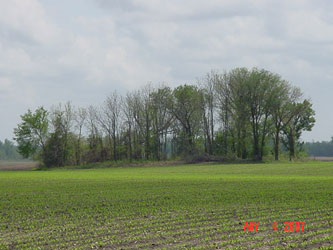
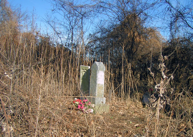
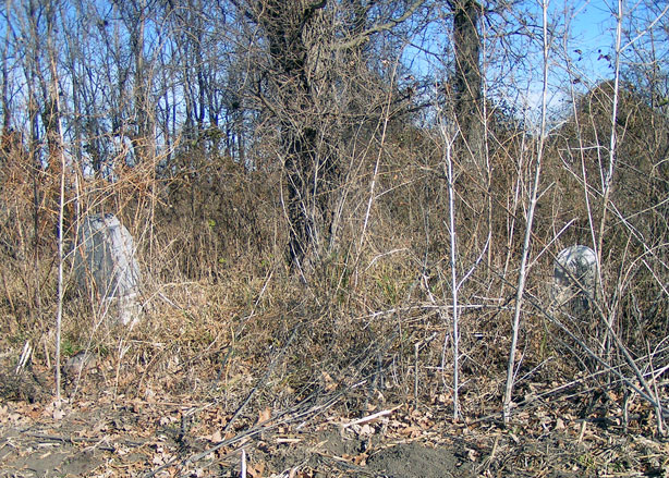
| Description | : | Cemetery Index: Located south of Hardin on Route J to 86th Street, east of 86th Street about 1/2 mile. At jog in road, cemetery 1350 feet southeast in a clump of trees. Ray County History 1973, p. 232: Cemeteries Not Listed on Map, #15; on Clifford Boggess farm, on route J, 1-1/2 miles south and 1/2 mile east of Hardin In the fall of 1838 a company of Mormons from Far West in Caldwell County marched into Ray and a skirmish was fought with a company of Ray County militia at "Bogart's battlefield" on Crooked River. Later in 1838 the Mormons... Read More |
frequently asked questions (FAQ):
-
Where is Boggess Cemetery?
Boggess Cemetery is located at Hardin, Ray County ,Missouri ,USA.
-
Boggess Cemetery cemetery's updated grave count on graveviews.com?
0 memorials
-
Where are the coordinates of the Boggess Cemetery?
Latitude: 39.2447200
Longitude: -93.8205600
Nearby Cemetories:
1. Hardin Cemetery
Hardin, Ray County, USA
Coordinate: 39.2661018, -93.8181000
2. Forest Grove Cemetery
Lexington, Lafayette County, USA
Coordinate: 39.2014008, -93.8638992
3. Watson Cemetery
Cherry Valley Township, Carroll County, USA
Coordinate: 39.2246000, -93.7438000
4. Lavelock Cemetery
Hardin, Ray County, USA
Coordinate: 39.3078003, -93.8394012
5. Lexington Memory Gardens
Lexington, Lafayette County, USA
Coordinate: 39.1857600, -93.8553400
6. Forester Cemetery
Hardin, Ray County, USA
Coordinate: 39.3125700, -93.8079100
7. Pioneer Mother Memorial
Lexington, Lafayette County, USA
Coordinate: 39.1865900, -93.8863200
8. Slusher Cemetery
Lafayette County, USA
Coordinate: 39.1847000, -93.7572021
9. Machpelah Cemetery
Lexington, Lafayette County, USA
Coordinate: 39.1787400, -93.8751300
10. Memorial Park Cemetery
Lexington, Lafayette County, USA
Coordinate: 39.1771100, -93.8740900
11. McGaugh-Dickey Cemetery
Richmond, Ray County, USA
Coordinate: 39.2742800, -93.9229200
12. Bohannon Cemetery
Hardin, Ray County, USA
Coordinate: 39.3291600, -93.8580600
13. Pugh Cemetery
Richmond, Ray County, USA
Coordinate: 39.3124800, -93.8968700
14. Old Catholic Cemetery
Lexington, Lafayette County, USA
Coordinate: 39.1702100, -93.8863200
15. Liberty Cemetery
Hardin, Ray County, USA
Coordinate: 39.3331800, -93.7667800
16. Murray-Anderson Cemetery
Richmond, Ray County, USA
Coordinate: 39.2631400, -93.9447100
17. Watkins Cemetery
Richmond, Ray County, USA
Coordinate: 39.2633018, -93.9449997
18. Nutter Cemetery
Richmond, Ray County, USA
Coordinate: 39.2966995, -93.9344025
19. Hickory Grove Cemetery
Richmond, Ray County, USA
Coordinate: 39.3288120, -93.9006293
20. Hill Cemetery
Richmond, Ray County, USA
Coordinate: 39.2933006, -93.9419022
21. Richmond Memory Gardens
Richmond, Ray County, USA
Coordinate: 39.2771988, -93.9518967
22. Clark Cemetery
Hardin, Ray County, USA
Coordinate: 39.3499985, -93.7956009
23. Lile Cemetery
Richmond, Ray County, USA
Coordinate: 39.2881700, -93.9477800
24. Wakenda Cemetery
Hardin, Ray County, USA
Coordinate: 39.3519300, -93.8456900