| Memorials | : | 1 |
| Location | : | Hardin, Ray County, USA |
| Coordinate | : | 39.3499985, -93.7956009 |
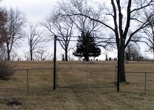
| Description | : | This cemetery is located two miles northest of Lakeview. George and Mary (Storms) Clark deeded one acre of ground from their farm to be used for burial of their family members. They were the parents of nine children. The cemetery is maintained from contributions. Roy Falknor, Hardin, is the Sec.-Treas. of the funds (1973). Source: Ray County History 1973 |
frequently asked questions (FAQ):
-
Where is Clark Cemetery?
Clark Cemetery is located at Hardin, Ray County ,Missouri ,USA.
-
Clark Cemetery cemetery's updated grave count on graveviews.com?
1 memorials
-
Where are the coordinates of the Clark Cemetery?
Latitude: 39.3499985
Longitude: -93.7956009
Nearby Cemetories:
1. Meinking-Wilson Cemetery
Ray County, USA
Coordinate: 39.3576200, -93.7995600
2. Liberty Cemetery
Hardin, Ray County, USA
Coordinate: 39.3331800, -93.7667800
3. Forester Cemetery
Hardin, Ray County, USA
Coordinate: 39.3125700, -93.8079100
4. Wakenda Cemetery
Hardin, Ray County, USA
Coordinate: 39.3519300, -93.8456900
5. Woolard Cemetery
Hardin, Ray County, USA
Coordinate: 39.3769300, -93.8351500
6. Bohannon Cemetery
Hardin, Ray County, USA
Coordinate: 39.3291600, -93.8580600
7. Lavelock Cemetery
Hardin, Ray County, USA
Coordinate: 39.3078003, -93.8394012
8. Providence Cemetery
Norborne, Carroll County, USA
Coordinate: 39.3511009, -93.7230988
9. Berry Cemetery
Hardin, Ray County, USA
Coordinate: 39.3913800, -93.8710800
10. Bethany Church Cemetery
Stet, Ray County, USA
Coordinate: 39.4230995, -93.7838974
11. Carleton Cemetery
Ray County, USA
Coordinate: 39.4014200, -93.8712700
12. New Hope United Methodist Church Cemetery
Millville, Ray County, USA
Coordinate: 39.4236259, -93.8416061
13. Smith Cemetery
Ray County, USA
Coordinate: 39.4028015, -93.8799973
14. Hickory Grove Cemetery
Richmond, Ray County, USA
Coordinate: 39.3288120, -93.9006293
15. Hardin Cemetery
Hardin, Ray County, USA
Coordinate: 39.2661018, -93.8181000
16. Pugh Cemetery
Richmond, Ray County, USA
Coordinate: 39.3124800, -93.8968700
17. Trinity Lutheran Cemetery
Norborne, Carroll County, USA
Coordinate: 39.3293991, -93.6844025
18. Stempel Cemetery
Norborne, Carroll County, USA
Coordinate: 39.3270780, -93.6829730
19. Old New Hope Cemetery
Millville, Ray County, USA
Coordinate: 39.4327200, -93.8435900
20. Silas Keith Cemetery
Regal, Ray County, USA
Coordinate: 39.4387800, -93.8262100
21. Antioch Cemetery
Norborne, Carroll County, USA
Coordinate: 39.4083519, -93.7010498
22. Fairhaven Cemetery
Norborne, Carroll County, USA
Coordinate: 39.2991982, -93.6903000
23. Mount Olivet Cemetery
Stet, Carroll County, USA
Coordinate: 39.4366000, -93.7403000
24. Mansur Cemetery
Grape Grove Township, Ray County, USA
Coordinate: 39.4230003, -93.8804016

