
| Memorials | : | 331 |
| Location | : | Parkstone, Poole Unitary Authority, England |
| Coordinate | : | 50.7362200, -1.9408200 |
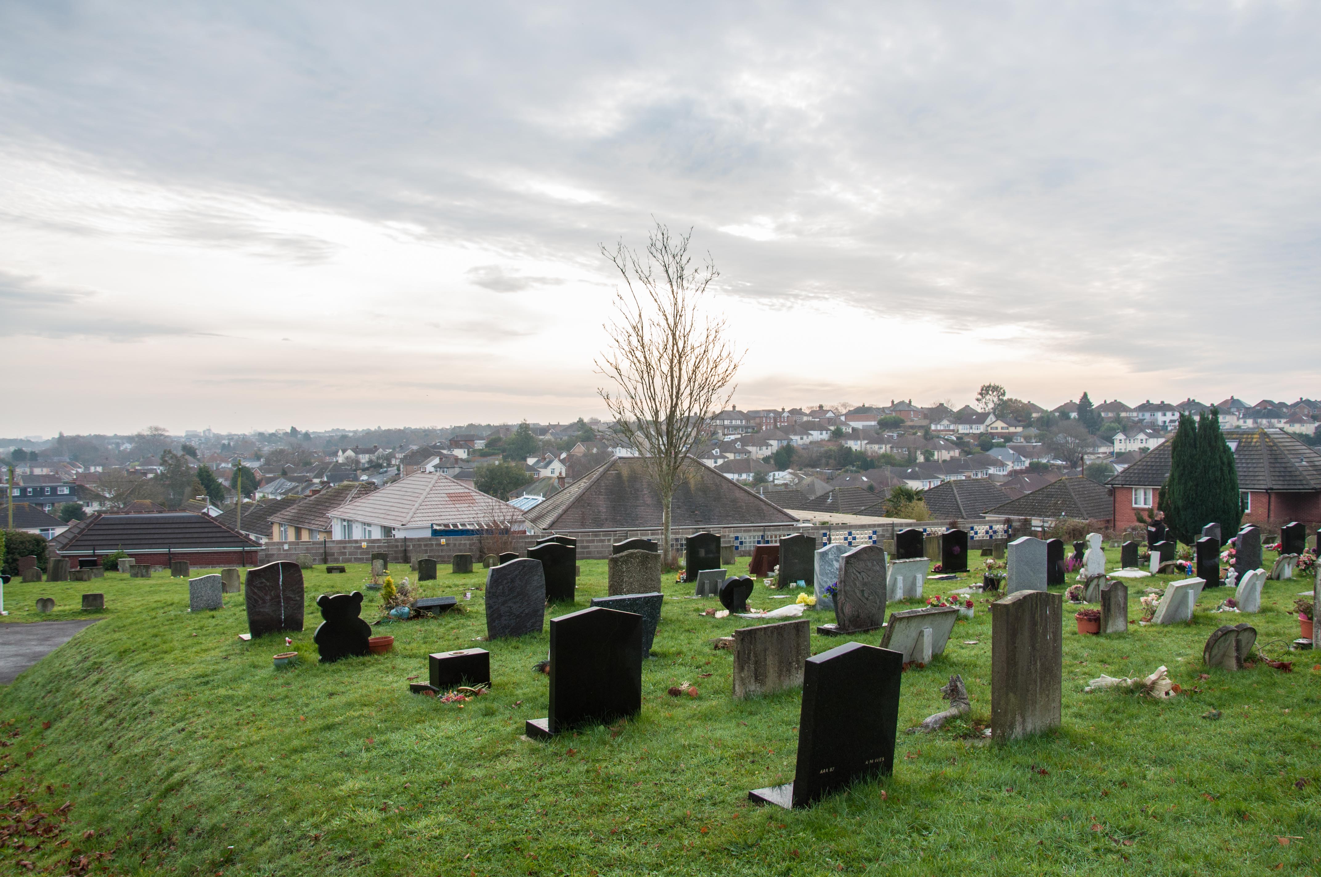
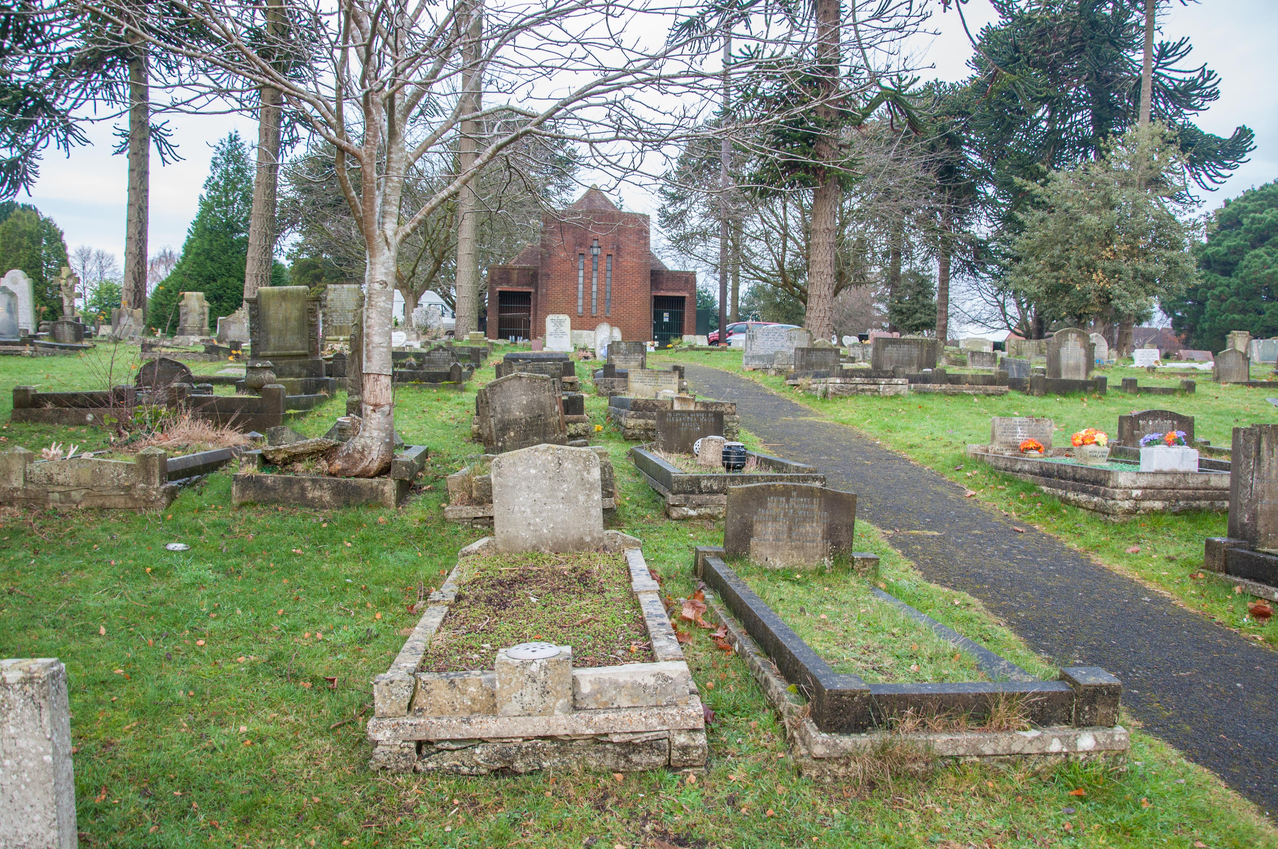
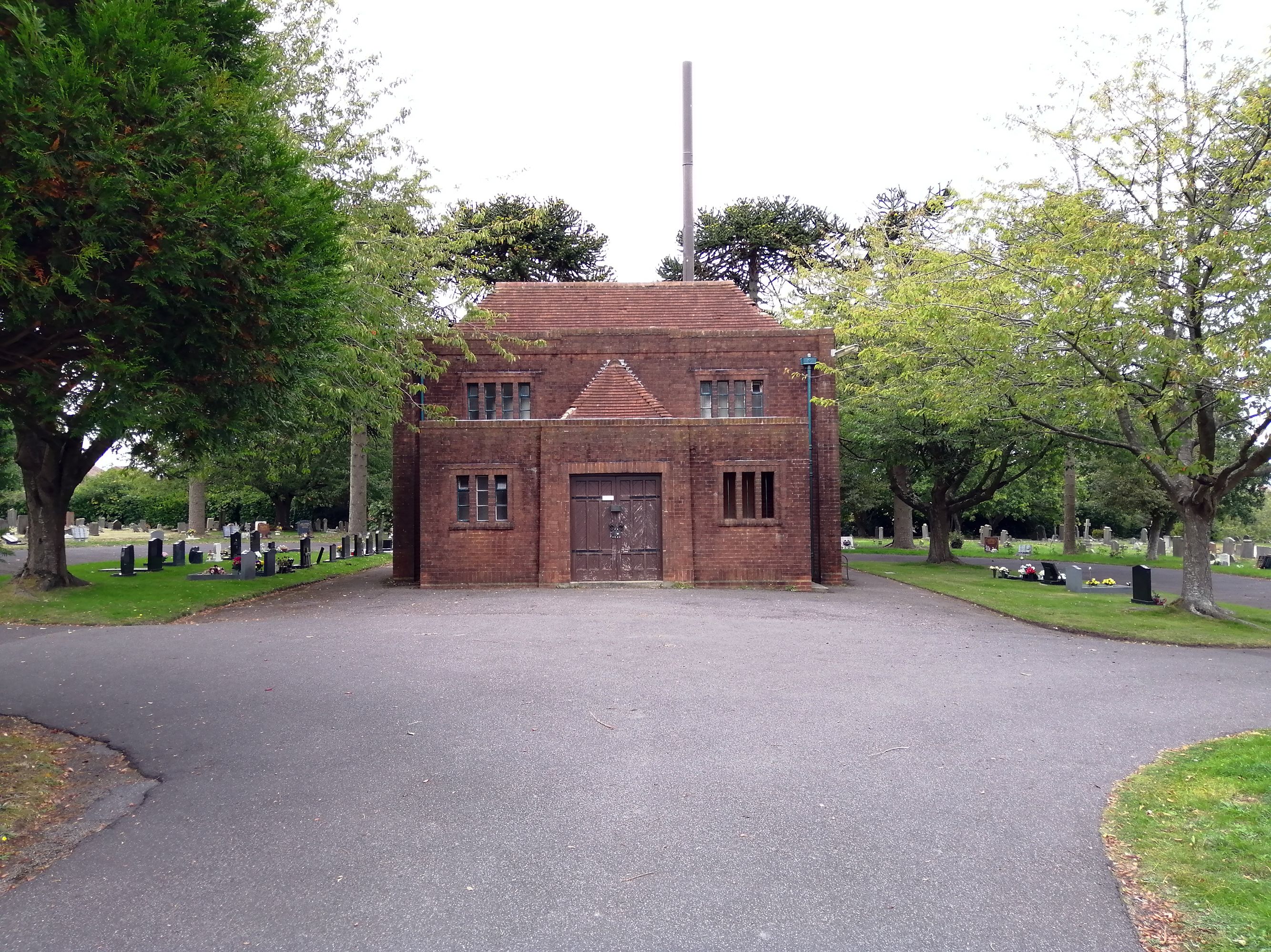
| Description | : | Branksome Cemetery Upper Road, Upper Parkstone The name Branksome Cemetery is nowadays a little misleading, because the cemetery is found situated in Upper Road on the outskirts of Parkstone, around ¾ of a mile from the main shopping area of Ashley Road. Branksome Cemetery has its own lodge at the entrance to the cemetery and a chapel a little further up. The chapel, while somewhat basic, at least offers a place of shelter for small funerals being followed by interment in the grounds. Branksome is set on the higher areas of Parkstone which overlook the areas from which... Read More |
frequently asked questions (FAQ):
-
Where is Branksome Cemetery?
Branksome Cemetery is located at Upper Road Parkstone, Poole Unitary Authority ,Dorset ,England.
-
Branksome Cemetery cemetery's updated grave count on graveviews.com?
331 memorials
-
Where are the coordinates of the Branksome Cemetery?
Latitude: 50.7362200
Longitude: -1.9408200
Nearby Cemetories:
1. St. Clement's Church
Parkstone, Poole Unitary Authority, England
Coordinate: 50.7377830, -1.9534610
2. St. Peter's Church
Parkstone, Poole Unitary Authority, England
Coordinate: 50.7245590, -1.9533390
3. Poole Cemetery
Poole, Poole Unitary Authority, England
Coordinate: 50.7345060, -1.9642670
4. Parkstone Cemetery
Poole, Poole Unitary Authority, England
Coordinate: 50.7147430, -1.9492790
5. St. Mary's Churchyard
Poole, Poole Unitary Authority, England
Coordinate: 50.7226400, -1.9716790
6. St. Mark's Churchyard
Bournemouth Unitary Authority, England
Coordinate: 50.7464670, -1.9026870
7. All Saints Churchyard
Poole, Poole Unitary Authority, England
Coordinate: 50.7134060, -1.9165840
8. St Ambrose Church
Bournemouth Unitary Authority, England
Coordinate: 50.7176530, -1.9004020
9. Hunger Hill Burial Ground
Poole, Poole Unitary Authority, England
Coordinate: 50.7169428, -1.9852496
10. Kinson Cemetery
Bournemouth, Bournemouth Unitary Authority, England
Coordinate: 50.7612600, -1.9030400
11. East Howe United Reformed Church Cemetery
Bournemouth, Bournemouth Unitary Authority, England
Coordinate: 50.7590790, -1.8996290
12. Poole Crematorium
Broadstone, Poole Unitary Authority, England
Coordinate: 50.7664860, -1.9764920
13. St James Churchyard
Poole, Poole Unitary Authority, England
Coordinate: 50.7134850, -1.9897060
14. Broadstone Cemetery
Broadstone, Poole Unitary Authority, England
Coordinate: 50.7651160, -1.9829030
15. St John the Baptist Churchyard
Broadstone, Poole Unitary Authority, England
Coordinate: 50.7620490, -1.9933870
16. St John the Baptist Churchyard
Bournemouth, Bournemouth Unitary Authority, England
Coordinate: 50.7500600, -1.8778700
17. St. Andrew's Churchyard
Kinson, Bournemouth Unitary Authority, England
Coordinate: 50.7718700, -1.9049920
18. Wimborne Road Cemetery
Bournemouth, Bournemouth Unitary Authority, England
Coordinate: 50.7323220, -1.8739990
19. St Peter Churchyard
Bournemouth, Bournemouth Unitary Authority, England
Coordinate: 50.7205020, -1.8755870
20. St. Michael's Churchyard
Hamworthy, Poole Unitary Authority, England
Coordinate: 50.7199660, -2.0099190
21. St. Mary's Church
Brownsea Island, Poole Unitary Authority, England
Coordinate: 50.6895400, -1.9615340
22. Canford Magna Civic Cemetery
Canford Magna, East Dorset District, England
Coordinate: 50.7845320, -1.9571820
23. All Saints Churchyard
West Parley, East Dorset District, England
Coordinate: 50.7710152, -1.8783700
24. Bournemouth Crematorium and North Cemetery
Bournemouth, Bournemouth Unitary Authority, England
Coordinate: 50.7455406, -1.8576280