
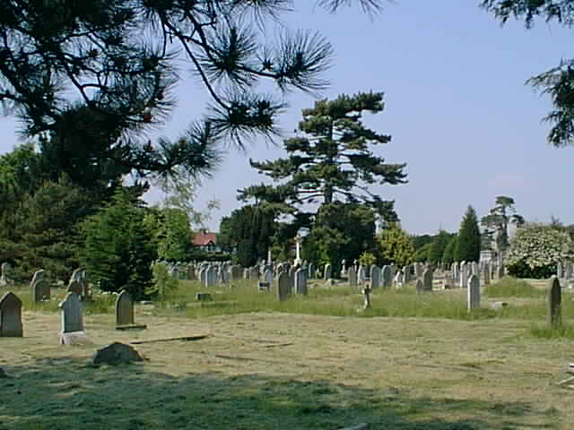
| Memorials | : | 0 |
| Location | : | Broadstone, Poole Unitary Authority, England |
| Coordinate | : | 50.7651160, -1.9829030 |
frequently asked questions (FAQ):
-
Where is Broadstone Cemetery?
Broadstone Cemetery is located at Broadstone, Poole Unitary Authority ,Dorset ,England.
-
Broadstone Cemetery cemetery's updated grave count on graveviews.com?
0 memorials
-
Where are the coordinates of the Broadstone Cemetery?
Latitude: 50.7651160
Longitude: -1.9829030
Nearby Cemetories:
1. Poole Crematorium
Broadstone, Poole Unitary Authority, England
Coordinate: 50.7664860, -1.9764920
2. St John the Baptist Churchyard
Broadstone, Poole Unitary Authority, England
Coordinate: 50.7620490, -1.9933870
3. Canford Magna Civic Cemetery
Canford Magna, East Dorset District, England
Coordinate: 50.7845320, -1.9571820
4. Corfe Mullen Cemetery
Corfe Mullen, East Dorset District, England
Coordinate: 50.7787500, -2.0177600
5. Canford Magna Parish Church
Canford Magna, East Dorset District, England
Coordinate: 50.7889000, -1.9560000
6. Poole Cemetery
Poole, Poole Unitary Authority, England
Coordinate: 50.7345060, -1.9642670
7. St. Clement's Church
Parkstone, Poole Unitary Authority, England
Coordinate: 50.7377830, -1.9534610
8. St. Cuthberga Churchyard
Wimborne Minster, East Dorset District, England
Coordinate: 50.7989260, -1.9880560
9. Corfe Mullen Church Cemetery
Corfe Mullen, East Dorset District, England
Coordinate: 50.7848260, -2.0344940
10. Upton Cemetery
Upton, Purbeck District, England
Coordinate: 50.7436900, -2.0348970
11. Branksome Cemetery
Parkstone, Poole Unitary Authority, England
Coordinate: 50.7362200, -1.9408200
12. Wimborne Cemetery
Wimborne, East Dorset District, England
Coordinate: 50.8040910, -1.9942650
13. Harbour View Woodland Burial Ground
Lytchett Minster, Purbeck District, England
Coordinate: 50.7507040, -2.0434430
14. St. Mary's Churchyard
Poole, Poole Unitary Authority, England
Coordinate: 50.7226400, -1.9716790
15. Woodland Burial Ground
Colehill, East Dorset District, England
Coordinate: 50.8088100, -1.9737900
16. All Saints Churchyard
Hampreston, East Dorset District, England
Coordinate: 50.7887250, -1.9231050
17. St. Peter's Church
Parkstone, Poole Unitary Authority, England
Coordinate: 50.7245590, -1.9533390
18. Poole and Wimborne Woodland Burial Ground
Wimborne, East Dorset District, England
Coordinate: 50.8097500, -1.9745150
19. St Michael and All Angels Churchyard
Colehill, East Dorset District, England
Coordinate: 50.8104720, -1.9661400
20. Hunger Hill Burial Ground
Poole, Poole Unitary Authority, England
Coordinate: 50.7169428, -1.9852496
21. St. Michael's Churchyard
Hamworthy, Poole Unitary Authority, England
Coordinate: 50.7199660, -2.0099190
22. St. Andrew's Churchyard
Kinson, Bournemouth Unitary Authority, England
Coordinate: 50.7718700, -1.9049920
23. Kinson Cemetery
Bournemouth, Bournemouth Unitary Authority, England
Coordinate: 50.7612600, -1.9030400
24. St James Churchyard
Poole, Poole Unitary Authority, England
Coordinate: 50.7134850, -1.9897060