
| Memorials | : | 0 |
| Location | : | Brownsea Island, Poole Unitary Authority, England |
| Coordinate | : | 50.6895400, -1.9615340 |
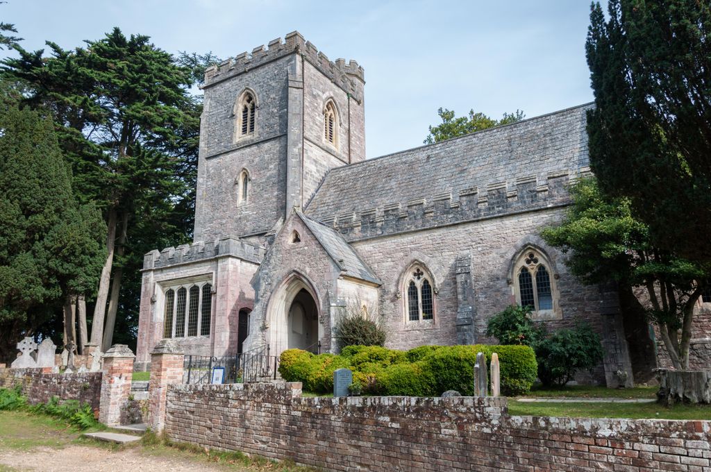
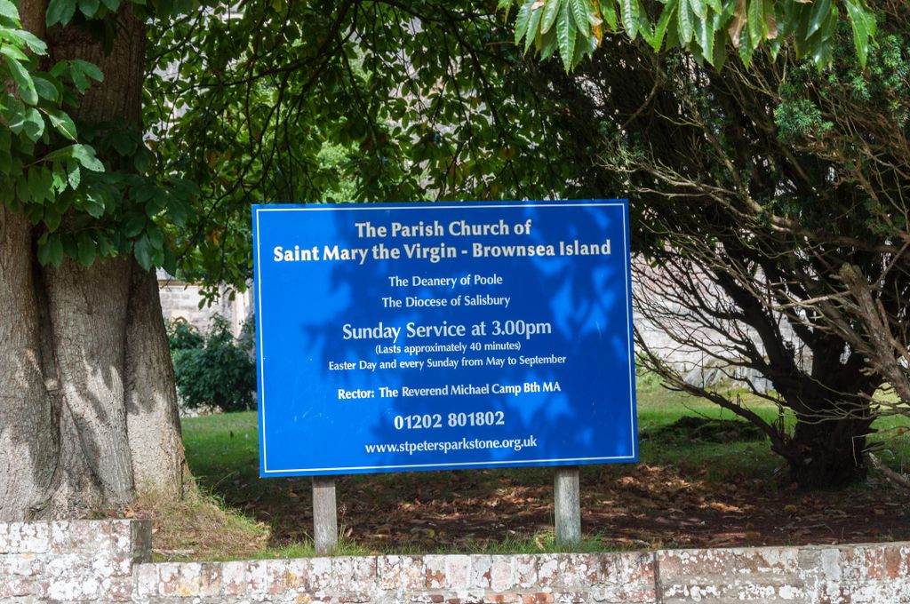
| Description | : | St. Mary's church was built by the owner of the island in the 1850's, to serve the small group of people who lived and worked on the island's pottery works, which made clay sewerage pipes and chimney pots.. Originally, the island was known as Branksea Island and served as the experimental scouting camp in 1907, by Lord Robert Baden-Powell, the founder of the Scout and Guide movement. St. Mary's Church continues to hold weekly services each Sunday at 3pm for both visitors to the island and those who live on it. The island was gifted to the National Trust by it's last private... Read More |
frequently asked questions (FAQ):
-
Where is St. Mary's Church?
St. Mary's Church is located at Brownsea Island, Poole Unitary Authority ,Dorset ,England.
-
St. Mary's Church cemetery's updated grave count on graveviews.com?
0 memorials
-
Where are the coordinates of the St. Mary's Church?
Latitude: 50.6895400
Longitude: -1.9615340
Nearby Cemetories:
1. Parkstone Cemetery
Poole, Poole Unitary Authority, England
Coordinate: 50.7147430, -1.9492790
2. St James Churchyard
Poole, Poole Unitary Authority, England
Coordinate: 50.7134850, -1.9897060
3. Hunger Hill Burial Ground
Poole, Poole Unitary Authority, England
Coordinate: 50.7169428, -1.9852496
4. St. Mary's Churchyard
Poole, Poole Unitary Authority, England
Coordinate: 50.7226400, -1.9716790
5. St. Peter's Church
Parkstone, Poole Unitary Authority, England
Coordinate: 50.7245590, -1.9533390
6. All Saints Churchyard
Poole, Poole Unitary Authority, England
Coordinate: 50.7134060, -1.9165840
7. St. Michael's Churchyard
Hamworthy, Poole Unitary Authority, England
Coordinate: 50.7199660, -2.0099190
8. Poole Cemetery
Poole, Poole Unitary Authority, England
Coordinate: 50.7345060, -1.9642670
9. Saint Nicholas Churchyard
Studland, Purbeck District, England
Coordinate: 50.6425800, -1.9498100
10. St Ambrose Church
Bournemouth Unitary Authority, England
Coordinate: 50.7176530, -1.9004020
11. Branksome Cemetery
Parkstone, Poole Unitary Authority, England
Coordinate: 50.7362200, -1.9408200
12. St. Clement's Church
Parkstone, Poole Unitary Authority, England
Coordinate: 50.7377830, -1.9534610
13. St Peter Churchyard
Bournemouth, Bournemouth Unitary Authority, England
Coordinate: 50.7205020, -1.8755870
14. St. Mark's Churchyard
Bournemouth Unitary Authority, England
Coordinate: 50.7464670, -1.9026870
15. Godlingston Cemetery
Swanage, Purbeck District, England
Coordinate: 50.6217400, -1.9749200
16. Wimborne Road Cemetery
Bournemouth, Bournemouth Unitary Authority, England
Coordinate: 50.7323220, -1.8739990
17. Upton Cemetery
Upton, Purbeck District, England
Coordinate: 50.7436900, -2.0348970
18. St John the Baptist Churchyard
Broadstone, Poole Unitary Authority, England
Coordinate: 50.7620490, -1.9933870
19. Broadstone Cemetery
Broadstone, Poole Unitary Authority, England
Coordinate: 50.7651160, -1.9829030
20. Lytchett Minster Parish Churchyard
Lytchett Minster, Purbeck District, England
Coordinate: 50.7372870, -2.0573970
21. Poole Crematorium
Broadstone, Poole Unitary Authority, England
Coordinate: 50.7664860, -1.9764920
22. Lytchett Minster United Reformed Church
Lytchett Minster, Purbeck District, England
Coordinate: 50.7346300, -2.0622130
23. Northbrook Cemetery
Swanage, Purbeck District, England
Coordinate: 50.6106750, -1.9631520
24. Old Church Cemetery
Corfe Castle, Purbeck District, England
Coordinate: 50.6367499, -2.0549142