
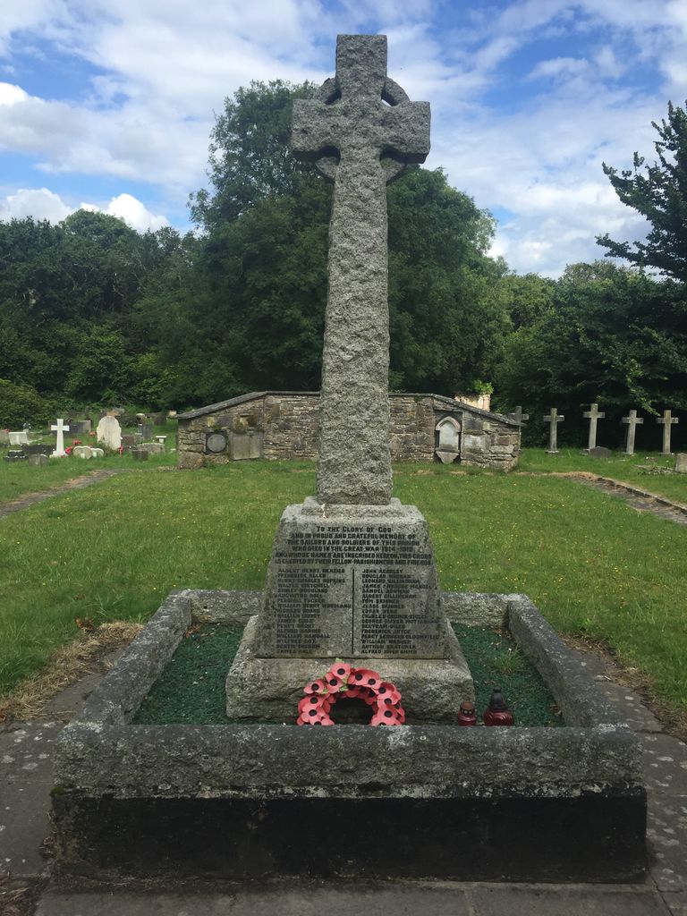
| Memorials | : | 0 |
| Location | : | Hamworthy, Poole Unitary Authority, England |
| Coordinate | : | 50.7199660, -2.0099190 |
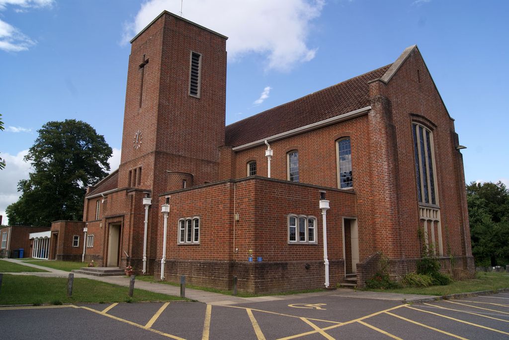
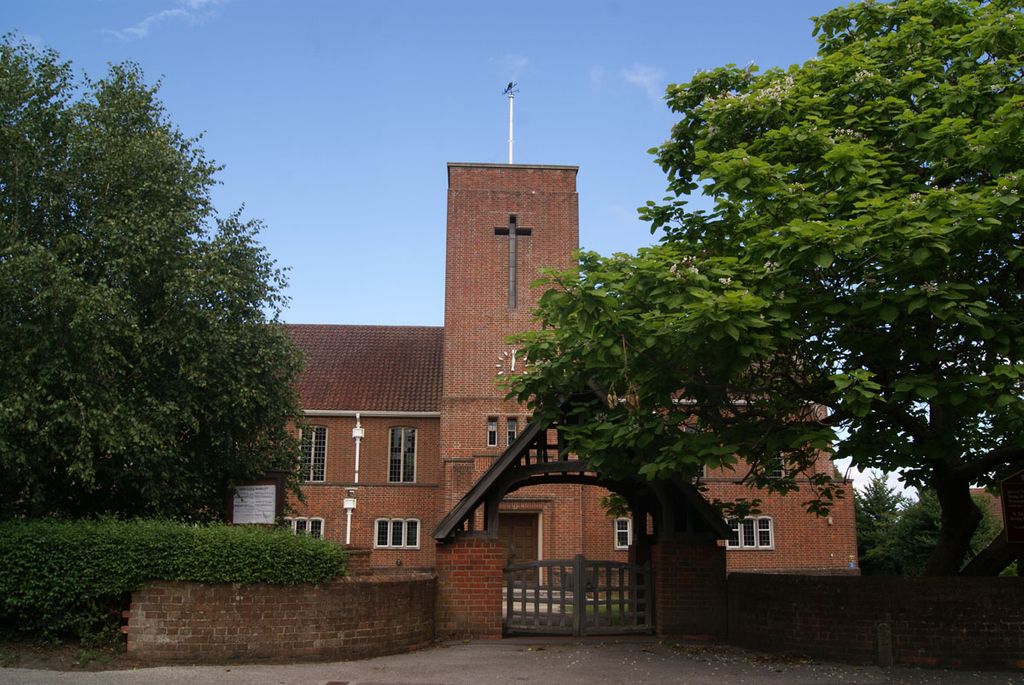
| Description | : | Hamworthy is a parish within the boundary of the town of Poole, Dorset. It was until 1850's a chapelry with Vicarage Hamlet within the control of Sturminster Marshall, Dorset. The original Church on this site was destroyed during the English Civil War of 1642-1646 and was not replaced until 1826. The replacement Church was demolished due to structural decay in 1959 and the new replacement we see today was built on the adjacent ground. |
frequently asked questions (FAQ):
-
Where is St. Michael's Churchyard?
St. Michael's Churchyard is located at Blandford Road Hamworthy, Poole Unitary Authority ,Dorset , BH15 4HREngland.
-
St. Michael's Churchyard cemetery's updated grave count on graveviews.com?
0 memorials
-
Where are the coordinates of the St. Michael's Churchyard?
Latitude: 50.7199660
Longitude: -2.0099190
Nearby Cemetories:
1. St James Churchyard
Poole, Poole Unitary Authority, England
Coordinate: 50.7134850, -1.9897060
2. Hunger Hill Burial Ground
Poole, Poole Unitary Authority, England
Coordinate: 50.7169428, -1.9852496
3. St. Mary's Churchyard
Poole, Poole Unitary Authority, England
Coordinate: 50.7226400, -1.9716790
4. Upton Cemetery
Upton, Purbeck District, England
Coordinate: 50.7436900, -2.0348970
5. Poole Cemetery
Poole, Poole Unitary Authority, England
Coordinate: 50.7345060, -1.9642670
6. Lytchett Minster Parish Churchyard
Lytchett Minster, Purbeck District, England
Coordinate: 50.7372870, -2.0573970
7. St. Peter's Church
Parkstone, Poole Unitary Authority, England
Coordinate: 50.7245590, -1.9533390
8. Lytchett Minster United Reformed Church
Lytchett Minster, Purbeck District, England
Coordinate: 50.7346300, -2.0622130
9. Harbour View Woodland Burial Ground
Lytchett Minster, Purbeck District, England
Coordinate: 50.7507040, -2.0434430
10. Parkstone Cemetery
Poole, Poole Unitary Authority, England
Coordinate: 50.7147430, -1.9492790
11. St. Clement's Church
Parkstone, Poole Unitary Authority, England
Coordinate: 50.7377830, -1.9534610
12. St. Mary's Church
Brownsea Island, Poole Unitary Authority, England
Coordinate: 50.6895400, -1.9615340
13. St John the Baptist Churchyard
Broadstone, Poole Unitary Authority, England
Coordinate: 50.7620490, -1.9933870
14. Branksome Cemetery
Parkstone, Poole Unitary Authority, England
Coordinate: 50.7362200, -1.9408200
15. Broadstone Cemetery
Broadstone, Poole Unitary Authority, England
Coordinate: 50.7651160, -1.9829030
16. Poole Crematorium
Broadstone, Poole Unitary Authority, England
Coordinate: 50.7664860, -1.9764920
17. Corfe Mullen Cemetery
Corfe Mullen, East Dorset District, England
Coordinate: 50.7787500, -2.0177600
18. All Saints Churchyard
Poole, Poole Unitary Authority, England
Coordinate: 50.7134060, -1.9165840
19. Corfe Mullen Church Cemetery
Corfe Mullen, East Dorset District, England
Coordinate: 50.7848260, -2.0344940
20. St Ambrose Church
Bournemouth Unitary Authority, England
Coordinate: 50.7176530, -1.9004020
21. Wareham Cemetery
Wareham, Purbeck District, England
Coordinate: 50.6848600, -2.1066320
22. United Reformed Churchyard
Wareham, Purbeck District, England
Coordinate: 50.6860338, -2.1078591
23. Lady St Mary Churchyard
Wareham, Purbeck District, England
Coordinate: 50.6843130, -2.1077420
24. St Martin-on-the-Walls
Wareham, Purbeck District, England
Coordinate: 50.6888000, -2.1115000