
| Memorials | : | 0 |
| Location | : | Poole, Poole Unitary Authority, England |
| Coordinate | : | 50.7134850, -1.9897060 |
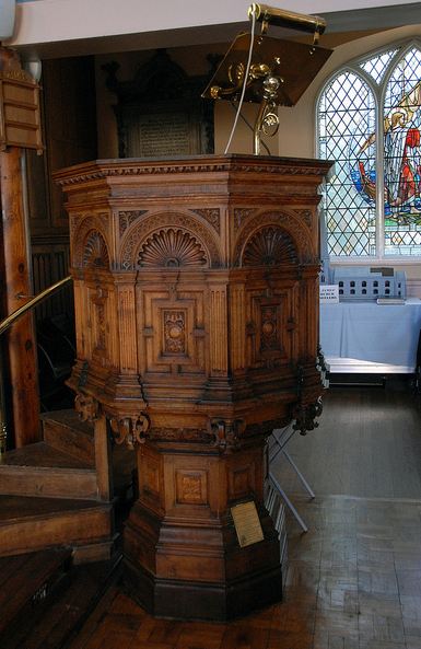
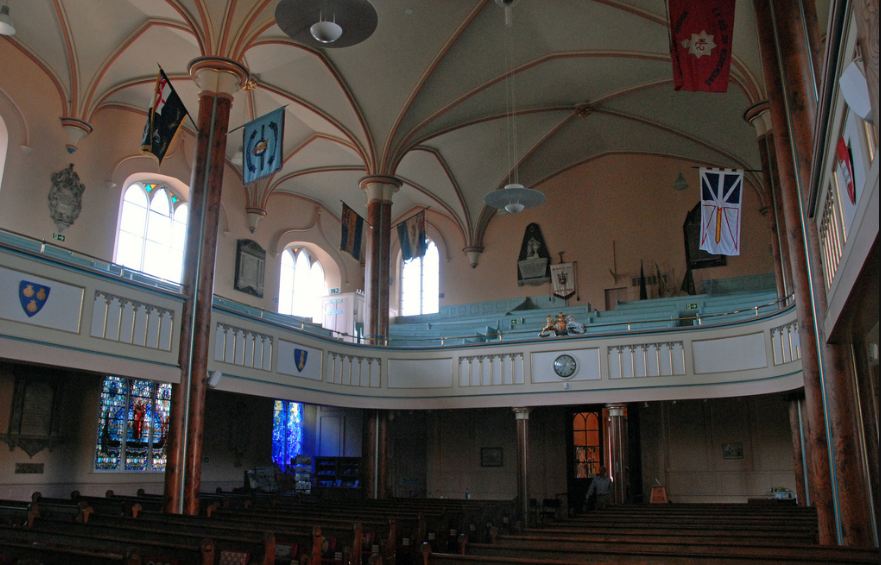
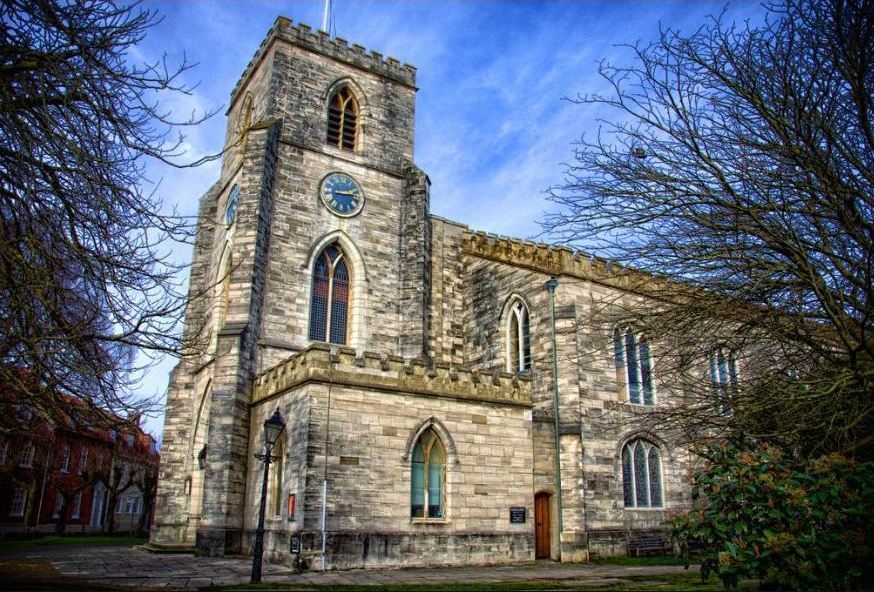
| Description | : | St James is a Church of England parish church in Poole on the south coast of England, in the ceremonial county of Dorset. The church is located in the historic quarter of the town, near Poole Quay. It is the parish church for the St James sub district of Poole. R. Mason is the current minister of the church. Today the church is still in use by the local population and has a large playgroup. The church has long been associated with the local fishing trade and is known locally as 'the fishermen's church'. The church has an unusual weather vane fashioned... Read More |
frequently asked questions (FAQ):
-
Where is St James Churchyard?
St James Churchyard is located at Church Street Poole, Poole Unitary Authority ,Dorset , BH 15England.
-
St James Churchyard cemetery's updated grave count on graveviews.com?
0 memorials
-
Where are the coordinates of the St James Churchyard?
Latitude: 50.7134850
Longitude: -1.9897060
Nearby Cemetories:
1. Hunger Hill Burial Ground
Poole, Poole Unitary Authority, England
Coordinate: 50.7169428, -1.9852496
2. St. Michael's Churchyard
Hamworthy, Poole Unitary Authority, England
Coordinate: 50.7199660, -2.0099190
3. St. Mary's Churchyard
Poole, Poole Unitary Authority, England
Coordinate: 50.7226400, -1.9716790
4. St. Peter's Church
Parkstone, Poole Unitary Authority, England
Coordinate: 50.7245590, -1.9533390
5. Parkstone Cemetery
Poole, Poole Unitary Authority, England
Coordinate: 50.7147430, -1.9492790
6. Poole Cemetery
Poole, Poole Unitary Authority, England
Coordinate: 50.7345060, -1.9642670
7. St. Mary's Church
Brownsea Island, Poole Unitary Authority, England
Coordinate: 50.6895400, -1.9615340
8. St. Clement's Church
Parkstone, Poole Unitary Authority, England
Coordinate: 50.7377830, -1.9534610
9. Branksome Cemetery
Parkstone, Poole Unitary Authority, England
Coordinate: 50.7362200, -1.9408200
10. Upton Cemetery
Upton, Purbeck District, England
Coordinate: 50.7436900, -2.0348970
11. All Saints Churchyard
Poole, Poole Unitary Authority, England
Coordinate: 50.7134060, -1.9165840
12. St John the Baptist Churchyard
Broadstone, Poole Unitary Authority, England
Coordinate: 50.7620490, -1.9933870
13. Lytchett Minster Parish Churchyard
Lytchett Minster, Purbeck District, England
Coordinate: 50.7372870, -2.0573970
14. Harbour View Woodland Burial Ground
Lytchett Minster, Purbeck District, England
Coordinate: 50.7507040, -2.0434430
15. Lytchett Minster United Reformed Church
Lytchett Minster, Purbeck District, England
Coordinate: 50.7346300, -2.0622130
16. Broadstone Cemetery
Broadstone, Poole Unitary Authority, England
Coordinate: 50.7651160, -1.9829030
17. Poole Crematorium
Broadstone, Poole Unitary Authority, England
Coordinate: 50.7664860, -1.9764920
18. St Ambrose Church
Bournemouth Unitary Authority, England
Coordinate: 50.7176530, -1.9004020
19. St. Mark's Churchyard
Bournemouth Unitary Authority, England
Coordinate: 50.7464670, -1.9026870
20. Corfe Mullen Cemetery
Corfe Mullen, East Dorset District, England
Coordinate: 50.7787500, -2.0177600
21. St Peter Churchyard
Bournemouth, Bournemouth Unitary Authority, England
Coordinate: 50.7205020, -1.8755870
22. Kinson Cemetery
Bournemouth, Bournemouth Unitary Authority, England
Coordinate: 50.7612600, -1.9030400
23. East Howe United Reformed Church Cemetery
Bournemouth, Bournemouth Unitary Authority, England
Coordinate: 50.7590790, -1.8996290
24. Canford Magna Civic Cemetery
Canford Magna, East Dorset District, England
Coordinate: 50.7845320, -1.9571820