
| Memorials | : | 0 |
| Location | : | Coombe Bissett, Wiltshire Unitary Authority, England |
| Coordinate | : | 51.0361120, -1.8473230 |
| Description | : | Coombe Bissett has a pub, a chapel, and a church and is informally known as "Crumbly Biscuit". There is a well looked after nature reserve, part of which is referred to as Rory Hill. On the other side of the village is Rolley Hill. The village also is home to a general shop. The village is within a ten minute drive from Salisbury, easily accessed via the Coombe Rd from Salisbury. |
frequently asked questions (FAQ):
-
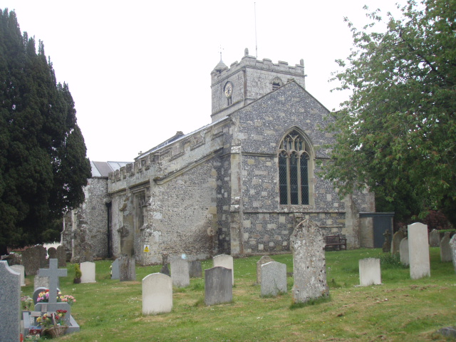
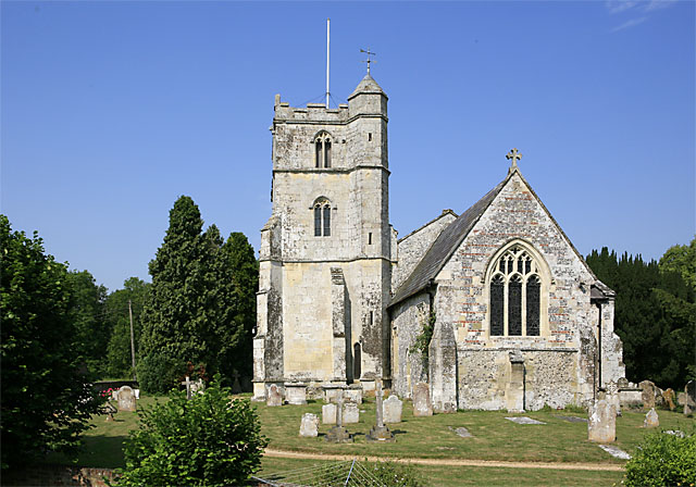
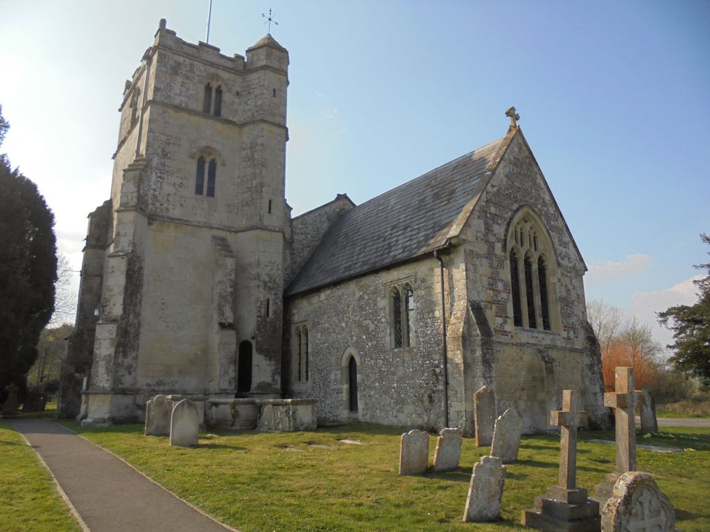
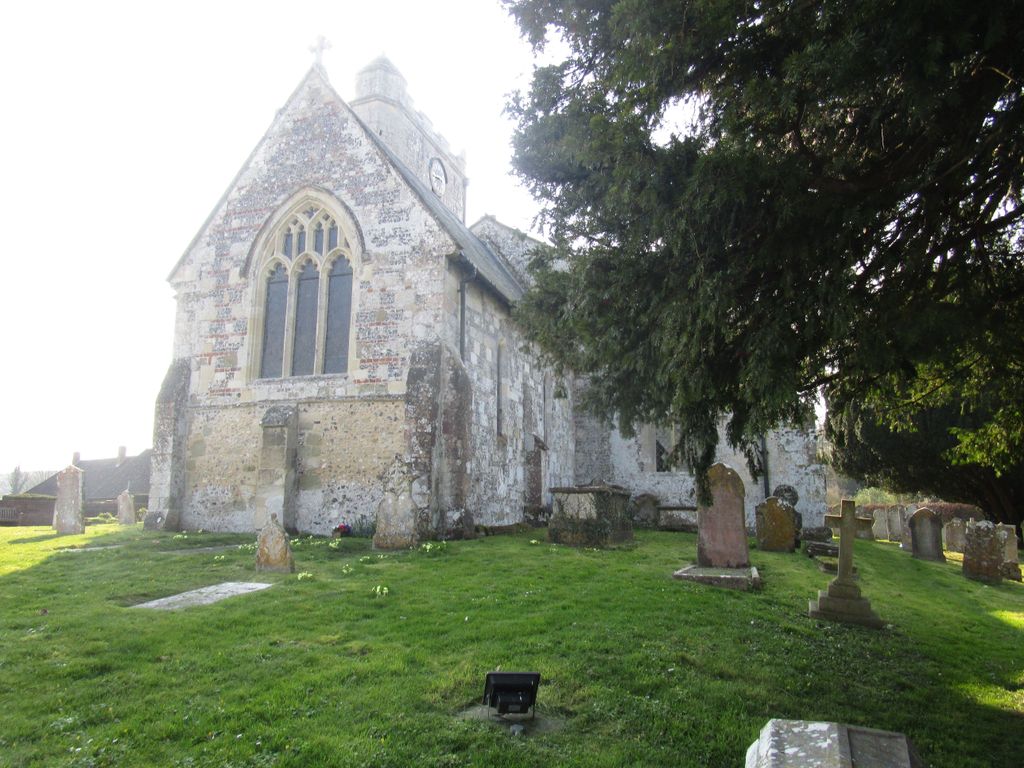
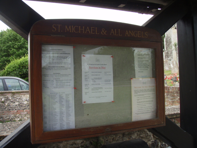
Where is St. Michael and All Angels Cemetery?
St. Michael and All Angels Cemetery is located at Thorne Close Coombe Bissett, Wiltshire Unitary Authority ,Wiltshire ,England.
-
St. Michael and All Angels Cemetery cemetery's updated grave count on graveviews.com?
0 memorials
-
Where are the coordinates of the St. Michael and All Angels Cemetery?
Latitude: 51.0361120
Longitude: -1.8473230
Nearby Cemetories:
1. St. John the Baptist Churchyard
Bishopstone (Salisbury), Wiltshire Unitary Authority, England
Coordinate: 51.0379160, -1.8812960
2. St Andrew Churchyard
Bemerton, Wiltshire Unitary Authority, England
Coordinate: 51.0740580, -1.8252960
3. Bemerton St John
Bemerton, Wiltshire Unitary Authority, England
Coordinate: 51.0759324, -1.8333699
4. St. Peter's Churchyard
Britford, Wiltshire Unitary Authority, England
Coordinate: 51.0551650, -1.7689880
5. All Saints Churchyard
Broad Chalke, Wiltshire Unitary Authority, England
Coordinate: 51.0274220, -1.9433110
6. Saint Martin Churchyard
Barford St Martin, Wiltshire Unitary Authority, England
Coordinate: 51.0818400, -1.9210400
7. Barford St Martin Church Cemetery
Barford St Martin, Wiltshire Unitary Authority, England
Coordinate: 51.0837860, -1.9186010
8. St Mary's Churchyard
Alderbury, Wiltshire Unitary Authority, England
Coordinate: 51.0413780, -1.7413140
9. St. Leonard's Churchyard
Whitsbury, New Forest District, England
Coordinate: 50.9713900, -1.8176000
10. All Saints Churchyard
Martin, New Forest District, England
Coordinate: 50.9753760, -1.9009220
11. Church of St. Michael and All the Angels
Downton, Wiltshire Unitary Authority, England
Coordinate: 51.0106010, -1.7411390
12. St. Andrew's Churchyard
Rockbourne, New Forest District, England
Coordinate: 50.9640400, -1.8369600
13. St. Michael's Churchyard
Compton Chamberlayne, Wiltshire Unitary Authority, England
Coordinate: 51.0700400, -1.9598240
14. St. Mary's Churchyard
Breamore, New Forest District, England
Coordinate: 50.9687400, -1.7834000
15. St Editha Churchyard
Baverstock, Wiltshire Unitary Authority, England
Coordinate: 51.0835750, -1.9603790
16. Holy Trinity Churchyard
Bowerchalke, Wiltshire Unitary Authority, England
Coordinate: 51.0064450, -1.9747320
17. Broad Chalke Congregational Chapelyard
Broad Chalke, Wiltshire Unitary Authority, England
Coordinate: 51.0523805, -1.7071162
18. St Mary Churchyard
Hale, New Forest District, England
Coordinate: 50.9670380, -1.7473110
19. St George Churchyard
Damerham, New Forest District, England
Coordinate: 50.9416320, -1.8483240
20. Woodgreen Cemetery
Woodgreen, New Forest District, England
Coordinate: 50.9525032, -1.7574225
21. St. Rumbold's Churchyard
Pentridge, East Dorset District, England
Coordinate: 50.9598410, -1.9537360
22. Saint Andrew's Churchyard
Durnford, Wiltshire Unitary Authority, England
Coordinate: 51.1438930, -1.8063690
23. All Saints Churchyard
Closworth, South Somerset District, England
Coordinate: 51.0588880, -2.0211820
24. Fordingbridge Methodist Church
Fordingbridge, New Forest District, England
Coordinate: 50.9251012, -1.7948375