
| Memorials | : | 0 |
| Location | : | Louisville, Jefferson County, USA |
| Coordinate | : | 38.2756430, -85.6391020 |
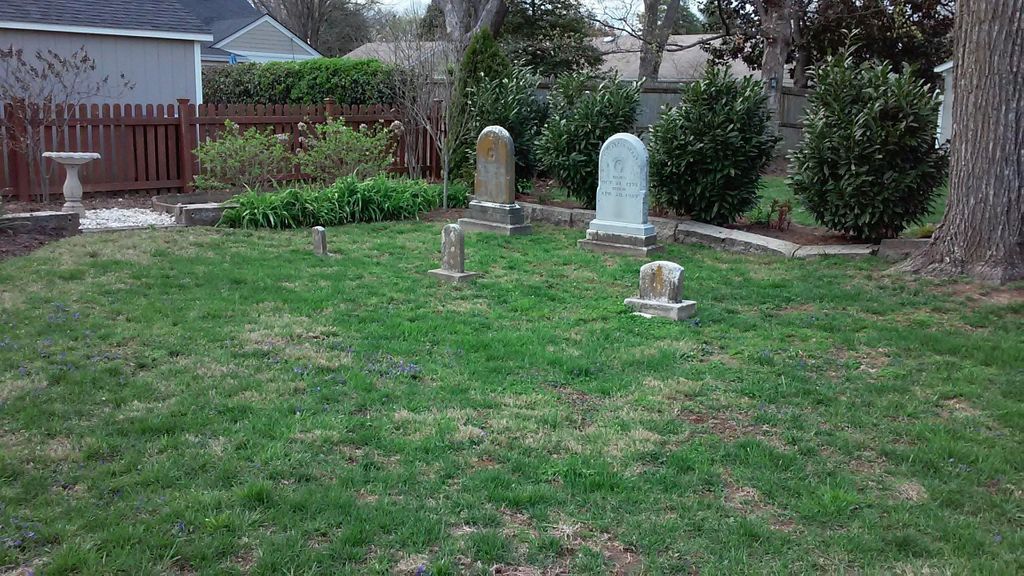
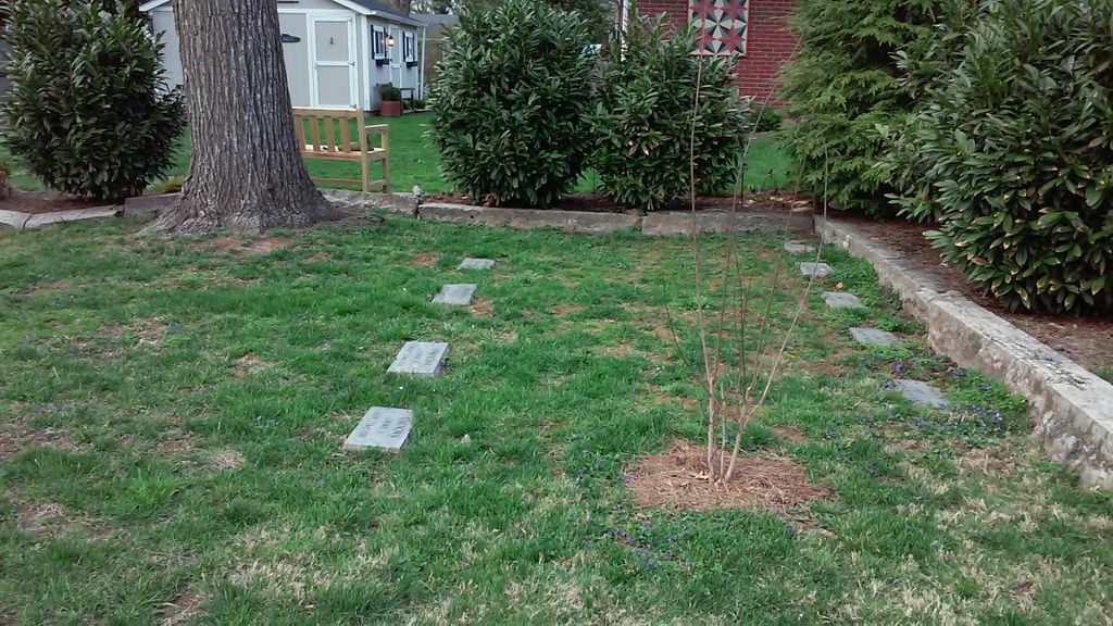
| Description | : | The Herr and Rudy families were prominent landowners in Louisville, Kentucky in the 1700s-1800s. Originally, this cemetery was on the property of John Herr, Sr. and his second wife, Elizabeth Whayne Simcoe Herr. The main house is still standing. It is on the National Register of Historic Places, and is located at 726 Waterford Road. This is in the Wexford Place subdivision within Windy Hills, off Brownsboro Road, approximately ½ mile west of the intersection of Brownsboro Road and Rudy Lane. The cemetery is located behind the house which now stands at 730 Waterford Road. From Brownsboro Road, turn onto... Read More |
frequently asked questions (FAQ):
-
Where is Herr Cemetery #3?
Herr Cemetery #3 is located at 730 Waterford Road Louisville, Jefferson County ,Kentucky , 40207USA.
-
Herr Cemetery #3 cemetery's updated grave count on graveviews.com?
0 memorials
-
Where are the coordinates of the Herr Cemetery #3?
Latitude: 38.2756430
Longitude: -85.6391020
Nearby Cemetories:
1. Christ Church United Methodist Memorial Garden
Louisville, Jefferson County, USA
Coordinate: 38.2740750, -85.6446790
2. Berry Hill Cemetery
Louisville, Jefferson County, USA
Coordinate: 38.2943910, -85.6404680
3. Arterburn Cemetery
Saint Matthews, Jefferson County, USA
Coordinate: 38.2552000, -85.6609900
4. Bullitt Family Cemetery
Louisville, Jefferson County, USA
Coordinate: 38.2463450, -85.6135210
5. Brown Family Cemetery
Saint Matthews, Jefferson County, USA
Coordinate: 38.2375660, -85.6331750
6. Parks Cemetery
Plymouth Village, Jefferson County, USA
Coordinate: 38.2377280, -85.6486690
7. Floyd-Breckinridge Cemetery
Plymouth Village, Jefferson County, USA
Coordinate: 38.2366982, -85.6489029
8. Murray-Young Cemetery
Lyndon, Jefferson County, USA
Coordinate: 38.2901887, -85.5873743
9. Burks Family Cemetery
Saint Matthews, Jefferson County, USA
Coordinate: 38.2318130, -85.6408060
10. Saint Francis in the Fields Memorial Garden
Harrods Creek, Jefferson County, USA
Coordinate: 38.3210520, -85.6248870
11. Ormsby Graveyard
Lyndon, Jefferson County, USA
Coordinate: 38.2653600, -85.5800600
12. Lawrence Family Cemetery
Hurstbourne, Jefferson County, USA
Coordinate: 38.2515259, -85.5847015
13. Saint Thomas Episcopal Church Meditation Garden
Jefferson County, USA
Coordinate: 38.2861100, -85.5743700
14. Louisville Presbyterian Seminary Memorial Garden
Louisville, Jefferson County, USA
Coordinate: 38.2387380, -85.6861190
15. Adams Family Cemetery (Defunct)
Jeffersonville, Clark County, USA
Coordinate: 38.3150300, -85.6887200
16. Hackberry Cemetery
Louisville, Jefferson County, USA
Coordinate: 38.2514500, -85.7032170
17. Kennedy Graveyard
Louisville, Jefferson County, USA
Coordinate: 38.2261920, -85.6049040
18. Hikes Cemetery
Jefferson County, USA
Coordinate: 38.2129790, -85.6373220
19. Anderson Family Cemetery
Louisville, Jefferson County, USA
Coordinate: 38.2356520, -85.5775420
20. Central State Hospital Cemetery
Lakeland, Jefferson County, USA
Coordinate: 38.2730020, -85.5579860
21. Doup Family Cemetery
Louisville, Jefferson County, USA
Coordinate: 38.2211500, -85.6821200
22. Hillcrest Cemetery
Utica, Clark County, USA
Coordinate: 38.3391991, -85.6514969
23. Civil War Cemetery #2
Jeffersonville, Clark County, USA
Coordinate: 38.2818400, -85.7206700
24. Civil War Cemetery #3
Jeffersonville, Clark County, USA
Coordinate: 38.2848790, -85.7217790