
| Memorials | : | 5 |
| Location | : | Brøttum, Ringsaker kommune, Norway |
| Coordinate | : | 61.0283660, 10.5496950 |
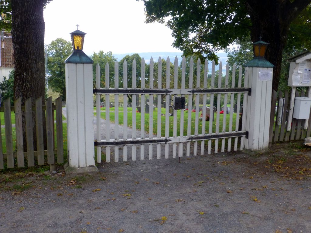
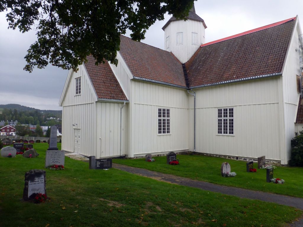
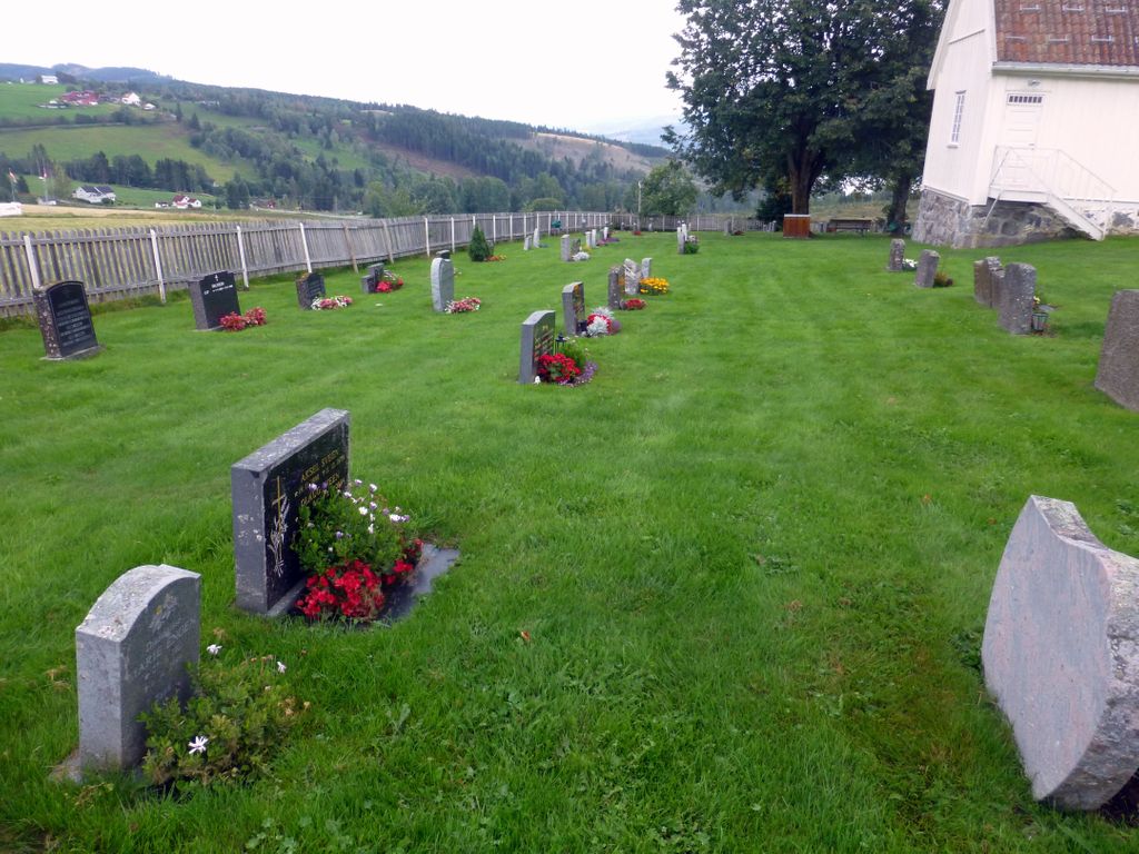
| Description | : | It is likely that there have been three older churches in Brøttum. All of these have been about the same place as the current one - at Mælums farm. In 1370 a stave church was mentioned, when it was built is not known. The next church, also a stave church - probably around 1411. The third church was built in 1629, it was then replaced by the present church. The new church and cemetery were built somewhat further south than where the former church stood - area was purchased from Gudbrand Mæhlum at... Read More |
frequently asked questions (FAQ):
-
Where is Brøttum Cemetery?
Brøttum Cemetery is located at Mælumsvegen 2 Brøttum, Ringsaker kommune ,Hedmark fylke , 2372Norway.
-
Brøttum Cemetery cemetery's updated grave count on graveviews.com?
5 memorials
-
Where are the coordinates of the Brøttum Cemetery?
Latitude: 61.0283660
Longitude: 10.5496950

Nearby Cemetories:
1. Vingrom kirkegård
Lillehammer, Lillehammer kommune, Norway
Coordinate: 61.0722800, 10.4298900
2. Biri kirkegård
Biri, Gjøvik kommune, Norway
Coordinate: 60.9588990, 10.6018850
3. Lillehammer kirkegård
Lillehammer, Lillehammer kommune, Norway
Coordinate: 61.1115150, 10.4635080
4. Mesnali kirkegård
Mesnali, Ringsaker kommune, Norway
Coordinate: 61.1027820, 10.6929130
5. Nordre Gravlund
Lillehammer, Lillehammer kommune, Norway
Coordinate: 61.1231000, 10.4543760
6. Søre Ål Cemetery
Lillehammer, Lillehammer kommune, Norway
Coordinate: 61.1229610, 10.4534440
7. Åsmarka kirkegård
Åsmarka, Ringsaker kommune, Norway
Coordinate: 61.0117202, 10.7800753
8. Nordre Ål kirkegård
Lillehammer, Lillehammer kommune, Norway
Coordinate: 61.1343800, 10.4674500
9. Ringsaker kirkegård
Moelv, Ringsaker kommune, Norway
Coordinate: 60.9031110, 10.7242950
10. Seegård kirkegård
Snertingdal, Gjøvik kommune, Norway
Coordinate: 60.8803220, 10.4626220
11. Fåberg kirkegård
Fåberg, Lillehammer kommune, Norway
Coordinate: 61.1607090, 10.3714490
12. Nykirke kirkegård
Snertingdal, Gjøvik kommune, Norway
Coordinate: 60.8977830, 10.3388270
13. Veldre kirkegård
Veldre, Ringsaker kommune, Norway
Coordinate: 60.9172800, 10.8907600
14. Vardal kirkegård
Bybrua, Gjøvik kommune, Norway
Coordinate: 60.8161530, 10.5234840
15. Hunn gravlund
Gjøvik, Gjøvik kommune, Norway
Coordinate: 60.8019010, 10.6734890
16. Bruvin gravlund
Øyer kommune, Norway
Coordinate: 61.2587591, 10.4401440
17. Follebu kirkegård
Follebu, Gausdal kommune, Norway
Coordinate: 61.2259500, 10.2677600
18. Brumunddal kirkegård
Brumunddal, Ringsaker kommune, Norway
Coordinate: 60.8845300, 10.9528000
19. Øyer kirkegård
Øyer kommune, Norway
Coordinate: 61.2661051, 10.4209226
20. Gjøvik gravlund
Gjøvik, Gjøvik kommune, Norway
Coordinate: 60.7880340, 10.6986880
21. Vestre Gausdal Cemetery
Vestre Gausdal, Gausdal kommune, Norway
Coordinate: 61.2005670, 10.1470830
22. Ostsinni Church Cemetery
Dokka, Nordre Land kommune, Norway
Coordinate: 60.8490580, 10.0783310
23. Fluberg kirke
Fluberg, Søndre Land kommune, Norway
Coordinate: 60.7758230, 10.2467960
24. Furnes kirkegård
Furnes, Ringsaker kommune, Norway
Coordinate: 60.8406000, 11.0217000