
| Memorials | : | 0 |
| Location | : | Brumunddal, Ringsaker kommune, Norway |
| Coordinate | : | 60.8845300, 10.9528000 |
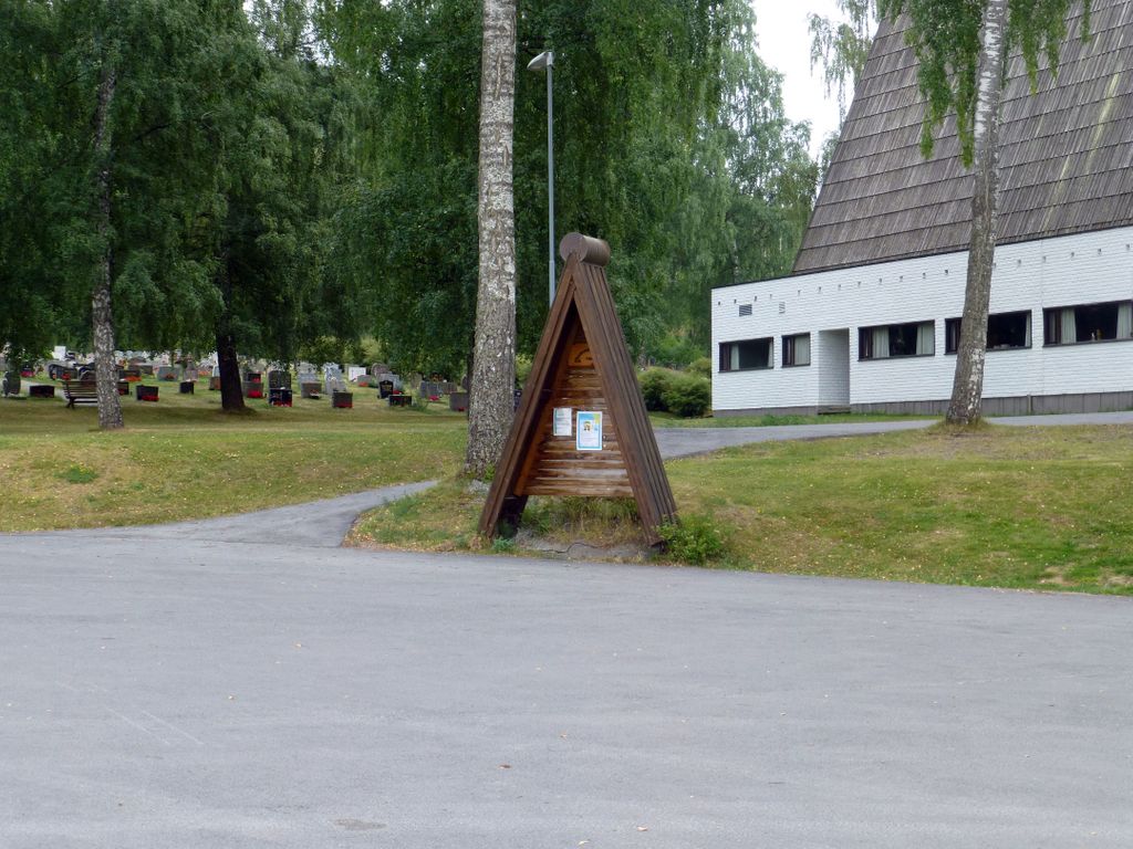
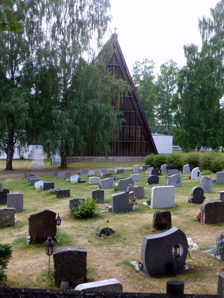
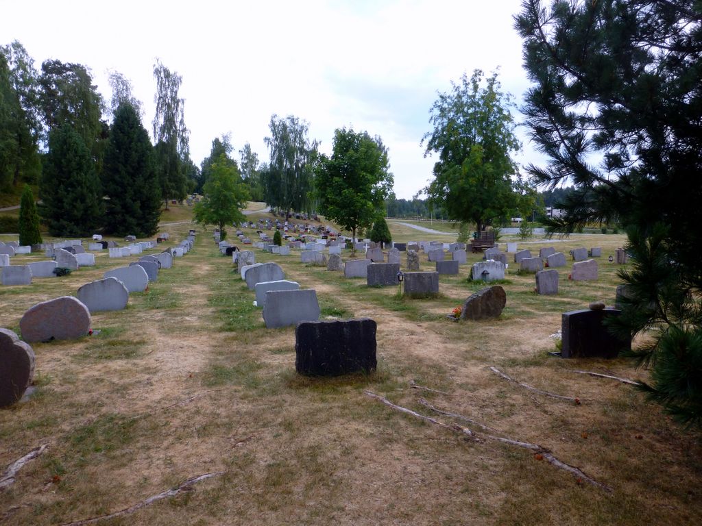
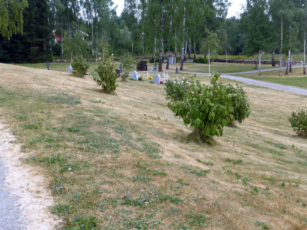
| Description | : | Brumunddal cemetery was consecrated on Sunday 9 December 1951. The cemetery was started with 168 graves, since it has been expanded several times - the last extension was completed in 2014. It is expected that this will last for 20 - 30 years to come. From 1964, Brumunddal (and Furnes) became part of Ringsaker municipality, but previously they belonged to Furnes municipality and Furnes parish (prestegjeld). It was at Furnes cemetery that people from Brumunddal were buried until they got their own cemetery. Brumunddal got its own church in 1965, it was consecrated... Read More |
frequently asked questions (FAQ):
-
Where is Brumunddal kirkegård?
Brumunddal kirkegård is located at Kirkevegen 67 Brumunddal, Ringsaker kommune ,Hedmark fylke , 2380Norway.
-
Brumunddal kirkegård cemetery's updated grave count on graveviews.com?
0 memorials
-
Where are the coordinates of the Brumunddal kirkegård?
Latitude: 60.8845300
Longitude: 10.9528000

Nearby Cemetories:
1. Veldre kirkegård
Veldre, Ringsaker kommune, Norway
Coordinate: 60.9172800, 10.8907600
2. Furnes kirkegård
Furnes, Ringsaker kommune, Norway
Coordinate: 60.8406000, 11.0217000
3. Hol Cemetery
Hamar, Hamar kommune, Norway
Coordinate: 60.8154900, 11.0450600
4. Hamar Kirkegaard
Hamar, Hamar kommune, Norway
Coordinate: 60.7991950, 11.0698420
5. Ringsaker kirkegård
Moelv, Ringsaker kommune, Norway
Coordinate: 60.9031110, 10.7242950
6. Nes kirkegård
Nes, Ringsaker kommune, Norway
Coordinate: 60.7625700, 10.9429500
7. Øvre Vang kirkegård
Hamar, Hamar kommune, Norway
Coordinate: 60.8458900, 11.2043400
8. Helgøya kirkegård
Nes, Ringsaker kommune, Norway
Coordinate: 60.7446645, 10.9585367
9. Åsmarka kirkegård
Åsmarka, Ringsaker kommune, Norway
Coordinate: 61.0117202, 10.7800753
10. Gjøvik gravlund
Gjøvik, Gjøvik kommune, Norway
Coordinate: 60.7880340, 10.6986880
11. Ottestad kirkegård
Ottestad, Stange kommune, Norway
Coordinate: 60.7573100, 11.1447300
12. Hunn gravlund
Gjøvik, Gjøvik kommune, Norway
Coordinate: 60.8019010, 10.6734890
13. Nordli Cemetery
Nordlia, Østre Toten kommune, Norway
Coordinate: 60.7432240, 10.7695170
14. Biri kirkegård
Biri, Gjøvik kommune, Norway
Coordinate: 60.9588990, 10.6018850
15. Løten Kirke Cemetery
Loten, Løten kommune, Norway
Coordinate: 60.8268950, 11.3172070
16. Stange Church Cemetery
Stange, Stange kommune, Norway
Coordinate: 60.7098210, 11.1373780
17. Romedal Kirkegård
Romedal, Stange kommune, Norway
Coordinate: 60.7517000, 11.2614400
18. Hoff Church Cemetery
Lena, Østre Toten kommune, Norway
Coordinate: 60.6847580, 10.8444930
19. Balke Kirkegaard
Skreia, Østre Toten kommune, Norway
Coordinate: 60.6681415, 10.9499695
20. Vardal kirkegård
Bybrua, Gjøvik kommune, Norway
Coordinate: 60.8161530, 10.5234840
21. Seegård kirkegård
Snertingdal, Gjøvik kommune, Norway
Coordinate: 60.8803220, 10.4626220
22. Brøttum Cemetery
Brøttum, Ringsaker kommune, Norway
Coordinate: 61.0283660, 10.5496950
23. Aas Churchyard
Raufoss, Vestre Toten kommune, Norway
Coordinate: 60.6693210, 10.6990180
24. Mesnali kirkegård
Mesnali, Ringsaker kommune, Norway
Coordinate: 61.1027820, 10.6929130