
| Memorials | : | 0 |
| Location | : | Gjøvik, Gjøvik kommune, Norway |
| Coordinate | : | 60.8019010, 10.6734890 |
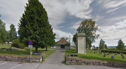
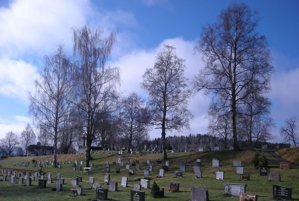
| Description | : | The cemetery is located between Hunnsvegen and Gravlundvegen, and the cemetery is divided into two by Føllingstad's road that runs through the cemetery across. Until Gjøvik gravlund came into use in 1906, Hunn gravlund was the only cemetery in the densely populated area around Gjøvik city. The oldest part is located southeast of Føllingstad's road, this burial ground originated as a cemetery for the old Hunn church, which was demolished in 1881. The cemetery has probably been in use since the Middle Ages, when the first church at Hunn was built. Northwest of Føllingstad's road lies the newest... Read More |
frequently asked questions (FAQ):
-
Where is Hunn gravlund?
Hunn gravlund is located at Hunnsvegen 55 Gjøvik, Gjøvik kommune ,Oppland fylke , 2819Norway.
-
Hunn gravlund cemetery's updated grave count on graveviews.com?
0 memorials
-
Where are the coordinates of the Hunn gravlund?
Latitude: 60.8019010
Longitude: 10.6734890
Nearby Cemetories:
1. Gjøvik gravlund
Gjøvik, Gjøvik kommune, Norway
Coordinate: 60.7880340, 10.6986880
2. Vardal kirkegård
Bybrua, Gjøvik kommune, Norway
Coordinate: 60.8161530, 10.5234840
3. Nordli Cemetery
Nordlia, Østre Toten kommune, Norway
Coordinate: 60.7432240, 10.7695170
4. Ringsaker kirkegård
Moelv, Ringsaker kommune, Norway
Coordinate: 60.9031110, 10.7242950
5. Seegård kirkegård
Snertingdal, Gjøvik kommune, Norway
Coordinate: 60.8803220, 10.4626220
6. Aas Churchyard
Raufoss, Vestre Toten kommune, Norway
Coordinate: 60.6693210, 10.6990180
7. Nes kirkegård
Nes, Ringsaker kommune, Norway
Coordinate: 60.7625700, 10.9429500
8. Hoff Church Cemetery
Lena, Østre Toten kommune, Norway
Coordinate: 60.6847580, 10.8444930
9. Helgøya kirkegård
Nes, Ringsaker kommune, Norway
Coordinate: 60.7446645, 10.9585367
10. Veldre kirkegård
Veldre, Ringsaker kommune, Norway
Coordinate: 60.9172800, 10.8907600
11. Brumunddal kirkegård
Brumunddal, Ringsaker kommune, Norway
Coordinate: 60.8845300, 10.9528000
12. Biri kirkegård
Biri, Gjøvik kommune, Norway
Coordinate: 60.9588990, 10.6018850
13. Furnes kirkegård
Furnes, Ringsaker kommune, Norway
Coordinate: 60.8406000, 11.0217000
14. Kolbu Kirke Churchyard
Østre Toten kommune, Norway
Coordinate: 60.6293210, 10.7737690
15. Hol Cemetery
Hamar, Hamar kommune, Norway
Coordinate: 60.8154900, 11.0450600
16. Nykirke kirkegård
Snertingdal, Gjøvik kommune, Norway
Coordinate: 60.8977830, 10.3388270
17. Balke Kirkegaard
Skreia, Østre Toten kommune, Norway
Coordinate: 60.6681415, 10.9499695
18. Hamar Kirkegaard
Hamar, Hamar kommune, Norway
Coordinate: 60.7991950, 11.0698420
19. Fluberg kirke
Fluberg, Søndre Land kommune, Norway
Coordinate: 60.7758230, 10.2467960
20. Åsmarka kirkegård
Åsmarka, Ringsaker kommune, Norway
Coordinate: 61.0117202, 10.7800753
21. Brøttum Cemetery
Brøttum, Ringsaker kommune, Norway
Coordinate: 61.0283660, 10.5496950
22. Ottestad kirkegård
Ottestad, Stange kommune, Norway
Coordinate: 60.7573100, 11.1447300
23. Stange Church Cemetery
Stange, Stange kommune, Norway
Coordinate: 60.7098210, 11.1373780
24. Øvre Vang kirkegård
Hamar, Hamar kommune, Norway
Coordinate: 60.8458900, 11.2043400