
| Memorials | : | 6 |
| Location | : | Holladay, Benton County, USA |
| Coordinate | : | 35.8985190, -87.9915550 |
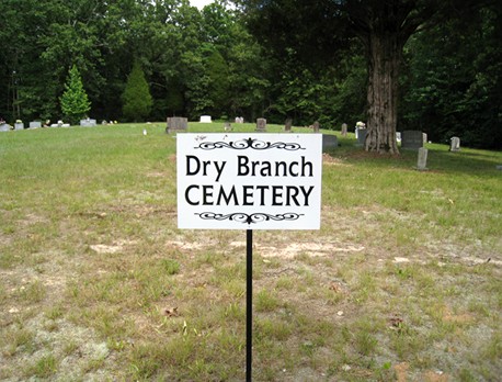
| Description | : | About 1/2 mile south of Eagle Creek on Birdsong Road/191 on the east side. There are approximately 125 unmarked graves. Located adjacent to the north side of the Dry Branch Church of Christ, on Birdsong Road. |
frequently asked questions (FAQ):
-
Where is Dry Branch Cemetery?
Dry Branch Cemetery is located at 12242 Birdsong Road Holladay, Benton County ,Tennessee , 38341USA.
-
Dry Branch Cemetery cemetery's updated grave count on graveviews.com?
6 memorials
-
Where are the coordinates of the Dry Branch Cemetery?
Latitude: 35.8985190
Longitude: -87.9915550
Nearby Cemetories:
1. Matlock Cemetery
Benton County, USA
Coordinate: 35.9030991, -87.9944000
2. Wilbanks Cemetery
Holladay, Benton County, USA
Coordinate: 35.8831960, -87.9942490
3. Eagle Creek Church Cemetery
Rockport, Benton County, USA
Coordinate: 35.9163200, -87.9833700
4. Malin Cemetery
Holladay, Benton County, USA
Coordinate: 35.8955430, -88.0161442
5. Fry Cemetery
Holladay, Benton County, USA
Coordinate: 35.8966530, -88.0252880
6. DePriest Cemetery
Benton County, USA
Coordinate: 35.9219017, -87.9713974
7. Peebles Sims Cemetery
Benton County, USA
Coordinate: 35.9236650, -88.0101830
8. Capps Cemetery
Holladay, Benton County, USA
Coordinate: 35.8997002, -88.0444031
9. Pavatt-Whitfield Cemetery
Holladay, Benton County, USA
Coordinate: 35.9260620, -87.9387750
10. Hamm Cemetery
Buffalo, Humphreys County, USA
Coordinate: 35.8816986, -87.9274979
11. Byrd Cemetery
Holladay, Benton County, USA
Coordinate: 35.9346950, -87.9382920
12. Manley Chapel Cemetery
McIllwain, Benton County, USA
Coordinate: 35.8690750, -88.0543250
13. Moore's Chapel Cemetery
McIllwain, Benton County, USA
Coordinate: 35.8690750, -88.0543250
14. Arrington Cemetery
Humphreys County, USA
Coordinate: 35.9082985, -87.9188995
15. Friendship Church Cemetery
McIllwain, Benton County, USA
Coordinate: 35.8682710, -88.0551560
16. Morgan Creek Primitive Baptist Cemetery
Holladay, Benton County, USA
Coordinate: 35.8409840, -88.0211680
17. Baker McAuley Cemetery
Benton County, USA
Coordinate: 35.9556007, -88.0274963
18. Cox Family Cemetery
Holladay, Benton County, USA
Coordinate: 35.8888100, -88.0700310
19. Luper Cemetery
Holladay, Benton County, USA
Coordinate: 35.9522370, -88.0372720
20. Bradley Cemetery
Benton County, USA
Coordinate: 35.8332470, -87.9994860
21. Tippitt Cemetery
Benton County, USA
Coordinate: 35.8877983, -88.0736008
22. Ezekiel Tippitt Cemetery
Holladay, Benton County, USA
Coordinate: 35.8875750, -88.0739270
23. Davis Cemetery
Birdsong Heights, Benton County, USA
Coordinate: 35.9578780, -88.0381140
24. Arthur Hatley Cemetery
Rockport, Benton County, USA
Coordinate: 35.9358430, -88.0661280