
| Memorials | : | 35 |
| Location | : | Benton County, USA |
| Coordinate | : | 35.9236650, -88.0101830 |
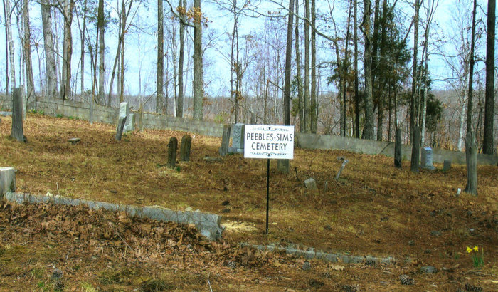
| Description | : | The road to the cemetery is about a mile south of TN 191 (Birdsong Rd). The road leads off to the east and is a good gravel road. The cemetery is about 3/4 mile from the McIllwain-Rockport Road. It has a concrete block wall around it and is very well cared for. There are about 25 unmarked graves and several homemade concrete markers. From the intersection of Rockport McIllwain Rd. & McIllwain Rd., east of US-641, travel northeast on Rockport McIllwain Rd. for 6.0 mi., turning southeast (right) onto an unnamed road logging road,... Read More |
frequently asked questions (FAQ):
-
Where is Peebles Sims Cemetery?
Peebles Sims Cemetery is located at Rockport McIllwain Road Benton County ,Tennessee , 38341USA.
-
Peebles Sims Cemetery cemetery's updated grave count on graveviews.com?
35 memorials
-
Where are the coordinates of the Peebles Sims Cemetery?
Latitude: 35.9236650
Longitude: -88.0101830
Nearby Cemetories:
1. Eagle Creek Church Cemetery
Rockport, Benton County, USA
Coordinate: 35.9163200, -87.9833700
2. Matlock Cemetery
Benton County, USA
Coordinate: 35.9030991, -87.9944000
3. Malin Cemetery
Holladay, Benton County, USA
Coordinate: 35.8955430, -88.0161442
4. Dry Branch Cemetery
Holladay, Benton County, USA
Coordinate: 35.8985190, -87.9915550
5. Fry Cemetery
Holladay, Benton County, USA
Coordinate: 35.8966530, -88.0252880
6. DePriest Cemetery
Benton County, USA
Coordinate: 35.9219017, -87.9713974
7. Baker McAuley Cemetery
Benton County, USA
Coordinate: 35.9556007, -88.0274963
8. Luper Cemetery
Holladay, Benton County, USA
Coordinate: 35.9522370, -88.0372720
9. Capps Cemetery
Holladay, Benton County, USA
Coordinate: 35.8997002, -88.0444031
10. Davis Cemetery
Birdsong Heights, Benton County, USA
Coordinate: 35.9578780, -88.0381140
11. Wilbanks Cemetery
Holladay, Benton County, USA
Coordinate: 35.8831960, -87.9942490
12. Dalton Cemetery
Mount Moriah, Benton County, USA
Coordinate: 35.9566680, -88.0498480
13. Arthur Hatley Cemetery
Rockport, Benton County, USA
Coordinate: 35.9358430, -88.0661280
14. Hatley Cemetery
Mount Moriah, Benton County, USA
Coordinate: 35.9358430, -88.0661280
15. Hatley Cemetery
Benton County, USA
Coordinate: 35.9361000, -88.0661011
16. Mount Moriah Cumberland Presbyterian Cemetery
Mount Moriah, Benton County, USA
Coordinate: 35.9620058, -88.0444794
17. Pavatt-Whitfield Cemetery
Holladay, Benton County, USA
Coordinate: 35.9260620, -87.9387750
18. Byrd Cemetery
Holladay, Benton County, USA
Coordinate: 35.9346950, -87.9382920
19. Cox Family Cemetery
Holladay, Benton County, USA
Coordinate: 35.8888100, -88.0700310
20. Tippitt Cemetery
Benton County, USA
Coordinate: 35.8877983, -88.0736008
21. Ezekiel Tippitt Cemetery
Holladay, Benton County, USA
Coordinate: 35.8875750, -88.0739270
22. Manley Chapel Cemetery
McIllwain, Benton County, USA
Coordinate: 35.8690750, -88.0543250
23. Moore's Chapel Cemetery
McIllwain, Benton County, USA
Coordinate: 35.8690750, -88.0543250
24. Friendship Church Cemetery
McIllwain, Benton County, USA
Coordinate: 35.8682710, -88.0551560