
| Memorials | : | 0 |
| Location | : | Ruby, Chesterfield County, USA |
| Coordinate | : | 34.7590400, -80.2025340 |
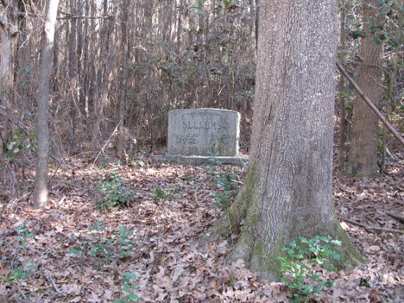
| Description | : | From Ruby, S.C. take Highway 9 West. Go past Elizabeth Academy Road. Pass one house on the right. The next drive on the right will turn in a field. The cemetery will be in the woods to the right of the drive. Note: This is the only two graves here and they have one stone together. Note: This is private property. Please get permission. |
frequently asked questions (FAQ):
-
Where is Sellers Cemetery?
Sellers Cemetery is located at Highway 9 West Ruby, Chesterfield County ,South Carolina ,USA.
-
Sellers Cemetery cemetery's updated grave count on graveviews.com?
0 memorials
-
Where are the coordinates of the Sellers Cemetery?
Latitude: 34.7590400
Longitude: -80.2025340
Nearby Cemetories:
1. Hancock Cemetery
Ruby, Chesterfield County, USA
Coordinate: 34.7579830, -80.1923260
2. Campbell Cemetery
Ruby, Chesterfield County, USA
Coordinate: 34.7502340, -80.1913550
3. Smith Cemetery
Ruby, Chesterfield County, USA
Coordinate: 34.7449670, -80.2004310
4. Smith Family Cemetery
Ruby, Chesterfield County, USA
Coordinate: 34.7451960, -80.1958290
5. Brantley Family Cemetery
Ruby, Chesterfield County, USA
Coordinate: 34.7468360, -80.1879220
6. Gulledge Cemetery
Mount Croghan, Chesterfield County, USA
Coordinate: 34.7516890, -80.2247430
7. Mount Croghan United Methodist Church Cemetery
Mount Croghan, Chesterfield County, USA
Coordinate: 34.7686430, -80.2240780
8. Mount Croghan Memorial Park
Mount Croghan, Chesterfield County, USA
Coordinate: 34.7686005, -80.2244034
9. Gulledge Family Cemetery
Ruby, Chesterfield County, USA
Coordinate: 34.7685860, -80.1802830
10. Ruby Church of God Cemetery
Ruby, Chesterfield County, USA
Coordinate: 34.7406250, -80.2151300
11. Timmonsville Baptist Church Cemetery Old
Mount Croghan, Chesterfield County, USA
Coordinate: 34.7789940, -80.1903360
12. Elizabeth Baptist Church Cemetery
Mount Croghan, Chesterfield County, USA
Coordinate: 34.7806015, -80.2130966
13. Timmonsville Baptist Church Cemetery
Mount Croghan, Chesterfield County, USA
Coordinate: 34.7825050, -80.1944070
14. Smith Cemetery
Ruby, Chesterfield County, USA
Coordinate: 34.7451040, -80.1773000
15. Ruby Cemetery
Ruby, Chesterfield County, USA
Coordinate: 34.7447014, -80.1769028
16. Rock Springs Baptist Church Cemetery
Ruby, Chesterfield County, USA
Coordinate: 34.7338650, -80.1962580
17. Gulledge Cemetery
Ruby, Chesterfield County, USA
Coordinate: 34.7370540, -80.2192710
18. Lamb of God Outreach Ministries Church Cemetery
Mount Croghan, Chesterfield County, USA
Coordinate: 34.7699190, -80.2325430
19. Massey Cemetery
Ruby, Chesterfield County, USA
Coordinate: 34.7783050, -80.1735600
20. Melton Family Cemetery
Ruby, Chesterfield County, USA
Coordinate: 34.7428650, -80.1607650
21. Thompson Creek Baptist Church Cemetery New
Chesterfield County, USA
Coordinate: 34.7756004, -80.1575012
22. Gaddy-Sellers Cemetery
Ruby, Chesterfield County, USA
Coordinate: 34.7500840, -80.1534820
23. Thompson Creek Baptist Church Cemetery Old
Chesterfield, Chesterfield County, USA
Coordinate: 34.7771740, -80.1573740
24. Sellers Family Cemetery
Chesterfield, Chesterfield County, USA
Coordinate: 34.7437060, -80.1537960