
| Memorials | : | 4835 |
| Location | : | Woodford, Metropolitan Borough of Stockport, England |
| Coordinate | : | 53.3375900, -2.1733800 |
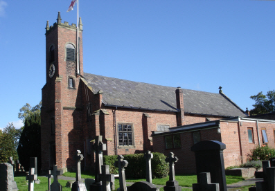
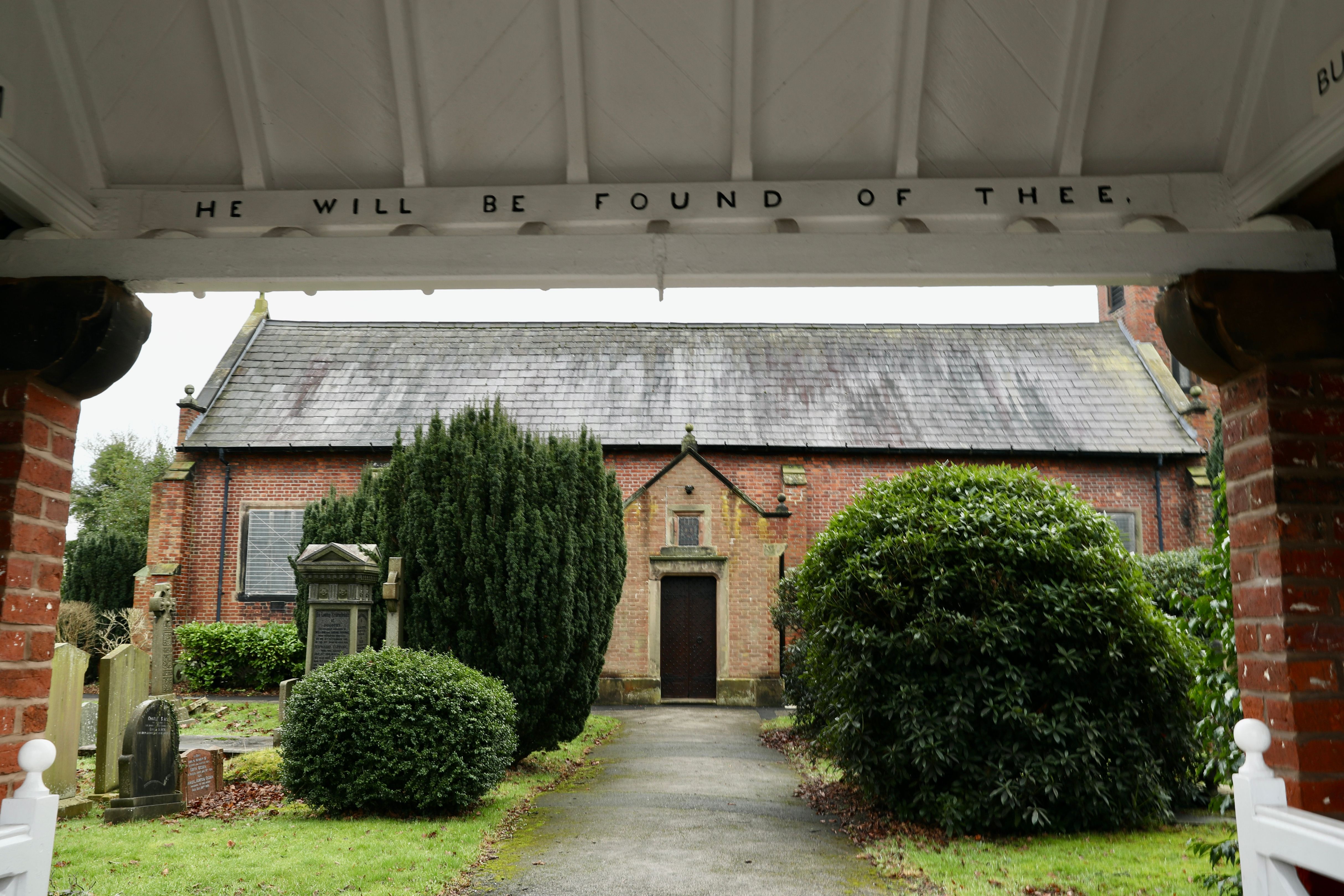
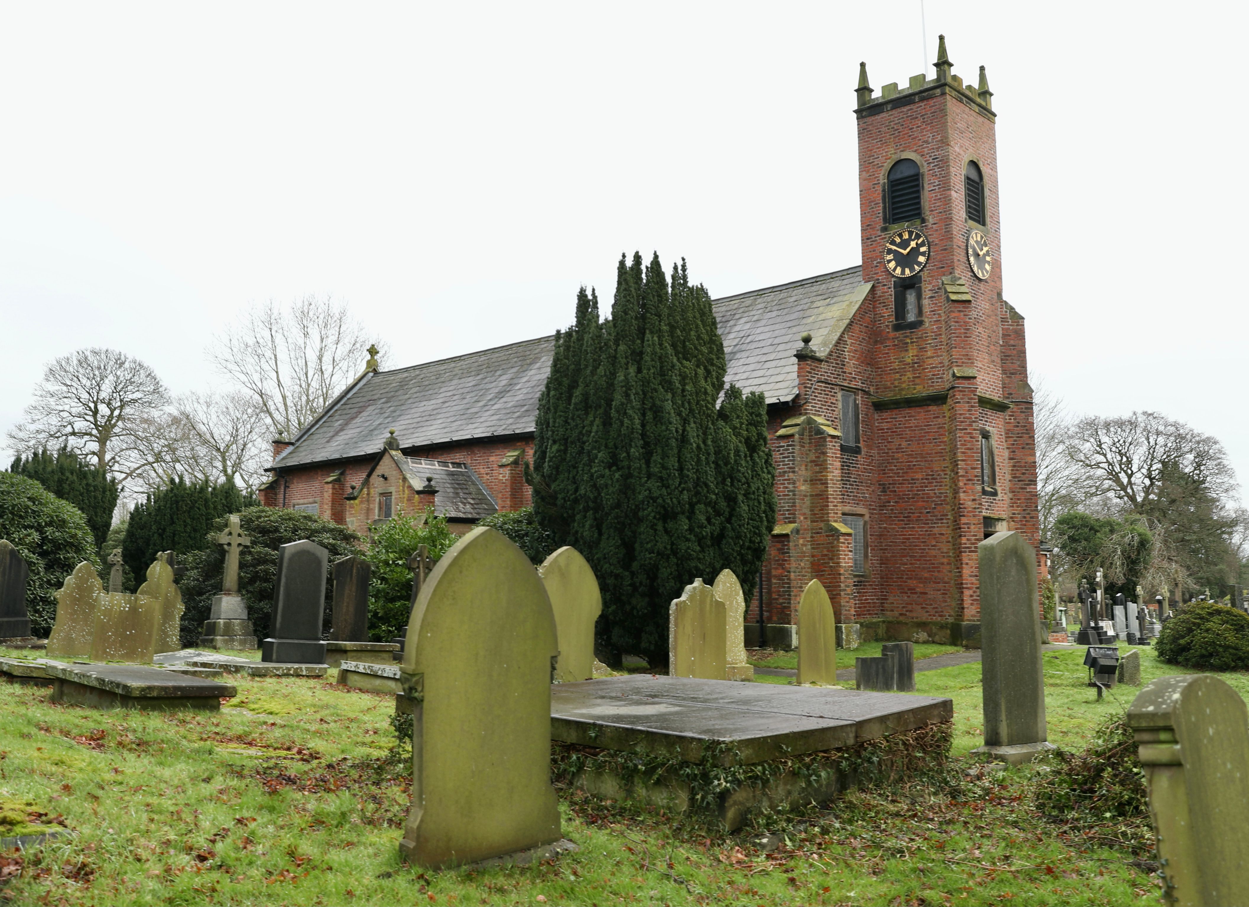
| Description | : | Christ Church was built in 1871 as a chapel-of-ease to Prestbury. In 1872 it was consecrated and in 1873 Woodford became a parish in its own right. |
frequently asked questions (FAQ):
-
Where is Christ Church Churchyard?
Christ Church Churchyard is located at Cheshire Road Woodford, Metropolitan Borough of Stockport ,Greater Manchester , SK7 1PREngland.
-
Christ Church Churchyard cemetery's updated grave count on graveviews.com?
4834 memorials
-
Where are the coordinates of the Christ Church Churchyard?
Latitude: 53.3375900
Longitude: -2.1733800
Nearby Cemetories:
1. Bramhall Baptist Church
Bramhall, Metropolitan Borough of Stockport, England
Coordinate: 53.3509311, -2.1644365
2. Dean Row Chapelyard
Wilmslow, Cheshire East Unitary Authority, England
Coordinate: 53.3304820, -2.1951770
3. St Chad
Handforth, Cheshire East Unitary Authority, England
Coordinate: 53.3485000, -2.2148100
4. Wilmslow Cemetery
Wilmslow, Cheshire East Unitary Authority, England
Coordinate: 53.3374170, -2.2236590
5. All Saints Churchyard
Cheadle Hulme, Metropolitan Borough of Stockport, England
Coordinate: 53.3669444, -2.1863889
6. St George Churchyard
Poynton, Cheshire East Unitary Authority, England
Coordinate: 53.3490610, -2.1231260
7. St. Bartholomew Churchyard
Wilmslow, Cheshire East Unitary Authority, England
Coordinate: 53.3301250, -2.2296900
8. Heald Green United Reformed Church
Heald Green, Metropolitan Borough of Stockport, England
Coordinate: 53.3674480, -2.2165710
9. St Peter Churchyard
Prestbury, Cheshire East Unitary Authority, England
Coordinate: 53.2892070, -2.1505100
10. Norbury St Thomas Churchyard
Hazel Grove, Metropolitan Borough of Stockport, England
Coordinate: 53.3761440, -2.1160440
11. St. John's Churchyard
Wilmslow, Cheshire East Unitary Authority, England
Coordinate: 53.3122370, -2.2532400
12. Cheadle Cemetery
Cheadle, Metropolitan Borough of Stockport, England
Coordinate: 53.3927610, -2.2054690
13. St. Christopher Churchyard
Pott Shrigley, Cheshire East Unitary Authority, England
Coordinate: 53.3096500, -2.0842900
14. Alderley Edge Cemetery
Alderley Edge, Cheshire East Unitary Authority, England
Coordinate: 53.2995180, -2.2530880
15. Stockport Cemetery and Crematorium
Stockport, Metropolitan Borough of Stockport, England
Coordinate: 53.3979110, -2.1511430
16. St Mary's Churchyard
Cheadle, Metropolitan Borough of Stockport, England
Coordinate: 53.3944820, -2.2176205
17. St John the Baptist Churchyard
Bollington, Cheshire East Unitary Authority, England
Coordinate: 53.2969600, -2.0926100
18. Wesleyan Chapel
Edgeley, Metropolitan Borough of Stockport, England
Coordinate: 53.4019700, -2.1673860
19. Mill Lane Cemetery
Cheadle, Metropolitan Borough of Stockport, England
Coordinate: 53.3992000, -2.2150800
20. St Thomas Churchyard
Stockport, Metropolitan Borough of Stockport, England
Coordinate: 53.4036000, -2.1550000
21. St Marys Churchyard
Nether Alderley, Cheshire East Unitary Authority, England
Coordinate: 53.2820200, -2.2388500
22. Quaker Burying Ground
Mobberley, Cheshire East Unitary Authority, England
Coordinate: 53.3174300, -2.2872500
23. Ringway St. Mary and All Saints Churchyard
Altrincham, Metropolitan Borough of Trafford, England
Coordinate: 53.3587900, -2.2885800
24. The Parish Church of Saint Peter
Stockport, Metropolitan Borough of Stockport, England
Coordinate: 53.4084880, -2.1492930