
| Memorials | : | 0 |
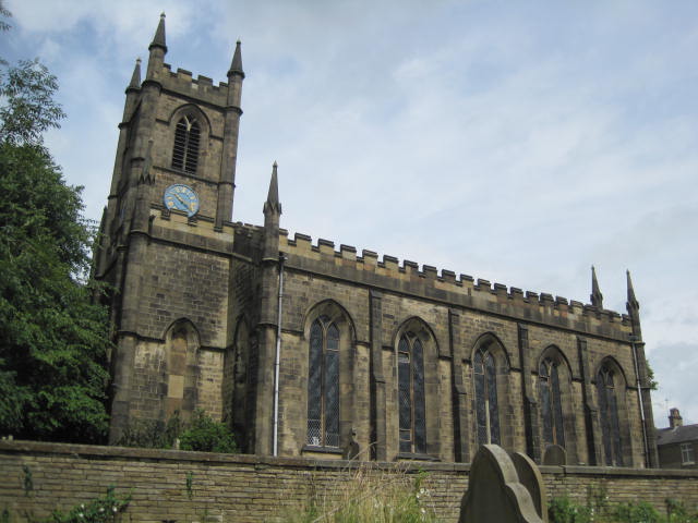
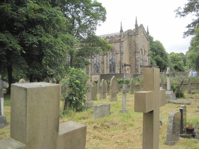
| Location | : | Bollington, Cheshire East Unitary Authority, England |
| Coordinate | : | 53.2969600, -2.0926100 |
frequently asked questions (FAQ):
-
Where is St John the Baptist Churchyard?
St John the Baptist Churchyard is located at Bollington, Cheshire East Unitary Authority ,Cheshire ,England.
-
St John the Baptist Churchyard cemetery's updated grave count on graveviews.com?
0 memorials
-
Where are the coordinates of the St John the Baptist Churchyard?
Latitude: 53.2969600
Longitude: -2.0926100
Nearby Cemetories:
1. St. Christopher Churchyard
Pott Shrigley, Cheshire East Unitary Authority, England
Coordinate: 53.3096500, -2.0842900
2. Wesleyan Chapel Chapelyard
Rainow, Cheshire East Unitary Authority, England
Coordinate: 53.2835470, -2.0709590
3. Holy Trinity Churchyard
Hurdsfield, Cheshire East Unitary Authority, England
Coordinate: 53.2647300, -2.1124600
4. St Peter Churchyard
Prestbury, Cheshire East Unitary Authority, England
Coordinate: 53.2892070, -2.1505100
5. Macclesfield Crematorium
Macclesfield, Cheshire East Unitary Authority, England
Coordinate: 53.2656340, -2.1373290
6. St. John the Evangelist Churchyard
Cheshire East Unitary Authority, England
Coordinate: 53.2862960, -2.0256440
7. Macclesfield Cemetery
Macclesfield, Cheshire East Unitary Authority, England
Coordinate: 53.2652260, -2.1376130
8. St Paul Churchyard
Macclesfield, Cheshire East Unitary Authority, England
Coordinate: 53.2574100, -2.1192400
9. St. Michael's & All Angels Churchyard
Macclesfield, Cheshire East Unitary Authority, England
Coordinate: 53.2572950, -2.1195970
10. St. Alban's Churchyard
Macclesfield, Cheshire East Unitary Authority, England
Coordinate: 53.2599190, -2.1339940
11. St George Churchyard
Poynton, Cheshire East Unitary Authority, England
Coordinate: 53.3490610, -2.1231260
12. St James Churchyard
Sutton (Macclesfield), Cheshire East Unitary Authority, England
Coordinate: 53.2378520, -2.1063910
13. St . Stephen's Church Forest Chapel
Macclesfield Forest, Cheshire East Unitary Authority, England
Coordinate: 53.2462260, -2.0399720
14. St. James Churchyard
Whaley Bridge, High Peak Borough, England
Coordinate: 53.3153270, -1.9918840
15. Christ Church Churchyard
Woodford, Metropolitan Borough of Stockport, England
Coordinate: 53.3375900, -2.1733800
16. Brunswick Wesleyan Methodist Chapel Chapelyard
Sutton (Macclesfield), Cheshire East Unitary Authority, England
Coordinate: 53.2359570, -2.1213260
17. St Thomas Churchyard
Henbury, Cheshire East Unitary Authority, England
Coordinate: 53.2594420, -2.1792260
18. Saint Mary's Parish Church
Disley, Cheshire East Unitary Authority, England
Coordinate: 53.3574410, -2.0397980
19. Bramhall Baptist Church
Bramhall, Metropolitan Borough of Stockport, England
Coordinate: 53.3509311, -2.1644365
20. Dean Row Chapelyard
Wilmslow, Cheshire East Unitary Authority, England
Coordinate: 53.3304820, -2.1951770
21. Fernilee Methodist Church
Fernilee, High Peak Borough, England
Coordinate: 53.3072690, -1.9752940
22. Norbury St Thomas Churchyard
Hazel Grove, Metropolitan Borough of Stockport, England
Coordinate: 53.3761440, -2.1160440
23. St. James Churchyard
Buxworth, High Peak Borough, England
Coordinate: 53.3362500, -1.9688500
24. Primitive Methodist Chapel 1841
Buxworth, High Peak Borough, England
Coordinate: 53.3363378, -1.9667282