
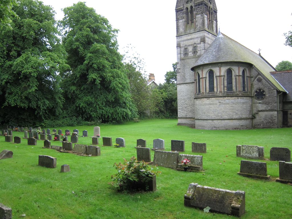
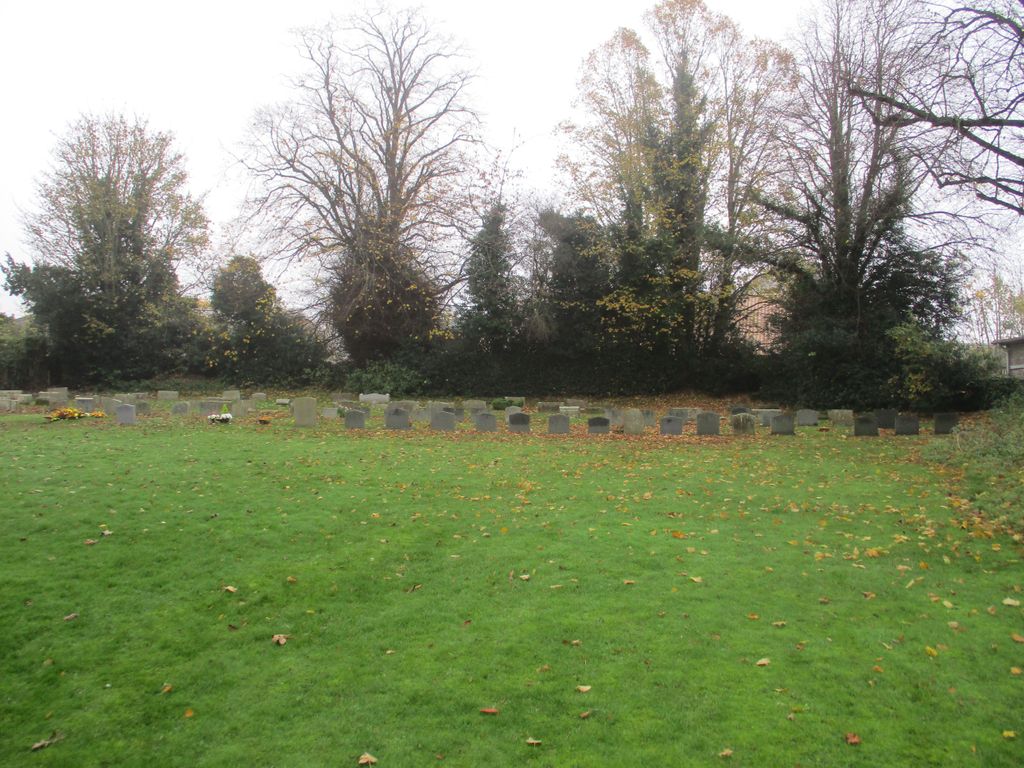
| Memorials | : | 139 |
| Location | : | Appleton-le-Moors, Ryedale District, England |
| Coordinate | : | 54.2832030, -0.8729120 |
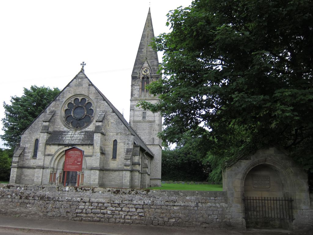
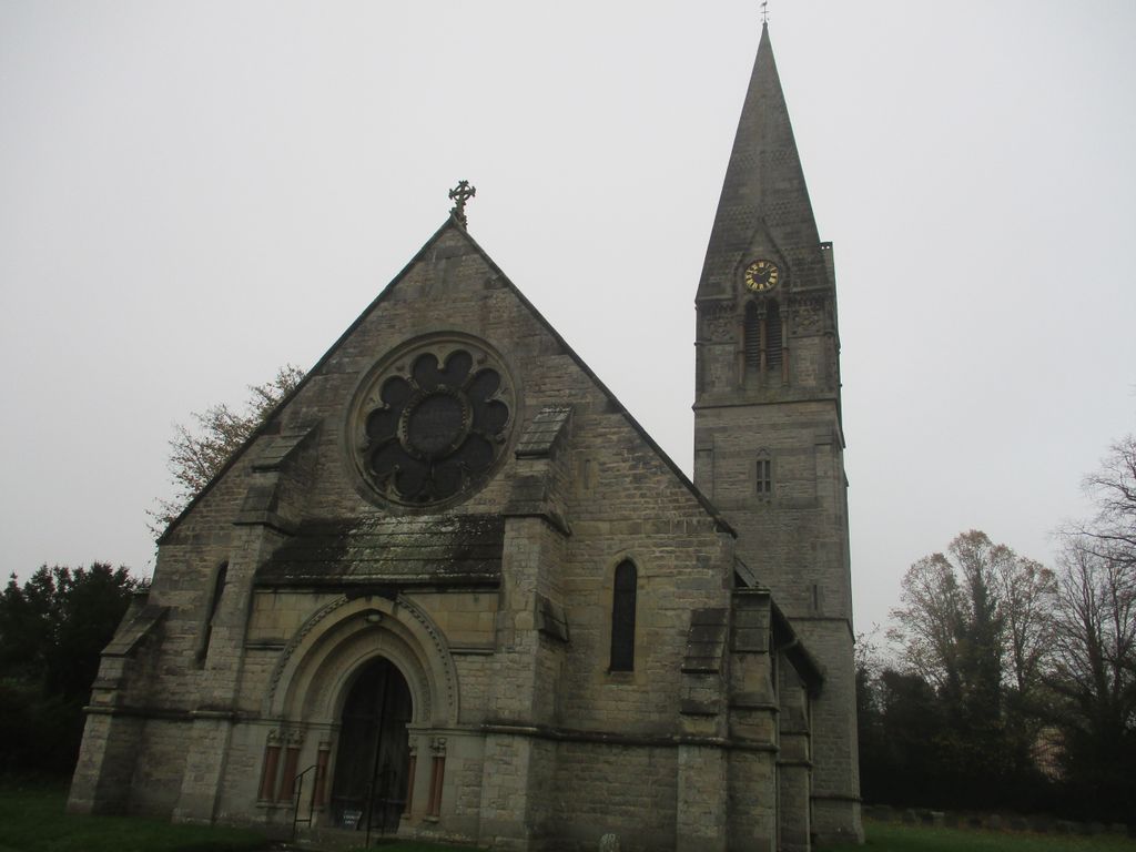
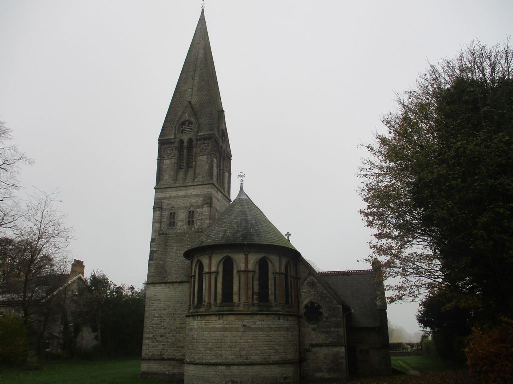
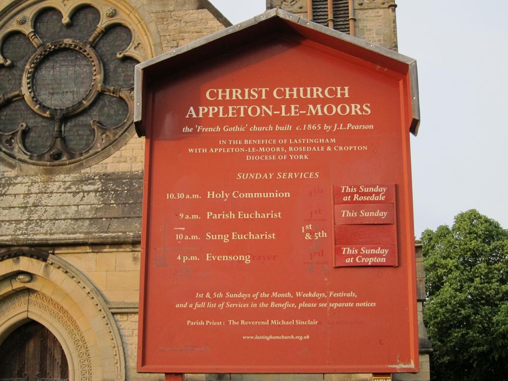
| Description | : | This Grade 1 listed church is described as a real surprise to visitors, built in the 1860s in the 'French Gothic Revival' style by the renowned architect J.L. Pearson, and has been called the 'little gem of moorland churches'. There is richly decorated stone and woodwork in the French Gothic style, a hammer-beam roof and some first rate stained glass. The village of Appleton-le-Moors is in the Ryedale district of North Yorkshire, and is located in the North York Moors National Park, in between Pickering and Kirbymoorside. It is recorded in the Domesday Book of 1085 and still has a classic... Read More |
frequently asked questions (FAQ):
-
Where is Christ Church Churchyard?
Christ Church Churchyard is located at Headlands Road Appleton-le-Moors, Ryedale District ,North Yorkshire , YO62England.
-
Christ Church Churchyard cemetery's updated grave count on graveviews.com?
139 memorials
-
Where are the coordinates of the Christ Church Churchyard?
Latitude: 54.2832030
Longitude: -0.8729120
Nearby Cemetories:
1. All Saints Churchyard
Sinnington, Ryedale District, England
Coordinate: 54.2647920, -0.8556060
2. St. Gregory Churchyard
Cropton, Ryedale District, England
Coordinate: 54.2935460, -0.8394850
3. St Mary Churchyard
Lastingham, Ryedale District, England
Coordinate: 54.3046870, -0.8827260
4. St Chad Churchyard
Hutton-le-Hole, Ryedale District, England
Coordinate: 54.3000700, -0.9167300
5. All Saints Churchyard
Kirkbymoorside, Ryedale District, England
Coordinate: 54.2703470, -0.9310110
6. St. Michael and All Angels Churchyard
Edstone, Ryedale District, England
Coordinate: 54.2469000, -0.9188000
7. St Andrew Churchyard
Middleton, Ryedale District, England
Coordinate: 54.2587500, -0.8011900
8. St Andrews Churchyard
Middleton, Ryedale District, England
Coordinate: 54.2587270, -0.8009640
9. St Aidan Churchyard
Gillamoor, Ryedale District, England
Coordinate: 54.3023510, -0.9502880
10. St Gregory Minster Churchyard
Nawton, Ryedale District, England
Coordinate: 54.2627570, -0.9621910
11. St. Gregory's Minster Churchyard
Kirkdale, Ryedale District, England
Coordinate: 54.2628300, -0.9622613
12. St Gregory Minster Churchyard Extension
Nawton, Ryedale District, England
Coordinate: 54.2628100, -0.9629100
13. St. Andrew's Churchyard
Normanby, Ryedale District, England
Coordinate: 54.2253710, -0.8744810
14. St Peter and St Paul Churchyard
Pickering, Ryedale District, England
Coordinate: 54.2456660, -0.7754960
15. Pickering Cemetery
Pickering, Ryedale District, England
Coordinate: 54.2490600, -0.7703600
16. St Mary and St Laurence Churchyard
Rosedale Abbey, Ryedale District, England
Coordinate: 54.3537300, -0.8872700
17. St. John’s Churchyard
Newton-on-Rawcliffe, Ryedale District, England
Coordinate: 54.3022700, -0.7520000
18. Newton upon Rawcliffe Cemetery
Newton-on-Rawcliffe, Ryedale District, England
Coordinate: 54.2998382, -0.7503566
19. St. John of Beverley Parish Churchyard
Salton, Ryedale District, England
Coordinate: 54.2105680, -0.9028560
20. St Laurence Churchyard
Kirby Misperton, Ryedale District, England
Coordinate: 54.2057120, -0.8070710
21. St Mary the Virgin Churchyard
Levisham, Ryedale District, England
Coordinate: 54.2992000, -0.7223000
22. St Saviour Churchyard
Harome, Ryedale District, England
Coordinate: 54.2302000, -1.0088000
23. Harome Village Cemetery
Harome, Ryedale District, England
Coordinate: 54.2308650, -1.0096380
24. St Giles Churchyard
Lockton, Ryedale District, England
Coordinate: 54.2987100, -0.7057700