
| Memorials | : | 71 |
| Location | : | Harome, Ryedale District, England |
| Coordinate | : | 54.2302000, -1.0088000 |
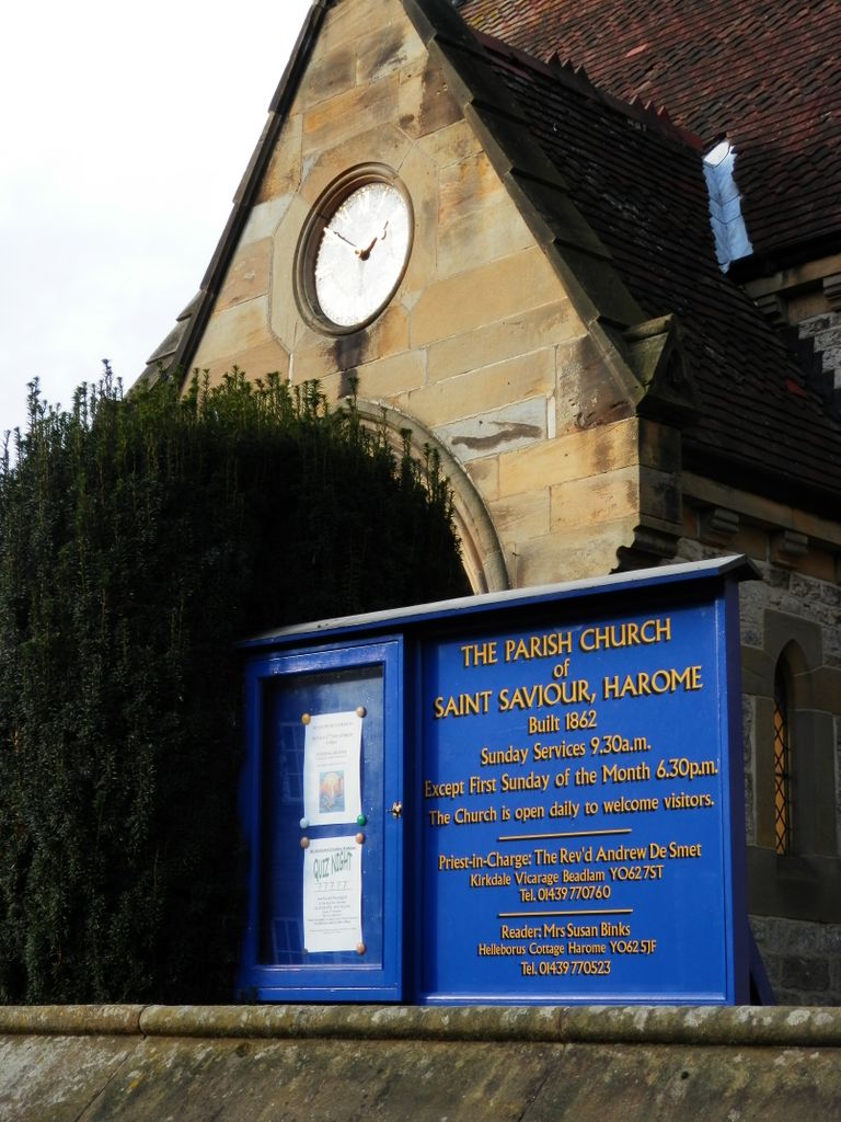
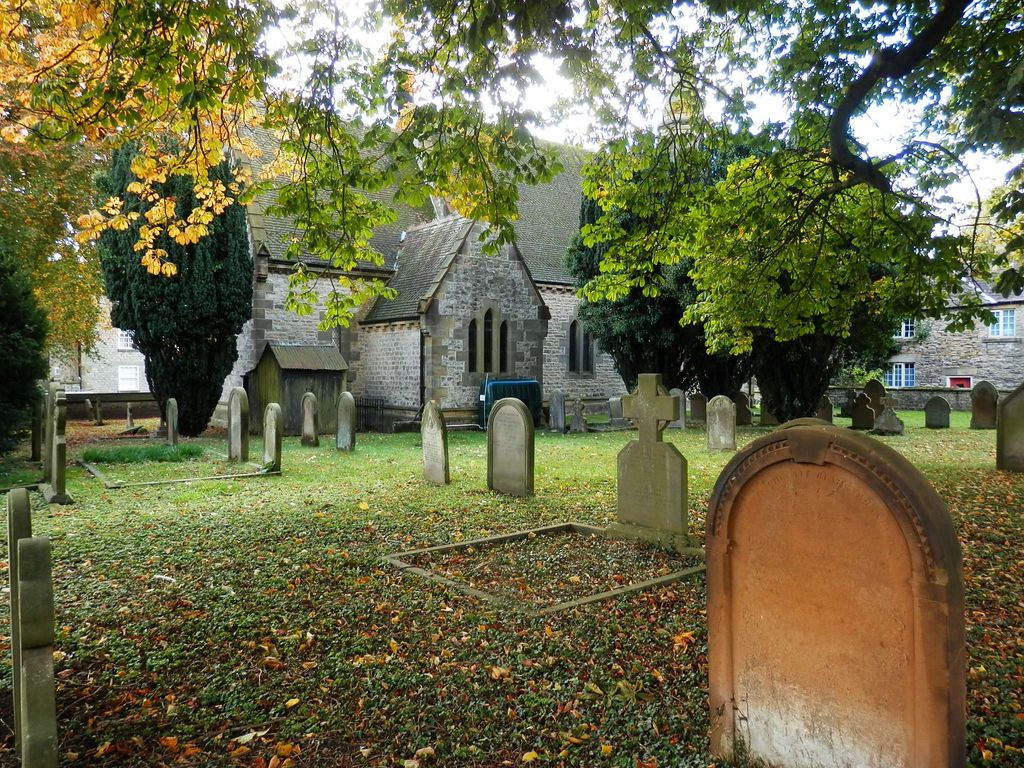
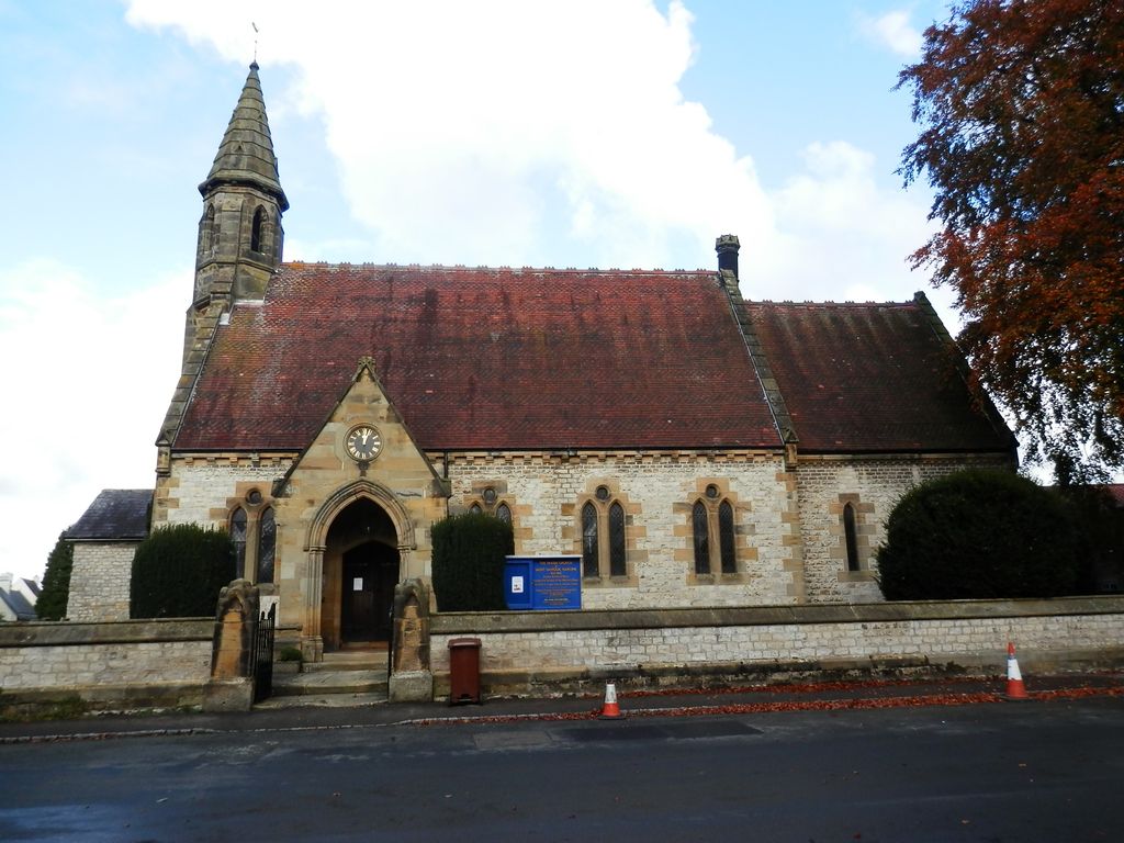
| Description | : | Construction of the local church began in May 1861, on the site of a previously demolished building. St Saviour church was completed in August, 1862, under the patronage of the Feversham Estate, by Charles Barry Jr, whose father designed the Houses of Parliament. It was originally furnished by William Duncombe, who represented the North Riding of Yorkshire as a Member of Parliament between 1859 and 1867. The church contains glass from Hardman, and most recently a Millennium Cross produced by a local craftsman. |
frequently asked questions (FAQ):
-
Where is St Saviour Churchyard?
St Saviour Churchyard is located at Harome, Ryedale District ,North Yorkshire ,England.
-
St Saviour Churchyard cemetery's updated grave count on graveviews.com?
71 memorials
-
Where are the coordinates of the St Saviour Churchyard?
Latitude: 54.2302000
Longitude: -1.0088000
Nearby Cemetories:
1. Harome Village Cemetery
Harome, Ryedale District, England
Coordinate: 54.2308650, -1.0096380
2. All Saints and St James Church
Nunnington, Ryedale District, England
Coordinate: 54.2031000, -0.9806000
3. Rievaulx Abbey
Helmsley, Ryedale District, England
Coordinate: 54.2449170, -1.0639570
4. All Saints Churchyard
Helmsley, Ryedale District, England
Coordinate: 54.2469000, -1.0625000
5. Helmsley Town Cemetery
Helmsley, Ryedale District, England
Coordinate: 54.2483300, -1.0620300
6. St Oswald Churchyard
Oswaldkirk, Ryedale District, England
Coordinate: 54.2022340, -1.0495510
7. Stonegrave Minster Churchyard
Stonegrave, Ryedale District, England
Coordinate: 54.1925011, -0.9966000
8. St Gregory Minster Churchyard Extension
Nawton, Ryedale District, England
Coordinate: 54.2628100, -0.9629100
9. St Gregory Minster Churchyard
Nawton, Ryedale District, England
Coordinate: 54.2627570, -0.9621910
10. St. Gregory's Minster Churchyard
Kirkdale, Ryedale District, England
Coordinate: 54.2628300, -0.9622613
11. Ampleforth Abbey - Monk's Wood
Ampleforth, Ryedale District, England
Coordinate: 54.2028689, -1.0841344
12. Ampleforth Abbey
Ampleforth, Ryedale District, England
Coordinate: 54.2019630, -1.0838000
13. Gilling New Churchyard
Gilling East, Ryedale District, England
Coordinate: 54.1856070, -1.0559535
14. Holy Cross Churchyard
Gilling East, Ryedale District, England
Coordinate: 54.1841290, -1.0580460
15. St. Michael and All Angels Churchyard
Edstone, Ryedale District, England
Coordinate: 54.2469000, -0.9188000
16. Hovingham Cemetery
Hovingham, Ryedale District, England
Coordinate: 54.1753500, -0.9808900
17. All Saints Churchyard
Hovingham, Ryedale District, England
Coordinate: 54.1728980, -0.9801260
18. All Saints Churchyard
Kirkbymoorside, Ryedale District, England
Coordinate: 54.2703470, -0.9310110
19. Our Lady & St Benedict RC Churchyard
Ampleforth, Ryedale District, England
Coordinate: 54.2009700, -1.1055400
20. St. John of Beverley Parish Churchyard
Salton, Ryedale District, England
Coordinate: 54.2105680, -0.9028560
21. St Hilda Churchyard
Ampleforth, Ryedale District, England
Coordinate: 54.2000630, -1.1075590
22. Ampleforth Friends Burial Ground
Ampleforth, Ryedale District, England
Coordinate: 54.2023420, -1.1213330
23. All Saints Churchyard
Slingsby, Ryedale District, England
Coordinate: 54.1655800, -0.9342900
24. St. Andrew's Churchyard
Normanby, Ryedale District, England
Coordinate: 54.2253710, -0.8744810