
| Memorials | : | 1 |
| Location | : | Normanby, Ryedale District, England |
| Coordinate | : | 54.2253710, -0.8744810 |
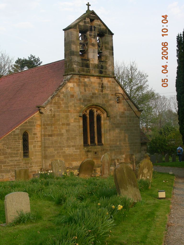
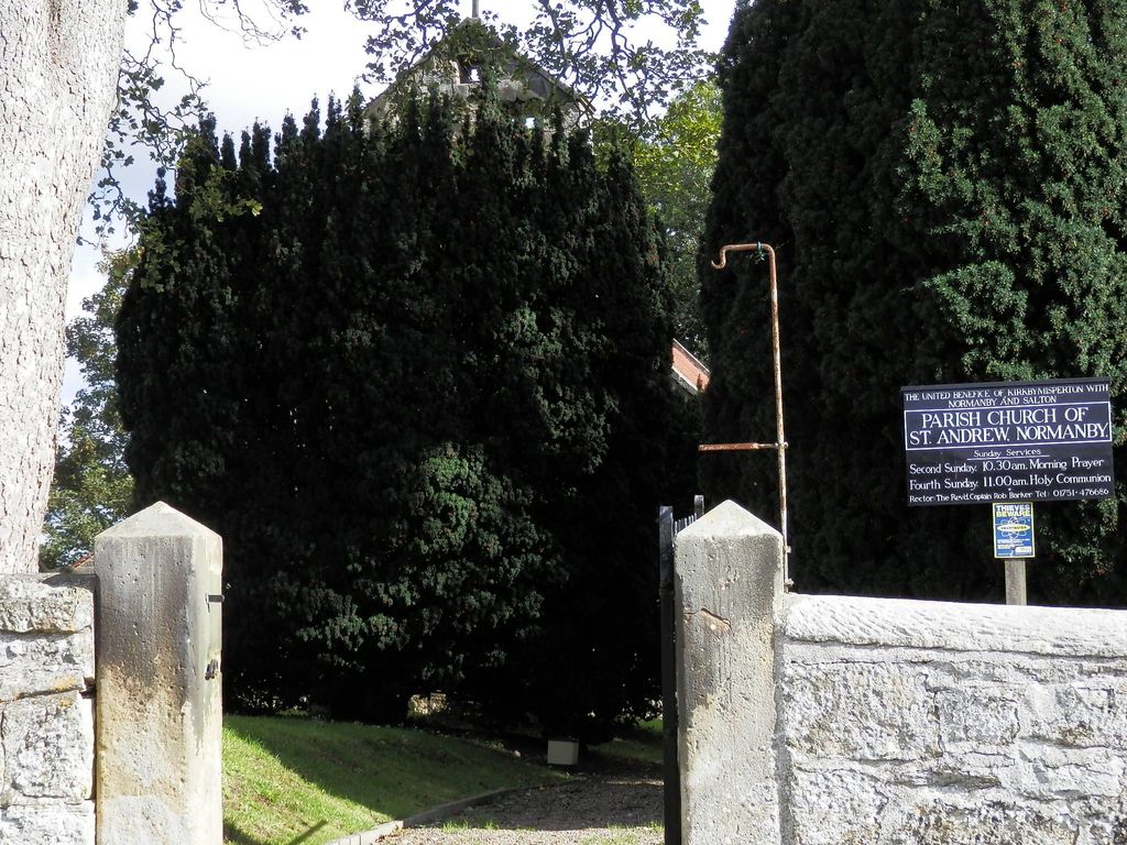
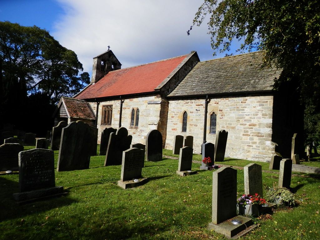
| Description | : | St. Andrew's Church dates to 1150 and originally operated under the patronage of St. Mary's Abbey at York. It is grade II listed and many remnants of the original church building can be found. Parish registers survive from 1699 and have been deposited in the North Yorkshire County Records Office (Northallerton, North Yorkshire). Bishops Transcripts of the registers date back to 1625; these have been deposited in the Borthwick Institute for Archives (University of York, Heslington, York). The Churchyard with many headstones surrounds the building on all sides. |
frequently asked questions (FAQ):
-
Where is St. Andrew's Churchyard?
St. Andrew's Churchyard is located at Barugh Lane Normanby, Ryedale District ,North Yorkshire , YO62 6RHEngland.
-
St. Andrew's Churchyard cemetery's updated grave count on graveviews.com?
1 memorials
-
Where are the coordinates of the St. Andrew's Churchyard?
Latitude: 54.2253710
Longitude: -0.8744810
Nearby Cemetories:
1. St. John of Beverley Parish Churchyard
Salton, Ryedale District, England
Coordinate: 54.2105680, -0.9028560
2. St. Michael and All Angels Churchyard
Edstone, Ryedale District, England
Coordinate: 54.2469000, -0.9188000
3. All Saints Churchyard
Sinnington, Ryedale District, England
Coordinate: 54.2647920, -0.8556060
4. St Laurence Churchyard
Kirby Misperton, Ryedale District, England
Coordinate: 54.2057120, -0.8070710
5. St Andrew Churchyard
Middleton, Ryedale District, England
Coordinate: 54.2587500, -0.8011900
6. St Andrews Churchyard
Middleton, Ryedale District, England
Coordinate: 54.2587270, -0.8009640
7. All Saints Churchyard
Kirkbymoorside, Ryedale District, England
Coordinate: 54.2703470, -0.9310110
8. Christ Church Churchyard
Appleton-le-Moors, Ryedale District, England
Coordinate: 54.2832030, -0.8729120
9. St Peter and St Paul Churchyard
Pickering, Ryedale District, England
Coordinate: 54.2456660, -0.7754960
10. St Gregory Minster Churchyard
Nawton, Ryedale District, England
Coordinate: 54.2627570, -0.9621910
11. St. Gregory's Minster Churchyard
Kirkdale, Ryedale District, England
Coordinate: 54.2628300, -0.9622613
12. St Gregory Minster Churchyard Extension
Nawton, Ryedale District, England
Coordinate: 54.2628100, -0.9629100
13. Pickering Cemetery
Pickering, Ryedale District, England
Coordinate: 54.2490600, -0.7703600
14. All Saints and St James Church
Nunnington, Ryedale District, England
Coordinate: 54.2031000, -0.9806000
15. Slingsby Cemetery
Slingsby, Ryedale District, England
Coordinate: 54.1650600, -0.9256700
16. St Michael Churchyard
Barton-le-Street, Ryedale District, England
Coordinate: 54.1587100, -0.8969600
17. All Saints Churchyard
Slingsby, Ryedale District, England
Coordinate: 54.1655800, -0.9342900
18. St. Gregory Churchyard
Cropton, Ryedale District, England
Coordinate: 54.2935460, -0.8394850
19. All Saints Churchyard
Appleton-le-Street, Ryedale District, England
Coordinate: 54.1529500, -0.8766300
20. St Helen Churchyard
Amotherby, Ryedale District, England
Coordinate: 54.1512000, -0.8521000
21. Stonegrave Minster Churchyard
Stonegrave, Ryedale District, England
Coordinate: 54.1925011, -0.9966000
22. St Saviour Churchyard
Harome, Ryedale District, England
Coordinate: 54.2302000, -1.0088000
23. St Chad Churchyard
Hutton-le-Hole, Ryedale District, England
Coordinate: 54.3000700, -0.9167300
24. Harome Village Cemetery
Harome, Ryedale District, England
Coordinate: 54.2308650, -1.0096380