
| Memorials | : | 0 |
| Location | : | Newbury, West Berkshire Unitary Authority, England |
| Coordinate | : | 51.4116940, -1.3186810 |
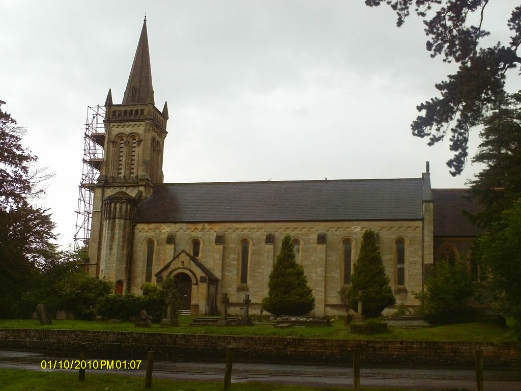
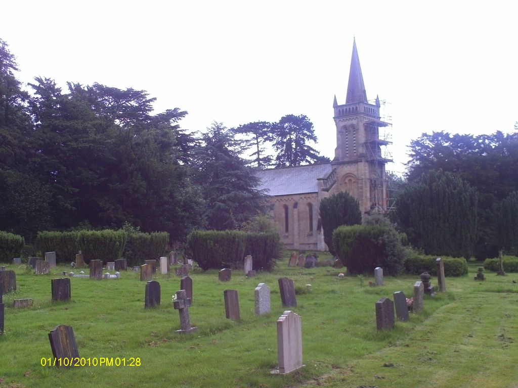
| Description | : | The church is situated in Shaw, on the northern edge of Newbury, in Berkshire. Anyone who has driven south along the old A34 (pre by-pass) may well have seen the building on the left hand side, just before reaching the infamous Robin Hood roundabout. Also known as Shaw-cum-Donnington |
frequently asked questions (FAQ):
-
Where is Shaw St Marys Churchyard?
Shaw St Marys Churchyard is located at Church Road Newbury, West Berkshire Unitary Authority ,Berkshire , RG14 2DSEngland.
-
Shaw St Marys Churchyard cemetery's updated grave count on graveviews.com?
0 memorials
-
Where are the coordinates of the Shaw St Marys Churchyard?
Latitude: 51.4116940
Longitude: -1.3186810
Nearby Cemetories:
1. Shaw Cemetery
Newbury, West Berkshire Unitary Authority, England
Coordinate: 51.4138160, -1.3106410
2. St Nicolas Churchyard
Newbury, West Berkshire Unitary Authority, England
Coordinate: 51.4009920, -1.3248370
3. Newbury Friends Burial Ground (Defunct)
Reading Borough, England
Coordinate: 51.3987240, -1.3228830
4. St. Mary the Virgin Churchyard
Speen, West Berkshire Unitary Authority, England
Coordinate: 51.4076540, -1.3469800
5. Newtown Road Cemetery
Newbury, West Berkshire Unitary Authority, England
Coordinate: 51.3924300, -1.3252900
6. St Mary the Virgin Churchyard
Greenham, West Berkshire Unitary Authority, England
Coordinate: 51.3883350, -1.3030280
7. Thatcham United Reform Church Burial Ground
Thatcham, West Berkshire Unitary Authority, England
Coordinate: 51.4025141, -1.2595003
8. St Mary's
Thatcham, West Berkshire Unitary Authority, England
Coordinate: 51.4017420, -1.2591060
9. St Mary and St John the Baptist Churchyard
Newtown, Basingstoke and Deane Borough, England
Coordinate: 51.3702000, -1.3169200
10. St. Michael and All Angels Churchyard
Enborne, West Berkshire Unitary Authority, England
Coordinate: 51.3893860, -1.3751660
11. St Mary Churchyard
Hamstead Marshall, West Berkshire Unitary Authority, England
Coordinate: 51.3981940, -1.3977010
12. Holy Trinity Churchyard
Hermitage, West Berkshire Unitary Authority, England
Coordinate: 51.4578340, -1.2609900
13. Marlston Chapel
Bucklebury, West Berkshire Unitary Authority, England
Coordinate: 51.4442400, -1.2400690
14. St Peter Churchyard
Headley, Basingstoke and Deane Borough, England
Coordinate: 51.3601370, -1.2620360
15. Bucklebury Churchyard
Bucklebury, West Berkshire Unitary Authority, England
Coordinate: 51.4163030, -1.2162090
16. Church of the Ascension Churchyard
Burghclere, Basingstoke and Deane Borough, England
Coordinate: 51.3466000, -1.3269200
17. St. Thomas Churchyard
Woolton Hill, Basingstoke and Deane Borough, England
Coordinate: 51.3517900, -1.3841060
18. St Mary the Virgin Churchyard
Bucklebury, West Berkshire Unitary Authority, England
Coordinate: 51.4341310, -1.2059030
19. St Lawrence Churchyard
Ecchinswell, Basingstoke and Deane Borough, England
Coordinate: 51.3356400, -1.2821600
20. St. Mary the Virgin Churchyard
Kintbury, West Berkshire Unitary Authority, England
Coordinate: 51.4007840, -1.4505240
21. Poughley Priory
Chaddleworth, West Berkshire Unitary Authority, England
Coordinate: 51.4770570, -1.4012960
22. Highclere Cemetery
Highclere, Basingstoke and Deane Borough, England
Coordinate: 51.3319240, -1.3625700
23. St Paul Churchyard
Ashford Hill, Basingstoke and Deane Borough, England
Coordinate: 51.3556440, -1.2120460
24. St. Martin's Churchyard
East Woodhay, Basingstoke and Deane Borough, England
Coordinate: 51.3511800, -1.4188700