
| Memorials | : | 0 |
| Location | : | Reading Borough, England |
| Coordinate | : | 51.3987240, -1.3228830 |
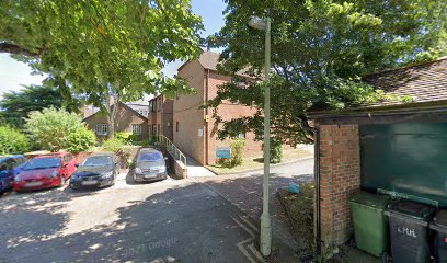
| Description | : | The meeting house is located near the corner of Highfield Avenue with Mayor’s Lane, near the centre of Newbury. The area is subject to development plans by the local council, and the meeting house has long been included in the development area. Under current plans it may not be demolished after all. Highfield Avenue is a cul-de-suggest a correction accessed via Mayor’s Lane to the east. Just in the angle of the two streets is a chestnut tree with a plaque below with the following inscription: ‘This stone is fixed here to mark the location of the old Quaker Burial... Read More |
frequently asked questions (FAQ):
-
Where is Newbury Friends Burial Ground (Defunct)?
Newbury Friends Burial Ground (Defunct) is located at Reading Borough ,Berkshire ,England.
-
Newbury Friends Burial Ground (Defunct) cemetery's updated grave count on graveviews.com?
0 memorials
-
Where are the coordinates of the Newbury Friends Burial Ground (Defunct)?
Latitude: 51.3987240
Longitude: -1.3228830
Nearby Cemetories:
1. St Nicolas Churchyard
Newbury, West Berkshire Unitary Authority, England
Coordinate: 51.4009920, -1.3248370
2. Newtown Road Cemetery
Newbury, West Berkshire Unitary Authority, England
Coordinate: 51.3924300, -1.3252900
3. Shaw St Marys Churchyard
Newbury, West Berkshire Unitary Authority, England
Coordinate: 51.4116940, -1.3186810
4. St Mary the Virgin Churchyard
Greenham, West Berkshire Unitary Authority, England
Coordinate: 51.3883350, -1.3030280
5. Shaw Cemetery
Newbury, West Berkshire Unitary Authority, England
Coordinate: 51.4138160, -1.3106410
6. St. Mary the Virgin Churchyard
Speen, West Berkshire Unitary Authority, England
Coordinate: 51.4076540, -1.3469800
7. St Mary and St John the Baptist Churchyard
Newtown, Basingstoke and Deane Borough, England
Coordinate: 51.3702000, -1.3169200
8. St. Michael and All Angels Churchyard
Enborne, West Berkshire Unitary Authority, England
Coordinate: 51.3893860, -1.3751660
9. Thatcham United Reform Church Burial Ground
Thatcham, West Berkshire Unitary Authority, England
Coordinate: 51.4025141, -1.2595003
10. St Mary's
Thatcham, West Berkshire Unitary Authority, England
Coordinate: 51.4017420, -1.2591060
11. St Mary Churchyard
Hamstead Marshall, West Berkshire Unitary Authority, England
Coordinate: 51.3981940, -1.3977010
12. Church of the Ascension Churchyard
Burghclere, Basingstoke and Deane Borough, England
Coordinate: 51.3466000, -1.3269200
13. St Peter Churchyard
Headley, Basingstoke and Deane Borough, England
Coordinate: 51.3601370, -1.2620360
14. St. Thomas Churchyard
Woolton Hill, Basingstoke and Deane Borough, England
Coordinate: 51.3517900, -1.3841060
15. St Lawrence Churchyard
Ecchinswell, Basingstoke and Deane Borough, England
Coordinate: 51.3356400, -1.2821600
16. Bucklebury Churchyard
Bucklebury, West Berkshire Unitary Authority, England
Coordinate: 51.4163030, -1.2162090
17. Marlston Chapel
Bucklebury, West Berkshire Unitary Authority, England
Coordinate: 51.4442400, -1.2400690
18. Holy Trinity Churchyard
Hermitage, West Berkshire Unitary Authority, England
Coordinate: 51.4578340, -1.2609900
19. Highclere Cemetery
Highclere, Basingstoke and Deane Borough, England
Coordinate: 51.3319240, -1.3625700
20. St. Martin's Churchyard
East Woodhay, Basingstoke and Deane Borough, England
Coordinate: 51.3511800, -1.4188700
21. St. Mary the Virgin Churchyard
Kintbury, West Berkshire Unitary Authority, England
Coordinate: 51.4007840, -1.4505240
22. West Woodhay Churchyard
West Woodhay, West Berkshire Unitary Authority, England
Coordinate: 51.3637960, -1.4385220
23. All Saints Churchyard
Old Burghclere, Basingstoke and Deane Borough, England
Coordinate: 51.3181600, -1.3290300
24. St Mary the Virgin Churchyard
Bucklebury, West Berkshire Unitary Authority, England
Coordinate: 51.4341310, -1.2059030