
| Memorials | : | 0 |
| Location | : | Bruton, South Somerset District, England |
| Coordinate | : | 51.1070450, -2.4843710 |
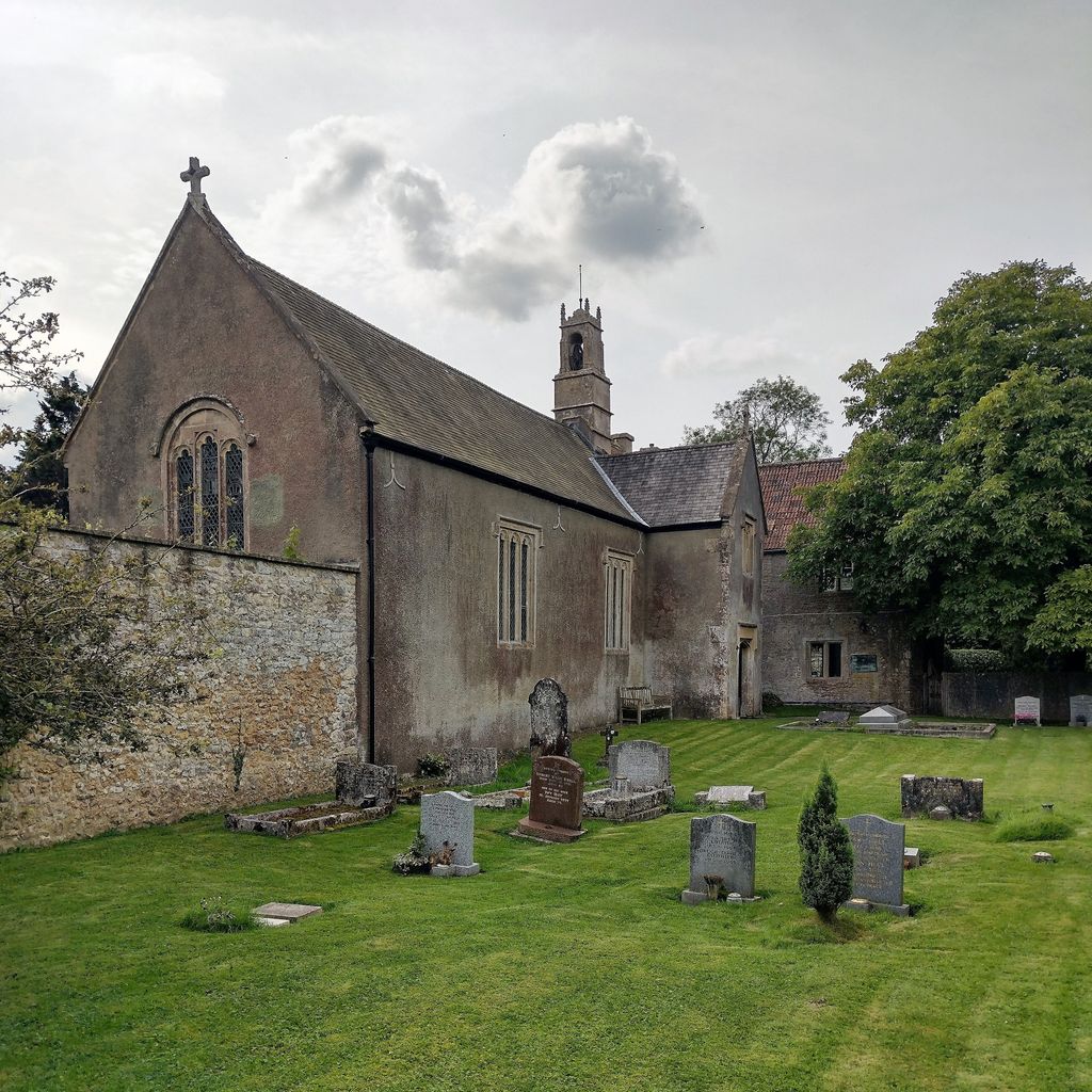
| Description | : | The Church of the Holy Trinity in Wyke Champflower, Bruton, Somerset, England dates from 1623 and has been designated as a Grade I listed building. A wooden tympanum between the nave and chancel bears the 1624 Royal Arms, the arms of the then Bishop of Bath and Wells and the Archbishop of Canterbury. The pews are Jacobean pews and the large stone pulpit Elizabethan. The font cover is from a similar era. The church contains a black-and-white marble monument commemorating Henry Southworth, who was the Lord of the Manor of Wyke, who died in 1625 and funded the construction of... Read More |
frequently asked questions (FAQ):
-
Where is Church of the Holy Trinity?
Church of the Holy Trinity is located at Wyke Lane, Wyke Champflower Bruton, South Somerset District ,Somerset ,England.
-
Church of the Holy Trinity cemetery's updated grave count on graveviews.com?
0 memorials
-
Where are the coordinates of the Church of the Holy Trinity?
Latitude: 51.1070450
Longitude: -2.4843710
Nearby Cemetories:
1. St Leonard Churchyard and Extension
Pitcombe, South Somerset District, England
Coordinate: 51.0925600, -2.4684600
2. Bruton Abbey
Bruton, South Somerset District, England
Coordinate: 51.1114890, -2.4530300
3. Blessed Virgin Mary Churchyard
Bruton, South Somerset District, England
Coordinate: 51.1115790, -2.4520520
4. St Andrew Churchyard
Ansford, South Somerset District, England
Coordinate: 51.0943350, -2.5180470
5. Bruton Cemetery
Bruton, South Somerset District, England
Coordinate: 51.1208280, -2.4464270
6. All Saints
Castle Cary, South Somerset District, England
Coordinate: 51.0865760, -2.5165400
7. St James Church
Milton Clevedon, Mendip District, England
Coordinate: 51.1381600, -2.4809000
8. St Peter Churchyard
Redlynch, South Somerset District, England
Coordinate: 51.0983279, -2.4299457
9. Castle Cary Cemetery
Castle Cary, South Somerset District, England
Coordinate: 51.0803800, -2.5223600
10. St Mary Magdalene Churchyard
Ditcheat, Mendip District, England
Coordinate: 51.1250270, -2.5362010
11. Evercreech Cemetery
Evercreech, Mendip District, England
Coordinate: 51.1461300, -2.4989500
12. St Peter Churchyard
Evercreech, Mendip District, England
Coordinate: 51.1462670, -2.5025440
13. St. Nicholas' Churchyard
Bratton Seymour, South Somerset District, England
Coordinate: 51.0679406, -2.4625400
14. Saint Mary The Virgin
Batcombe, Mendip District, England
Coordinate: 51.1495900, -2.4433900
15. All Saint's Church
Alford, South Somerset District, England
Coordinate: 51.0916210, -2.5659300
16. Church of St John the Baptist
Brewham, South Somerset District, England
Coordinate: 51.1236330, -2.4017130
17. Church of St Thomas à Becket
Pylle, Mendip District, England
Coordinate: 51.1428350, -2.5630230
18. St Mary's, Chesterblade
Evercreech, Mendip District, England
Coordinate: 51.1692610, -2.4861180
19. St Peter's Church
Hornblotton, Mendip District, England
Coordinate: 51.1037752, -2.5846439
20. All Saints Churchyard
East Pennard, Mendip District, England
Coordinate: 51.1351890, -2.5773210
21. Saint John's Churchyard
Charlton Musgrove, South Somerset District, England
Coordinate: 51.0840723, -2.3869787
22. St Nicolas' Churchyard
North Barrow, South Somerset District, England
Coordinate: 51.0623705, -2.5605033
23. Saint Stephen Churchyard
Charlton Musgrove, South Somerset District, England
Coordinate: 51.0678630, -2.4008550
24. Church of St Thomas of Canterbury
Lovington, South Somerset District, England
Coordinate: 51.0754000, -2.5771000