
| Memorials | : | 6 |
| Location | : | Bruton, South Somerset District, England |
| Coordinate | : | 51.1115790, -2.4520520 |
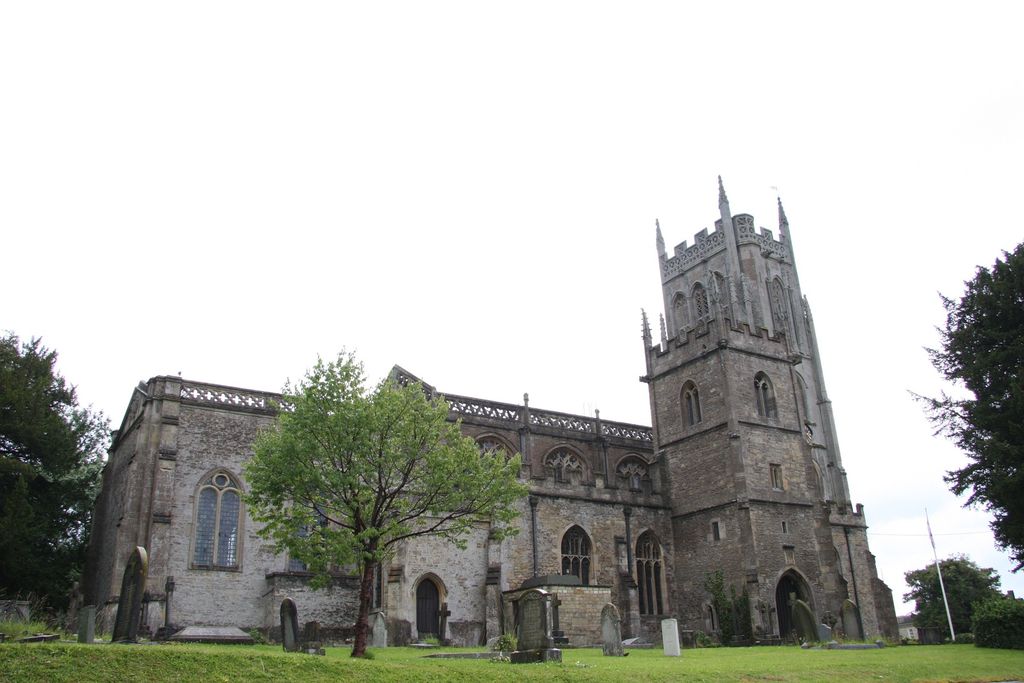
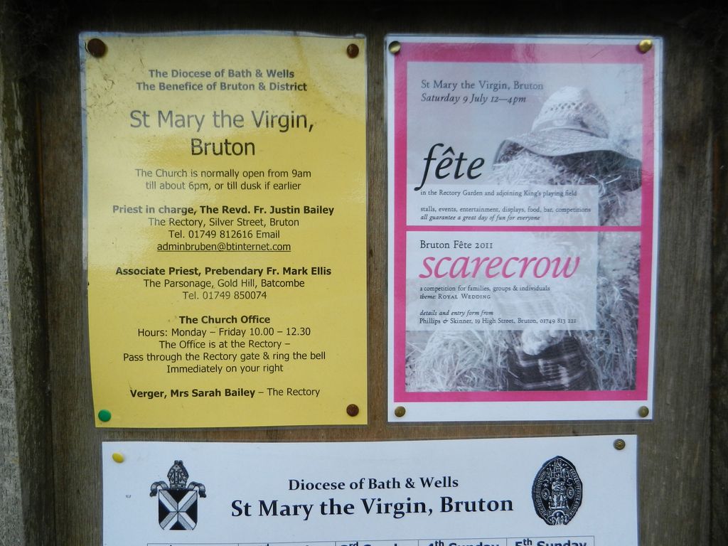
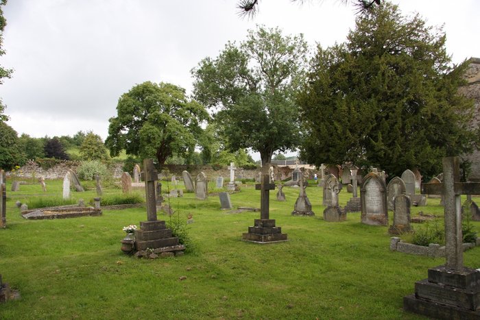
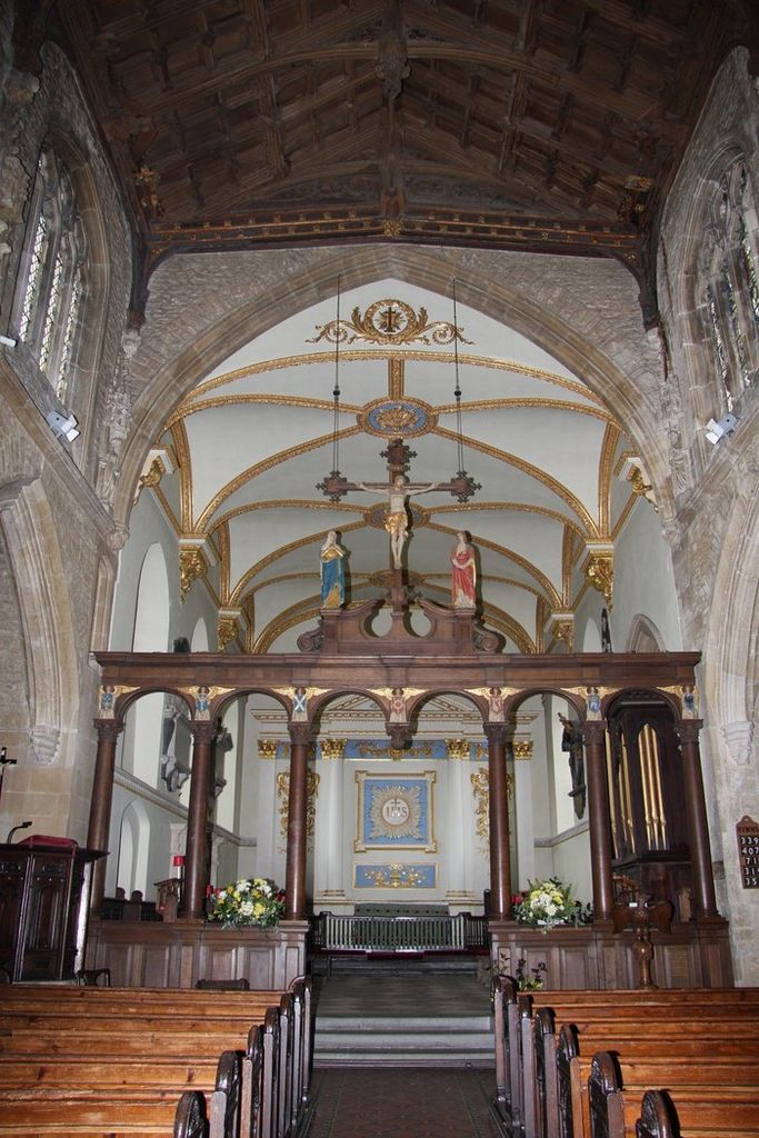
| Description | : | The church of Saint Mary the Virgin sits on an historic site at centre of the small saxon town of Bruton in Somerset. The present church was started in the twelfth century, but sits on the site of one of the earliest churches in England, founded by King Ina in the 7th century A.D. As a building the church exhibits many fine features, including its magnificent chancel built by the Berkley family in the 18th Century. It also boasts two towers, one in the north and one in the west, which houses the oldest dated bell in Somerset (1528).... Read More |
frequently asked questions (FAQ):
-
Where is Blessed Virgin Mary Churchyard?
Blessed Virgin Mary Churchyard is located at Plox Bruton, South Somerset District ,Somerset , BA10 0EFEngland.
-
Blessed Virgin Mary Churchyard cemetery's updated grave count on graveviews.com?
5 memorials
-
Where are the coordinates of the Blessed Virgin Mary Churchyard?
Latitude: 51.1115790
Longitude: -2.4520520
Nearby Cemetories:
1. Bruton Abbey
Bruton, South Somerset District, England
Coordinate: 51.1114890, -2.4530300
2. Bruton Cemetery
Bruton, South Somerset District, England
Coordinate: 51.1208280, -2.4464270
3. St Peter Churchyard
Redlynch, South Somerset District, England
Coordinate: 51.0983279, -2.4299457
4. Church of the Holy Trinity
Bruton, South Somerset District, England
Coordinate: 51.1070450, -2.4843710
5. St Leonard Churchyard and Extension
Pitcombe, South Somerset District, England
Coordinate: 51.0925600, -2.4684600
6. St James Church
Milton Clevedon, Mendip District, England
Coordinate: 51.1381600, -2.4809000
7. Church of St John the Baptist
Brewham, South Somerset District, England
Coordinate: 51.1236330, -2.4017130
8. Saint Mary The Virgin
Batcombe, Mendip District, England
Coordinate: 51.1495900, -2.4433900
9. St. Nicholas' Churchyard
Bratton Seymour, South Somerset District, England
Coordinate: 51.0679406, -2.4625400
10. St Andrew Churchyard
Ansford, South Somerset District, England
Coordinate: 51.0943350, -2.5180470
11. Evercreech Cemetery
Evercreech, Mendip District, England
Coordinate: 51.1461300, -2.4989500
12. St Peter Churchyard
Evercreech, Mendip District, England
Coordinate: 51.1462670, -2.5025440
13. All Saints
Castle Cary, South Somerset District, England
Coordinate: 51.0865760, -2.5165400
14. Saint John's Churchyard
Charlton Musgrove, South Somerset District, England
Coordinate: 51.0840723, -2.3869787
15. Stavordale Priory
Charlton Musgrove, South Somerset District, England
Coordinate: 51.0870410, -2.3778130
16. Castle Cary Cemetery
Castle Cary, South Somerset District, England
Coordinate: 51.0803800, -2.5223600
17. Saint Stephen Churchyard
Charlton Musgrove, South Somerset District, England
Coordinate: 51.0678630, -2.4008550
18. St Mary Magdalene Churchyard
Ditcheat, Mendip District, England
Coordinate: 51.1250270, -2.5362010
19. St Mary's, Chesterblade
Evercreech, Mendip District, England
Coordinate: 51.1692610, -2.4861180
20. The Blessed Virgin Mary Churchyard
Wanstrow, Mendip District, England
Coordinate: 51.1735190, -2.4164890
21. St. Michael Churchyard
Pen Selwood, South Somerset District, England
Coordinate: 51.0816300, -2.3499200
22. Saint Nicholas Churchyard
Holton, South Somerset District, England
Coordinate: 51.0401280, -2.4502641
23. All Saint's Church
Alford, South Somerset District, England
Coordinate: 51.0916210, -2.5659300
24. Church of St Thomas à Becket
Pylle, Mendip District, England
Coordinate: 51.1428350, -2.5630230