
| Memorials | : | 0 |
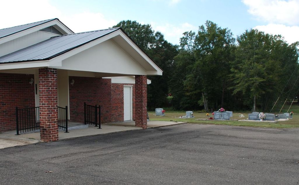
| Location | : | Raleigh, Smith County, USA |
| Coordinate | : | 32.0237000, -89.6119300 |
| Description | : | From Raleigh, MS proceed South on Mississippi Highway 35 (MS 35) four tenths of a mile to the intersection of Mississippi Highway 540 (MS 540.) make a slight Right turn (West) onto MS 540. Continue on MS 540 5.8 miles. Cemetery will be on the Left (South) side of road, specifically NE1/4 SE1/4, S7, T2N-R7E, Smith, Raleigh Quadrangle map, USNG 16S BA 53331 46021 |
frequently asked questions (FAQ):
-
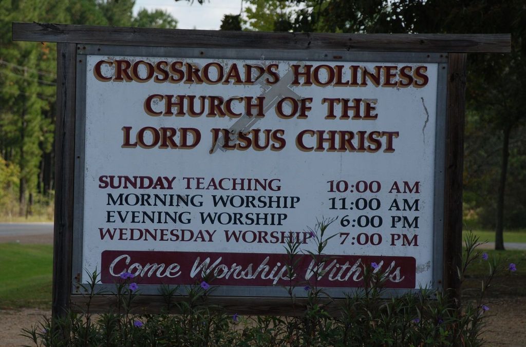
Where is Crossroads Holiness Church Cemetery?
Crossroads Holiness Church Cemetery is located at 5763 Mississippi Highway 540 Raleigh, Smith County ,Mississippi , 39153USA.
-
Crossroads Holiness Church Cemetery cemetery's updated grave count on graveviews.com?
0 memorials
-
Where are the coordinates of the Crossroads Holiness Church Cemetery?
Latitude: 32.0237000
Longitude: -89.6119300
Nearby Cemetories:
1. Pauper Cemetery
Raleigh, Smith County, USA
Coordinate: 32.0145490, -89.5891550
2. Pleasant Hill Baptist Church Cemetery
Raleigh, Smith County, USA
Coordinate: 32.0127300, -89.6373700
3. Merchant Cemetery
Smith County, USA
Coordinate: 32.0335999, -89.6472015
4. Corinth Baptist Church Cemetery
Raleigh, Smith County, USA
Coordinate: 32.0265100, -89.5593900
5. Easterling Cemetery
Raleigh, Smith County, USA
Coordinate: 32.0045300, -89.5485500
6. Wilkinson Memorial Baptist Cemetery
Raleigh, Smith County, USA
Coordinate: 31.9817700, -89.5653800
7. Rocky Hill Baptist Church Cemetery
Smith County, USA
Coordinate: 31.9657100, -89.6490800
8. Dukes Cemetery
Smith County, USA
Coordinate: 32.0581700, -89.6848700
9. Partridge Cemetery
Smith County, USA
Coordinate: 32.0581700, -89.6848700
10. Gordan Cemetery
Raleigh, Smith County, USA
Coordinate: 32.0950012, -89.5935974
11. Sharon Baptist Church Cemetery
Raleigh, Smith County, USA
Coordinate: 32.0909100, -89.5740800
12. Raleigh Cemetery
Raleigh, Smith County, USA
Coordinate: 32.0308500, -89.5229600
13. White Oak Cemetery
White Oak, Smith County, USA
Coordinate: 32.0712800, -89.6830100
14. Boykin Church Cemetery
Raleigh, Smith County, USA
Coordinate: 32.0985177, -89.5898151
15. Craft Cemetery
Smith County, USA
Coordinate: 32.0774994, -89.5460968
16. North Raleigh Cemetery
Raleigh, Smith County, USA
Coordinate: 32.0432140, -89.5222230
17. Myers Cemetery
Raleigh, Smith County, USA
Coordinate: 32.0950012, -89.5730972
18. Butler Cemetery
Simpson County, USA
Coordinate: 31.9549256, -89.6573443
19. Mount Pisgah Cemetery
Raleigh, Smith County, USA
Coordinate: 32.0589300, -89.5261100
20. White Oak Cemetery Old
White Oak, Smith County, USA
Coordinate: 32.0692700, -89.6927900
21. Butler Cemetery
Mize, Smith County, USA
Coordinate: 31.9407280, -89.5959160
22. Moss Cemetery
Smith County, USA
Coordinate: 32.1063995, -89.5919037
23. Steve Hughes Cemetery
Smith County, USA
Coordinate: 32.1073600, -89.6344000
24. Lewis Harper Cemetery
Raleigh, Smith County, USA
Coordinate: 32.0396800, -89.5115600