
| Memorials | : | 0 |
| Location | : | Raleigh, Smith County, USA |
| Coordinate | : | 32.0045300, -89.5485500 |
| Description | : | From Raleigh, MS proceed South on Mississippi Highway 35 (MS 35) four tenths of a mile to the intersection of Mississippi Highway 540 (MS 540 aka Cohay Road.) Make a slight Right (West) onto MS 540 and proceed 1.2 miles to the intersection of Smith County Road 121 (SCR 121.) Turn Left (South) onto SCR 121 and proceed 1.9 miles (note, SCR 121 is also called Miller Road in some areas.) A sign for Easterling Cemetery will be on the Left (East) as will be the driveway leading to the cemetery which is approximately 600 feet from SCR 121. |
frequently asked questions (FAQ):
-
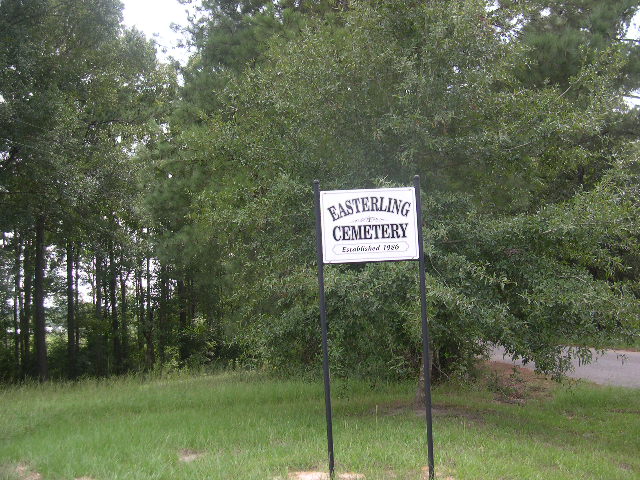
Where is Easterling Cemetery?
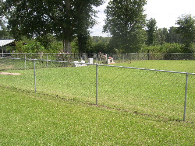
Easterling Cemetery is located at Smith County Road 121 Raleigh, Smith County ,Mississippi , 39153USA.
-
Easterling Cemetery cemetery's updated grave count on graveviews.com?
0 memorials
-
Where are the coordinates of the Easterling Cemetery?
Latitude: 32.0045300
Longitude: -89.5485500
Nearby Cemetories:
1. Corinth Baptist Church Cemetery
Raleigh, Smith County, USA
Coordinate: 32.0265100, -89.5593900
2. Wilkinson Memorial Baptist Cemetery
Raleigh, Smith County, USA
Coordinate: 31.9817700, -89.5653800
3. Union Baptist Church Cemetery
Raleigh, Smith County, USA
Coordinate: 31.9799600, -89.5219900
4. Raleigh Cemetery
Raleigh, Smith County, USA
Coordinate: 32.0308500, -89.5229600
5. Pauper Cemetery
Raleigh, Smith County, USA
Coordinate: 32.0145490, -89.5891550
6. North Raleigh Cemetery
Raleigh, Smith County, USA
Coordinate: 32.0432140, -89.5222230
7. Tillson Cemetery
Mize, Smith County, USA
Coordinate: 31.9655800, -89.5187300
8. South Raleigh Christian Cemetery
Mize, Smith County, USA
Coordinate: 31.9650100, -89.5195300
9. Lewis Harper Cemetery
Raleigh, Smith County, USA
Coordinate: 32.0396800, -89.5115600
10. McAlpin Cemetery
Raleigh, Smith County, USA
Coordinate: 31.9644900, -89.5182000
11. Eastside Baptist Church Cemetery
Raleigh, Smith County, USA
Coordinate: 32.0360600, -89.5063500
12. Turner Chapel Cemetery
Raleigh, Smith County, USA
Coordinate: 32.0474700, -89.5075300
13. Bezer Cemetery West
Bezer, Smith County, USA
Coordinate: 31.9746170, -89.4928284
14. Crossroads Holiness Church Cemetery
Raleigh, Smith County, USA
Coordinate: 32.0237000, -89.6119300
15. Mount Pisgah Cemetery
Raleigh, Smith County, USA
Coordinate: 32.0589300, -89.5261100
16. Bezer Cemetery
Raleigh, Smith County, USA
Coordinate: 31.9699993, -89.4894028
17. Moore Cemetery
Raleigh, Smith County, USA
Coordinate: 32.0132190, -89.4658840
18. Craft Cemetery
Smith County, USA
Coordinate: 32.0774994, -89.5460968
19. Butler Cemetery
Mize, Smith County, USA
Coordinate: 31.9407280, -89.5959160
20. Pleasant Hill Baptist Church Cemetery
Raleigh, Smith County, USA
Coordinate: 32.0127300, -89.6373700
21. Page Cemetery
Raleigh, Smith County, USA
Coordinate: 32.0891991, -89.5432968
22. Hancock Cemetery
Mize, Smith County, USA
Coordinate: 31.9387610, -89.4847580
23. Austin Cemetery
Shongelo, Smith County, USA
Coordinate: 32.0875015, -89.5233002
24. Harmony Baptist Church Cemetery
Mize, Smith County, USA
Coordinate: 31.9184190, -89.5370930