
| Memorials | : | 0 |
| Location | : | Raleigh, Smith County, USA |
| Coordinate | : | 32.0396800, -89.5115600 |
| Description | : | From the four way stop located at the intersection of Highways 18 & 35, take Hwy 35 North nearly 4 tenths of a mile to the intersection of Smith County Road 18-2 (SCR 18-2) also called Turner Chapel Road, and turn right East. In six tenths of a mile, at the intersection of SCR 18-2 and SCR 119, make a right turn (South East) remaining on SCR 18-2. Cemetery will be on left (East) side of road in approximately one tenth mile, specifically: NE1/4 SE1/4, S6, T2N-R8E, Smith, Raleigh Quadrangle map, USNG: 16S BA 62832 47574. |
frequently asked questions (FAQ):
-
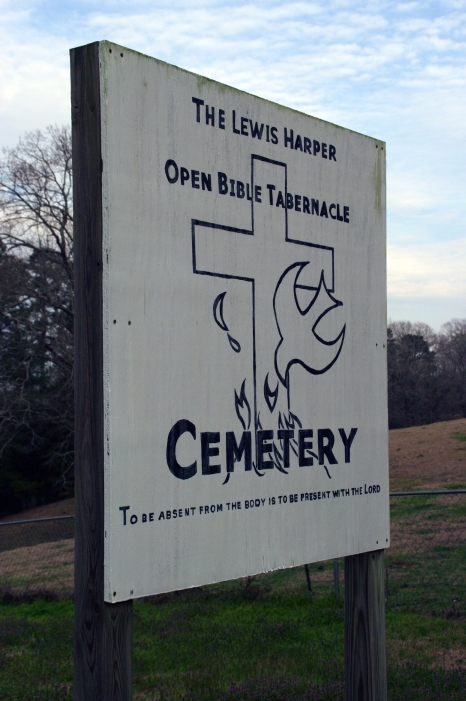
Where is Lewis Harper Cemetery?
Lewis Harper Cemetery is located at 409 Turner Chapel Road Raleigh, Smith County ,Mississippi , 39153USA.
-
Lewis Harper Cemetery cemetery's updated grave count on graveviews.com?
0 memorials
-
Where are the coordinates of the Lewis Harper Cemetery?
Latitude: 32.0396800
Longitude: -89.5115600
Nearby Cemetories:
1. Eastside Baptist Church Cemetery
Raleigh, Smith County, USA
Coordinate: 32.0360600, -89.5063500
2. Turner Chapel Cemetery
Raleigh, Smith County, USA
Coordinate: 32.0474700, -89.5075300
3. North Raleigh Cemetery
Raleigh, Smith County, USA
Coordinate: 32.0432140, -89.5222230
4. Raleigh Cemetery
Raleigh, Smith County, USA
Coordinate: 32.0308500, -89.5229600
5. Mount Pisgah Cemetery
Raleigh, Smith County, USA
Coordinate: 32.0589300, -89.5261100
6. Corinth Baptist Church Cemetery
Raleigh, Smith County, USA
Coordinate: 32.0265100, -89.5593900
7. Double Church Cemetery
Raleigh, Smith County, USA
Coordinate: 32.0460420, -89.4574910
8. Moore Cemetery
Raleigh, Smith County, USA
Coordinate: 32.0132190, -89.4658840
9. Easterling Cemetery
Raleigh, Smith County, USA
Coordinate: 32.0045300, -89.5485500
10. Craft Cemetery
Smith County, USA
Coordinate: 32.0774994, -89.5460968
11. Austin Cemetery
Shongelo, Smith County, USA
Coordinate: 32.0875015, -89.5233002
12. High Hill Baptist Church Cemetery
Raleigh, Smith County, USA
Coordinate: 32.0860100, -89.4780800
13. Barnes Cemetery
Raleigh, Smith County, USA
Coordinate: 32.0946999, -89.5068970
14. Page Cemetery
Raleigh, Smith County, USA
Coordinate: 32.0891991, -89.5432968
15. Union Baptist Church Cemetery
Raleigh, Smith County, USA
Coordinate: 31.9799600, -89.5219900
16. Trinity Methodist Cemetery
Raleigh, Smith County, USA
Coordinate: 32.0920600, -89.4753300
17. Mount Nebo Cemetery
Smith County, USA
Coordinate: 32.0951900, -89.4677200
18. Bezer Cemetery West
Bezer, Smith County, USA
Coordinate: 31.9746170, -89.4928284
19. Pauper Cemetery
Raleigh, Smith County, USA
Coordinate: 32.0145490, -89.5891550
20. Bezer Cemetery
Raleigh, Smith County, USA
Coordinate: 31.9699993, -89.4894028
21. Sharon Baptist Church Cemetery
Raleigh, Smith County, USA
Coordinate: 32.0909100, -89.5740800
22. Wilkinson Memorial Baptist Cemetery
Raleigh, Smith County, USA
Coordinate: 31.9817700, -89.5653800
23. Tillson Cemetery
Mize, Smith County, USA
Coordinate: 31.9655800, -89.5187300
24. South Raleigh Christian Cemetery
Mize, Smith County, USA
Coordinate: 31.9650100, -89.5195300