
| Memorials | : | 1 |
| Location | : | Gerald, Franklin County, USA |
| Coordinate | : | 38.5043182, -91.3180161 |
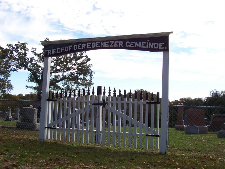
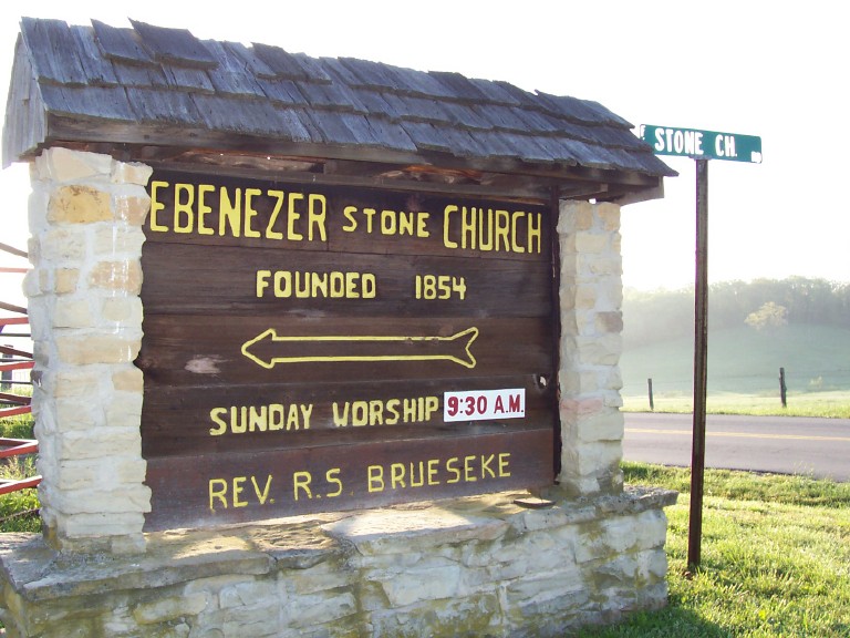
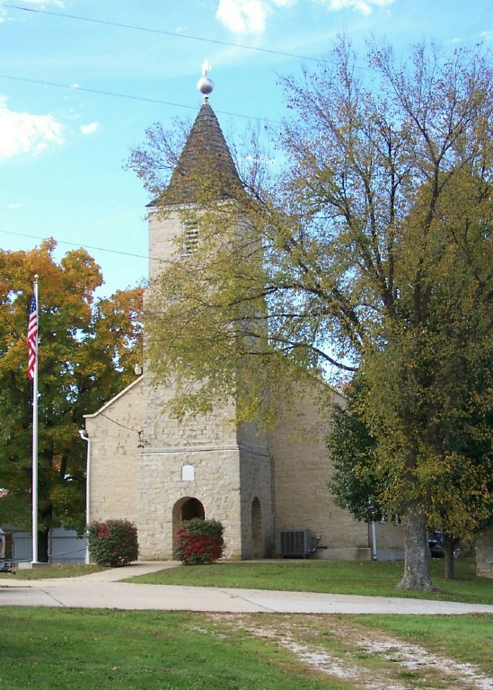
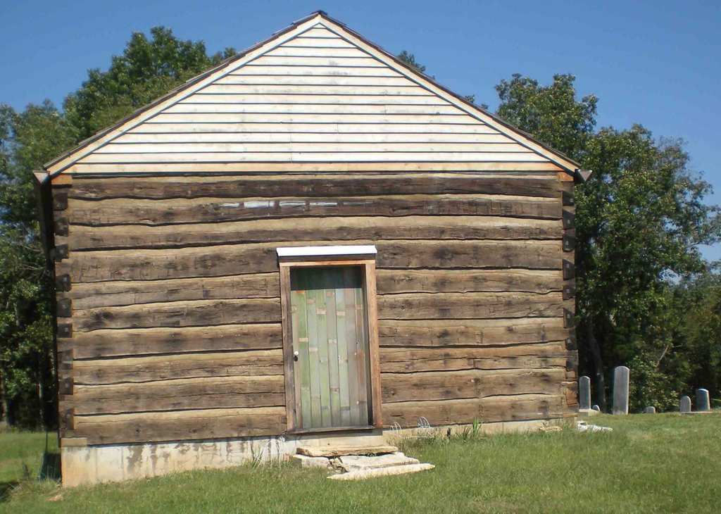
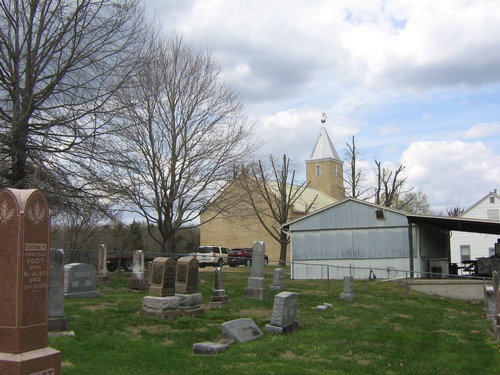
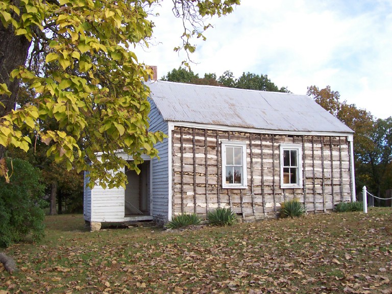
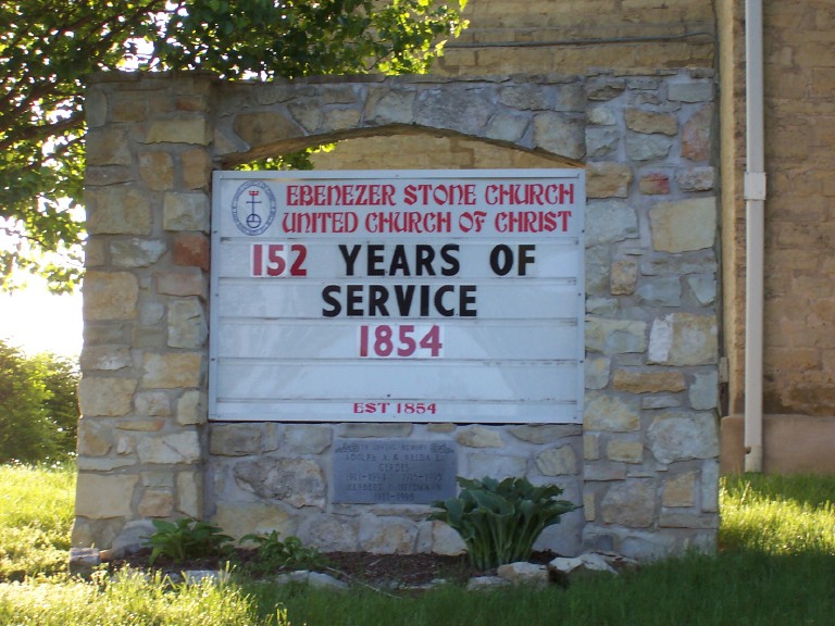
| Description | : | Ebenezer "Stone" Church and cemetery are located on Stone Church Road about six miles north of Gerald, MO, and approximately three miles south of Detmold off Highway Y. Much of the following is from article in New Haven Leader, 13 October 2004: First records of the church date from 12 June 1854, when the church was organized by settlers from Westphalia, Germany. The first church building, photo #5 to right, was constructed from logs hewn out of surrounding forest and dedicated 9 July 1854; this building still stands 2008. The present day church was built 1863-1865 reminiscent of... Read More |
frequently asked questions (FAQ):
-
Where is Ebenezer Stone Church Cemetery?
Ebenezer Stone Church Cemetery is located at Gerald, Franklin County ,Missouri ,USA.
-
Ebenezer Stone Church Cemetery cemetery's updated grave count on graveviews.com?
1 memorials
-
Where are the coordinates of the Ebenezer Stone Church Cemetery?
Latitude: 38.5043182
Longitude: -91.3180161
Nearby Cemetories:
1. Schroeder Cemetery
Beemont, Franklin County, USA
Coordinate: 38.4897000, -91.3295600
2. Hoemann Cemetery
Detmold, Franklin County, USA
Coordinate: 38.5343500, -91.3185400
3. Detmold Cemetery
Detmold, Franklin County, USA
Coordinate: 38.5385000, -91.2935300
4. New Hope Missionary Baptist Church Cemetery
Beemont, Franklin County, USA
Coordinate: 38.4813770, -91.3595580
5. Stevens Cemetery
Gerald, Franklin County, USA
Coordinate: 38.4644700, -91.3099700
6. Bridges Family Cemetery
Franklin County, USA
Coordinate: 38.4681100, -91.2778300
7. Meyer Family Cemetery
Gasconade County, USA
Coordinate: 38.4723700, -91.3681400
8. Sprick Family Cemetery
Port Hudson, Franklin County, USA
Coordinate: 38.4682100, -91.2692400
9. Beemont United Methodist Cemetery
Owensville, Gasconade County, USA
Coordinate: 38.4844398, -91.3830566
10. Saint James Cemetery
New Haven, Franklin County, USA
Coordinate: 38.5459500, -91.3678600
11. Neely Family Cemetery
Port Hudson, Franklin County, USA
Coordinate: 38.4564100, -91.2692600
12. Malvern Cemetery
Port Hudson, Franklin County, USA
Coordinate: 38.4560400, -91.2689600
13. Georgetown Cemetery
Gasconade County, USA
Coordinate: 38.4608002, -91.3786011
14. Schuett Cemetery
Port Hudson, Franklin County, USA
Coordinate: 38.4680700, -91.2463600
15. Helling Cemetery
Franklin County, USA
Coordinate: 38.5710983, -91.3202972
16. Holy Family Port Hudson Cemetery
Leslie, Franklin County, USA
Coordinate: 38.4956000, -91.2304300
17. Kohlbush Cemetery
Franklin County, USA
Coordinate: 38.5741997, -91.3330994
18. Kohlbusch Family Cemetery
New Haven, Franklin County, USA
Coordinate: 38.5747430, -91.3323930
19. Bethlehem Lutheran Church Cemetery
New Haven, Franklin County, USA
Coordinate: 38.5485770, -91.2433280
20. Mann Cemetery
Gasconade County, USA
Coordinate: 38.5321999, -91.4057999
21. Cedar Fork United Baptist Church #1
Gerald, Franklin County, USA
Coordinate: 38.4284100, -91.3373500
22. Koirtyohann-Bates Family Cemetery
Gerald, Franklin County, USA
Coordinate: 38.4286003, -91.2941971
23. Smith Cemetery of Senate Grove
Berger, Franklin County, USA
Coordinate: 38.5833000, -91.3237800
24. Meyer Family Cemetery
New Haven, Franklin County, USA
Coordinate: 38.5831929, -91.3034617