
| Memorials | : | 4 |
| Location | : | Owensville, Gasconade County, USA |
| Coordinate | : | 38.4844398, -91.3830566 |
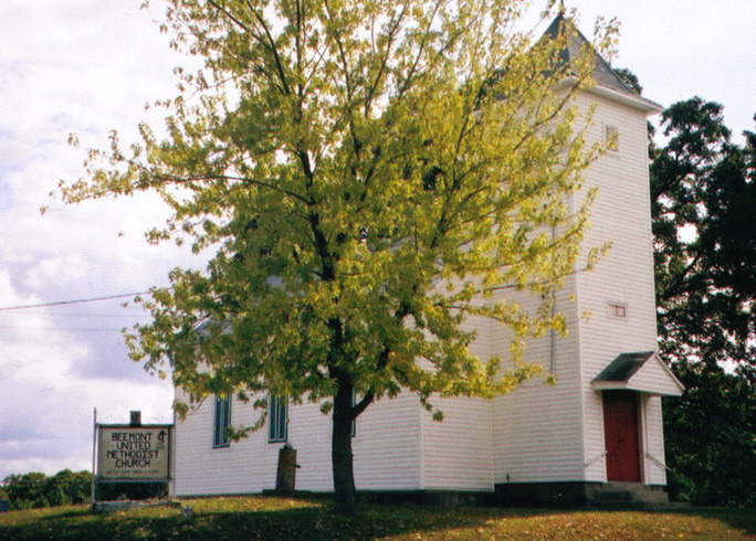
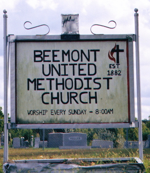
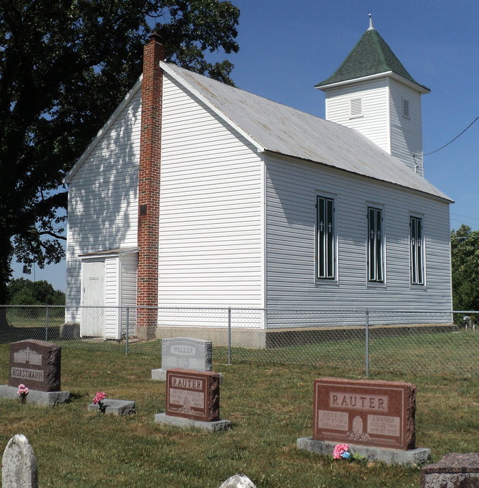
| Description | : | Beemont Church and Cemetery are on Hwy ZZ. Approx 3 miles west of Beemont, MO (across the county line in Franklin Co) and approx 5 miles east of Drake, MO. County map is T43N R4W Sec 9. |
frequently asked questions (FAQ):
-
Where is Beemont United Methodist Cemetery?
Beemont United Methodist Cemetery is located at Owensville, Gasconade County ,Missouri ,USA.
-
Beemont United Methodist Cemetery cemetery's updated grave count on graveviews.com?
4 memorials
-
Where are the coordinates of the Beemont United Methodist Cemetery?
Latitude: 38.4844398
Longitude: -91.3830566
Nearby Cemetories:
1. Meyer Family Cemetery
Gasconade County, USA
Coordinate: 38.4723700, -91.3681400
2. New Hope Missionary Baptist Church Cemetery
Beemont, Franklin County, USA
Coordinate: 38.4813770, -91.3595580
3. Georgetown Cemetery
Gasconade County, USA
Coordinate: 38.4608002, -91.3786011
4. Schroeder Cemetery
Gasconade County, USA
Coordinate: 38.4536018, -91.4047012
5. Schroeder Cemetery
Beemont, Franklin County, USA
Coordinate: 38.4897000, -91.3295600
6. Mann Cemetery
Gasconade County, USA
Coordinate: 38.5321999, -91.4057999
7. Ebenezer Stone Church Cemetery
Gerald, Franklin County, USA
Coordinate: 38.5043182, -91.3180161
8. Stevens Cemetery
Gerald, Franklin County, USA
Coordinate: 38.4644700, -91.3099700
9. Saint John Lutheran Church Cemetery
Owensville, Gasconade County, USA
Coordinate: 38.4457800, -91.4428100
10. Cedar Fork United Baptist Church #2
Gerald, Franklin County, USA
Coordinate: 38.4283500, -91.3499200
11. Saint James Cemetery
New Haven, Franklin County, USA
Coordinate: 38.5459500, -91.3678600
12. Saint James UCC Cemetery
Drake, Gasconade County, USA
Coordinate: 38.4419950, -91.4420980
13. Cedar Fork United Baptist Church #1
Gerald, Franklin County, USA
Coordinate: 38.4284100, -91.3373500
14. Hoemann Cemetery
Detmold, Franklin County, USA
Coordinate: 38.5343500, -91.3185400
15. Immanuel Cemetery
Gasconade County, USA
Coordinate: 38.4460983, -91.4677963
16. Bridges Family Cemetery
Franklin County, USA
Coordinate: 38.4681100, -91.2778300
17. Roth Cemetery
Gasconade County, USA
Coordinate: 38.5705986, -91.3886032
18. Detmold Cemetery
Detmold, Franklin County, USA
Coordinate: 38.5385000, -91.2935300
19. Koirtyohann-Bates Family Cemetery
Gerald, Franklin County, USA
Coordinate: 38.4286003, -91.2941971
20. Sprick Family Cemetery
Port Hudson, Franklin County, USA
Coordinate: 38.4682100, -91.2692400
21. Evangelical Saint Paul Cemetery
Gerald, Franklin County, USA
Coordinate: 38.4105988, -91.3106003
22. Neely Family Cemetery
Port Hudson, Franklin County, USA
Coordinate: 38.4564100, -91.2692600
23. Methodist Cemetery
Rosebud, Gasconade County, USA
Coordinate: 38.3917660, -91.3999690
24. Malvern Cemetery
Port Hudson, Franklin County, USA
Coordinate: 38.4560400, -91.2689600