
| Memorials | : | 0 |
| Location | : | Buncombe County, USA |
| Coordinate | : | 35.5043000, -82.2269000 |
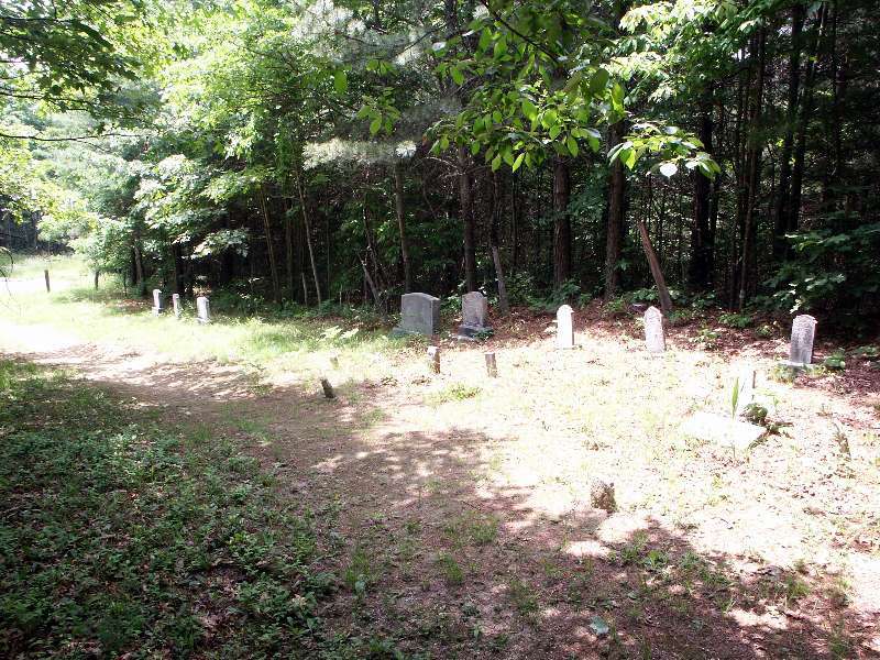
| Description | : | Red Top Cemetery is located approx 11 miles south of Black Mountain. Take NC#9 south from Black Mountain to the second intersection with Rock Creek Road (which makes a loop off and back into #9). The turn will be to the left and will take you by the Broad River Fire Dept. You will cross an old iron bridge and after crossing the river you will take a right on Upper Rock Creek Road. Follow Upper Rock Creek Road to what is the end of public access. There is a gate blocking the road just past the... Read More |
frequently asked questions (FAQ):
-
Where is Red Top Cemetery?
Red Top Cemetery is located at Broad River Community Buncombe County ,North Carolina , 28711USA.
-
Red Top Cemetery cemetery's updated grave count on graveviews.com?
0 memorials
-
Where are the coordinates of the Red Top Cemetery?
Latitude: 35.5043000
Longitude: -82.2269000
Nearby Cemetories:
1. Ledbetter-Gilliam Family Cemetery
Buncombe County, USA
Coordinate: 35.5107630, -82.2584800
2. Stone Mountain Missionary Baptist Church Cemetery
Black Mountain, Buncombe County, USA
Coordinate: 35.5333400, -82.2301900
3. Gilliam Family Cemetery
Buncombe County, USA
Coordinate: 35.5114040, -82.2655770
4. Stroud Family Cemetery
Black Mountain, Buncombe County, USA
Coordinate: 35.5297330, -82.2538600
5. Broad River Baptist Church Cemetery
Black Mountain, Buncombe County, USA
Coordinate: 35.5008300, -82.2689800
6. Ledbetter Family Cemetery
Black Mountain, Buncombe County, USA
Coordinate: 35.4992500, -82.2713700
7. Old Broad River Cemetery
Black Mountain, Buncombe County, USA
Coordinate: 35.4894400, -82.2733280
8. Bald Mountain Baptist Church Cemetery
Buncombe County, USA
Coordinate: 35.4703690, -82.2637050
9. Buffalo Cemetery
Lake Lure, Rutherford County, USA
Coordinate: 35.4611250, -82.1910620
10. Fairfield Mountains Chapel Columbarium
Lake Lure, Rutherford County, USA
Coordinate: 35.4612430, -82.1878700
11. Searcy Family Cemetery
Henderson County, USA
Coordinate: 35.4708150, -82.2826950
12. Laurel Springs Baptist Church Cemetery
Fairview, Buncombe County, USA
Coordinate: 35.5235600, -82.3001100
13. Chimney Rock Baptist Church Cemetery
Lake Lure, Rutherford County, USA
Coordinate: 35.4382380, -82.2301020
14. Bagwell Cemetery
Lake Lure, Rutherford County, USA
Coordinate: 35.4542730, -82.1719410
15. Flynn Cemetery
Bills Creek, Rutherford County, USA
Coordinate: 35.4530640, -82.1729440
16. Episcopal Church of the Transfiguration Cemetery
Bat Cave, Henderson County, USA
Coordinate: 35.4501200, -82.2800600
17. Hill Cemetery
Bat Cave, Henderson County, USA
Coordinate: 35.4608002, -82.2960968
18. Nesbitt Chapel Cemetery
Fairview, Buncombe County, USA
Coordinate: 35.5368004, -82.3066025
19. Bat Cave Baptist Church Cemetery
Bat Cave, Henderson County, USA
Coordinate: 35.4503420, -82.2892850
20. Conner Cemetery
Bat Cave, Henderson County, USA
Coordinate: 35.4575005, -82.2981033
21. Dalton Family Cemetery
Bills Creek, Rutherford County, USA
Coordinate: 35.4826320, -82.1391050
22. Pine Cove Cemetery
McDowell County, USA
Coordinate: 35.5774994, -82.2063980
23. Weaver Cemetery
Lake Lure, Rutherford County, USA
Coordinate: 35.4294587, -82.2047271
24. Wilkey Baptist Church Cemetery
Buncombe County, USA
Coordinate: 35.5675350, -82.2870830