
| Memorials | : | 2 |
| Location | : | Black Mountain, Buncombe County, USA |
| Coordinate | : | 35.4894400, -82.2733280 |
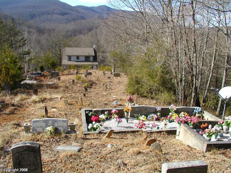
| Description | : | Located on NC#9 south from Black Mountain approx. 10 miles. You will see the New Broad River Missionary Bapt. Church and cemetery on the left. Continue south on #9 approx. one mile through a long straight. On the south end of the straight on the left there is a road to the left Raven Road that goes to several houses. Take the first left off Raven Road. The cemetery is in the edge of the woods behind the house. No other road access is available. You may want to tell the homeowner what you are doing if at home.... Read More |
frequently asked questions (FAQ):
-
Where is Old Broad River Cemetery?
Old Broad River Cemetery is located at Ravenwood Trail Black Mountain, Buncombe County ,North Carolina , 28711USA.
-
Old Broad River Cemetery cemetery's updated grave count on graveviews.com?
2 memorials
-
Where are the coordinates of the Old Broad River Cemetery?
Latitude: 35.4894400
Longitude: -82.2733280
Nearby Cemetories:
1. Ledbetter Family Cemetery
Black Mountain, Buncombe County, USA
Coordinate: 35.4992500, -82.2713700
2. Broad River Baptist Church Cemetery
Black Mountain, Buncombe County, USA
Coordinate: 35.5008300, -82.2689800
3. Searcy Family Cemetery
Henderson County, USA
Coordinate: 35.4708150, -82.2826950
4. Bald Mountain Baptist Church Cemetery
Buncombe County, USA
Coordinate: 35.4703690, -82.2637050
5. Gilliam Family Cemetery
Buncombe County, USA
Coordinate: 35.5114040, -82.2655770
6. Ledbetter-Gilliam Family Cemetery
Buncombe County, USA
Coordinate: 35.5107630, -82.2584800
7. Hill Cemetery
Bat Cave, Henderson County, USA
Coordinate: 35.4608002, -82.2960968
8. Conner Cemetery
Bat Cave, Henderson County, USA
Coordinate: 35.4575005, -82.2981033
9. Episcopal Church of the Transfiguration Cemetery
Bat Cave, Henderson County, USA
Coordinate: 35.4501200, -82.2800600
10. Laurel Springs Baptist Church Cemetery
Fairview, Buncombe County, USA
Coordinate: 35.5235600, -82.3001100
11. Red Top Cemetery
Buncombe County, USA
Coordinate: 35.5043000, -82.2269000
12. Bat Cave Baptist Church Cemetery
Bat Cave, Henderson County, USA
Coordinate: 35.4503420, -82.2892850
13. Stroud Family Cemetery
Black Mountain, Buncombe County, USA
Coordinate: 35.5297330, -82.2538600
14. Edney Family Cemetery
Bat Cave, Henderson County, USA
Coordinate: 35.4403960, -82.2958910
15. Barnwell Baptist Church Cemetery
Henderson County, USA
Coordinate: 35.4483000, -82.3164700
16. Nesbitt Chapel Cemetery
Fairview, Buncombe County, USA
Coordinate: 35.5368004, -82.3066025
17. East of Gerton
Gerton, Henderson County, USA
Coordinate: 35.4773890, -82.3387500
18. Stone Mountain Missionary Baptist Church Cemetery
Black Mountain, Buncombe County, USA
Coordinate: 35.5333400, -82.2301900
19. Chimney Rock Baptist Church Cemetery
Lake Lure, Rutherford County, USA
Coordinate: 35.4382380, -82.2301020
20. Bearwallow Cemetery
Gerton, Henderson County, USA
Coordinate: 35.4809900, -82.3510300
21. Barnwell Family Cemetery
Edneyville, Henderson County, USA
Coordinate: 35.4391000, -82.3244640
22. Buffalo Cemetery
Lake Lure, Rutherford County, USA
Coordinate: 35.4611250, -82.1910620
23. Case Family Cemetery
Edneyville, Henderson County, USA
Coordinate: 35.4324390, -82.3312470
24. Fairfield Mountains Chapel Columbarium
Lake Lure, Rutherford County, USA
Coordinate: 35.4612430, -82.1878700