
| Memorials | : | 138 |
| Location | : | Montague, Franklin County, USA |
| Coordinate | : | 42.5836200, -72.5471600 |
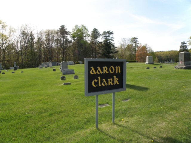
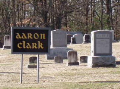
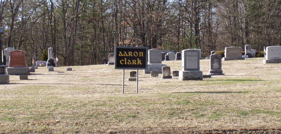
| Description | : | This is a privately-owned cemetery. It is located on the west side of Turners Falls Road across from Our Lady of Czestochowa Cemetery. The cemetery is on the southern border of Saint Marys Cemetery. The Town of Montague refers to this cemetery in MassGIS as Parcel ID: 21-010. The Massachusetts Historical Commission does not refer to this cemetery in MACRIS. |
frequently asked questions (FAQ):
-
Where is Aaron Clark Memorial Cemetery?
Aaron Clark Memorial Cemetery is located at Turners Falls Road Montague, Franklin County ,Massachusetts ,USA.
-
Aaron Clark Memorial Cemetery cemetery's updated grave count on graveviews.com?
110 memorials
-
Where are the coordinates of the Aaron Clark Memorial Cemetery?
Latitude: 42.5836200
Longitude: -72.5471600
Nearby Cemetories:
1. Our Lady of Czestochowa Cemetery
Montague, Franklin County, USA
Coordinate: 42.5846000, -72.5469400
2. Saint Marys Cemetery
Montague, Franklin County, USA
Coordinate: 42.5852200, -72.5475100
3. Saint Annes Cemetery
Montague, Franklin County, USA
Coordinate: 42.5861300, -72.5480600
4. Springdale Cemetery
Montague, Franklin County, USA
Coordinate: 42.5884700, -72.5530900
5. Fairway Avenue Cemetery
Montague, Franklin County, USA
Coordinate: 42.5924270, -72.5646970
6. Burnham Cemetery
Montague, Franklin County, USA
Coordinate: 42.5875300, -72.5720140
7. East Mineral Road Cemetery
Montague, Franklin County, USA
Coordinate: 42.5810500, -72.5086300
8. Highland Cemetery
Montague, Franklin County, USA
Coordinate: 42.5778008, -72.5083008
9. East Deerfield Cemetery
Deerfield, Franklin County, USA
Coordinate: 42.5555992, -72.5642014
10. Riverside Cemetery
Gill, Franklin County, USA
Coordinate: 42.6156006, -72.5410995
11. High Street Cemetery
Greenfield, Franklin County, USA
Coordinate: 42.6044840, -72.5806660
12. Town Cemetery
Montague, Franklin County, USA
Coordinate: 42.5595000, -72.5070200
13. Federal Street Cemetery
Greenfield, Franklin County, USA
Coordinate: 42.5941400, -72.5977300
14. Elm Grove Cemetery
Montague, Franklin County, USA
Coordinate: 42.5418600, -72.5359000
15. Green River Cemetery
Greenfield, Franklin County, USA
Coordinate: 42.5804400, -72.6052500
16. Old Catholic Cemetery
Greenfield, Franklin County, USA
Coordinate: 42.5795753, -72.6064215
17. Locust Hill Cemetery
Montague, Franklin County, USA
Coordinate: 42.5394700, -72.5363400
18. Calvary Cemetery
Greenfield, Franklin County, USA
Coordinate: 42.5764008, -72.6138992
19. Durkee Burial Lot
Northfield, Franklin County, USA
Coordinate: 42.6070000, -72.4861000
20. Mater Dolorosa Cemetery
Greenfield, Franklin County, USA
Coordinate: 42.5758000, -72.6165000
21. Lower Meadow Cemetery
Greenfield, Franklin County, USA
Coordinate: 42.5945600, -72.6200300
22. Laurel Hill Cemetery
Deerfield, Franklin County, USA
Coordinate: 42.5416670, -72.5973020
23. Log Plain Cemetery
Greenfield, Franklin County, USA
Coordinate: 42.6378320, -72.5725800
24. Greenfield Hebrew Congregation Cemetery
Greenfield, Franklin County, USA
Coordinate: 42.6409410, -72.5653360