
| Memorials | : | 195 |
| Location | : | Montague, Franklin County, USA |
| Coordinate | : | 42.5861300, -72.5480600 |
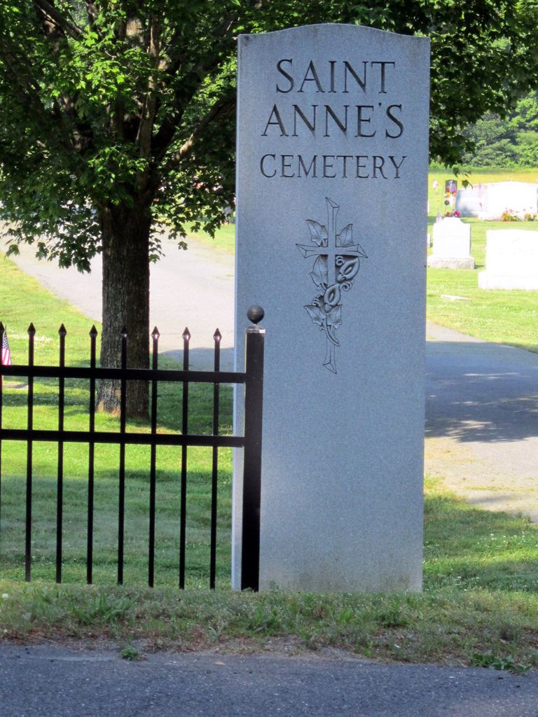
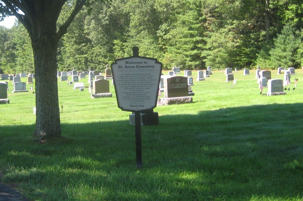
| Description | : | Contact: Our Lady of Peace Parish, 90 7th Street, Turners Falls, MA 01376 Tel: (413)863-2585 St Anne's Cemetery is the first cemetery driveway on the left heading south on Turners Falls Road. It directly joins St Mary's Cemetery. On the map, St Anne's is the northern half of the cemetery. On the ground, the hill forms a small bluff; St Anne's ends below the bluff. St Mary's is the portion above the bluff. On the satellite map view, the dividing line is much clearer than on the ground. Both cemeteries are administered by Our Lady of Peace Parish (formerly St Mary's of the... Read More |
frequently asked questions (FAQ):
-
Where is Saint Annes Cemetery?
Saint Annes Cemetery is located at Turners Falls Road Montague, Franklin County ,Massachusetts , 01376USA.
-
Saint Annes Cemetery cemetery's updated grave count on graveviews.com?
195 memorials
-
Where are the coordinates of the Saint Annes Cemetery?
Latitude: 42.5861300
Longitude: -72.5480600
Nearby Cemetories:
1. Saint Marys Cemetery
Montague, Franklin County, USA
Coordinate: 42.5852200, -72.5475100
2. Our Lady of Czestochowa Cemetery
Montague, Franklin County, USA
Coordinate: 42.5846000, -72.5469400
3. Aaron Clark Memorial Cemetery
Montague, Franklin County, USA
Coordinate: 42.5836200, -72.5471600
4. Springdale Cemetery
Montague, Franklin County, USA
Coordinate: 42.5884700, -72.5530900
5. Fairway Avenue Cemetery
Montague, Franklin County, USA
Coordinate: 42.5924270, -72.5646970
6. Burnham Cemetery
Montague, Franklin County, USA
Coordinate: 42.5875300, -72.5720140
7. East Mineral Road Cemetery
Montague, Franklin County, USA
Coordinate: 42.5810500, -72.5086300
8. Riverside Cemetery
Gill, Franklin County, USA
Coordinate: 42.6156006, -72.5410995
9. High Street Cemetery
Greenfield, Franklin County, USA
Coordinate: 42.6044840, -72.5806660
10. Highland Cemetery
Montague, Franklin County, USA
Coordinate: 42.5778008, -72.5083008
11. East Deerfield Cemetery
Deerfield, Franklin County, USA
Coordinate: 42.5555992, -72.5642014
12. Federal Street Cemetery
Greenfield, Franklin County, USA
Coordinate: 42.5941400, -72.5977300
13. Town Cemetery
Montague, Franklin County, USA
Coordinate: 42.5595000, -72.5070200
14. Green River Cemetery
Greenfield, Franklin County, USA
Coordinate: 42.5804400, -72.6052500
15. Old Catholic Cemetery
Greenfield, Franklin County, USA
Coordinate: 42.5795753, -72.6064215
16. Elm Grove Cemetery
Montague, Franklin County, USA
Coordinate: 42.5418600, -72.5359000
17. Locust Hill Cemetery
Montague, Franklin County, USA
Coordinate: 42.5394700, -72.5363400
18. Calvary Cemetery
Greenfield, Franklin County, USA
Coordinate: 42.5764008, -72.6138992
19. Durkee Burial Lot
Northfield, Franklin County, USA
Coordinate: 42.6070000, -72.4861000
20. Mater Dolorosa Cemetery
Greenfield, Franklin County, USA
Coordinate: 42.5758000, -72.6165000
21. Lower Meadow Cemetery
Greenfield, Franklin County, USA
Coordinate: 42.5945600, -72.6200300
22. Log Plain Cemetery
Greenfield, Franklin County, USA
Coordinate: 42.6378320, -72.5725800
23. Greenfield Hebrew Congregation Cemetery
Greenfield, Franklin County, USA
Coordinate: 42.6409410, -72.5653360
24. Laurel Hill Cemetery
Deerfield, Franklin County, USA
Coordinate: 42.5416670, -72.5973020