
| Memorials | : | 138 |
| Location | : | Montague, Franklin County, USA |
| Phone | : | 413-863-2585 |
| Coordinate | : | 42.5852200, -72.5475100 |
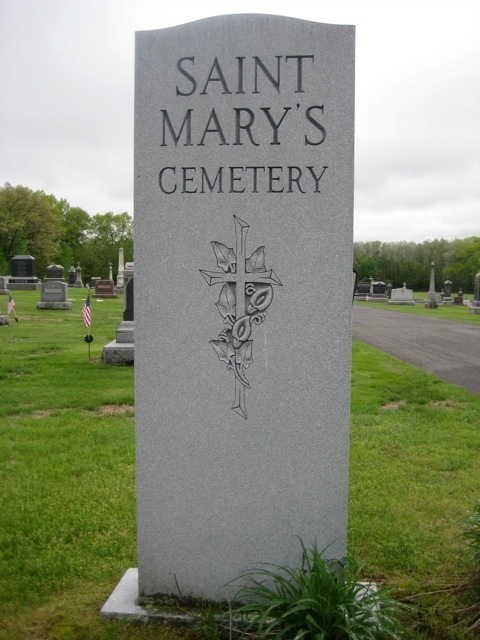
| Description | : | Contact: Our Lady of Peace Parish, 90 7th Street, Turners Falls, MA 01376 Tel: (413)863-2585 This cemetery is affiliated with Our Lady of Peace Parish (formerly Saint Marys of the Assumption Parish). This is a privately-owned cemetery. It is located on the west side of Turners Falls Road across from Our Lady of Czestochowa Cemetery. The cemetery is on the northern border of Aaron Clark Memorial Cemetery. St Mary's Cemetery is the second cemetery driveway on the left heading south on Turners Falls Roads. St Mary's Cemetery directly joins St Anne's Cemetery. On the map, it is the... Read More |
frequently asked questions (FAQ):
-
Where is Saint Marys Cemetery?
Saint Marys Cemetery is located at Turners Falls Road Montague, Franklin County ,Massachusetts , 01376USA.
-
Saint Marys Cemetery cemetery's updated grave count on graveviews.com?
116 memorials
-
Where are the coordinates of the Saint Marys Cemetery?
Latitude: 42.5852200
Longitude: -72.5475100
Nearby Cemetories:
1. Our Lady of Czestochowa Cemetery
Montague, Franklin County, USA
Coordinate: 42.5846000, -72.5469400
2. Saint Annes Cemetery
Montague, Franklin County, USA
Coordinate: 42.5861300, -72.5480600
3. Aaron Clark Memorial Cemetery
Montague, Franklin County, USA
Coordinate: 42.5836200, -72.5471600
4. Springdale Cemetery
Montague, Franklin County, USA
Coordinate: 42.5884700, -72.5530900
5. Fairway Avenue Cemetery
Montague, Franklin County, USA
Coordinate: 42.5924270, -72.5646970
6. Burnham Cemetery
Montague, Franklin County, USA
Coordinate: 42.5875300, -72.5720140
7. East Mineral Road Cemetery
Montague, Franklin County, USA
Coordinate: 42.5810500, -72.5086300
8. Highland Cemetery
Montague, Franklin County, USA
Coordinate: 42.5778008, -72.5083008
9. Riverside Cemetery
Gill, Franklin County, USA
Coordinate: 42.6156006, -72.5410995
10. High Street Cemetery
Greenfield, Franklin County, USA
Coordinate: 42.6044840, -72.5806660
11. East Deerfield Cemetery
Deerfield, Franklin County, USA
Coordinate: 42.5555992, -72.5642014
12. Federal Street Cemetery
Greenfield, Franklin County, USA
Coordinate: 42.5941400, -72.5977300
13. Town Cemetery
Montague, Franklin County, USA
Coordinate: 42.5595000, -72.5070200
14. Green River Cemetery
Greenfield, Franklin County, USA
Coordinate: 42.5804400, -72.6052500
15. Old Catholic Cemetery
Greenfield, Franklin County, USA
Coordinate: 42.5795753, -72.6064215
16. Elm Grove Cemetery
Montague, Franklin County, USA
Coordinate: 42.5418600, -72.5359000
17. Locust Hill Cemetery
Montague, Franklin County, USA
Coordinate: 42.5394700, -72.5363400
18. Calvary Cemetery
Greenfield, Franklin County, USA
Coordinate: 42.5764008, -72.6138992
19. Durkee Burial Lot
Northfield, Franklin County, USA
Coordinate: 42.6070000, -72.4861000
20. Mater Dolorosa Cemetery
Greenfield, Franklin County, USA
Coordinate: 42.5758000, -72.6165000
21. Lower Meadow Cemetery
Greenfield, Franklin County, USA
Coordinate: 42.5945600, -72.6200300
22. Log Plain Cemetery
Greenfield, Franklin County, USA
Coordinate: 42.6378320, -72.5725800
23. Laurel Hill Cemetery
Deerfield, Franklin County, USA
Coordinate: 42.5416670, -72.5973020
24. Greenfield Hebrew Congregation Cemetery
Greenfield, Franklin County, USA
Coordinate: 42.6409410, -72.5653360